Places
26 places found.
Those places high-lighted have photos. All locations may have maps, books and memories.
- Cemmaes Road, Powys
- Six Road Ends, County Down
- Road Weedon, Northamptonshire
- Severn Road Bridge, Gloucestershire
- Roade, Northamptonshire
- Berkeley Road, Gloucestershire
- Harling Road, Norfolk
- Road Green, Devon
- Builth Road, Powys
- Cross Roads, Yorkshire
- Steele Road, Borders
- Cross Roads, Devon
- Four Roads, Dyfed
- Road Green, Norfolk
- Biggar Road, Strathclyde
- Clarbeston Road, Dyfed
- Five Roads, Dyfed
- Eccles Road, Norfolk
- Grampound Road, Cornwall
- Morchard Road, Devon
- Wood Road, Greater Manchester
- Four Roads, Isle of Man
- St Columb Road, Cornwall
- Clipiau, Gwynedd (near Cemmaes Road)
- New Road Side, Yorkshire (near Silsden)
- New Road Side, Yorkshire (near Cleckheaton)
Photos
14,329 photos found. Showing results 2,261 to 2,280.
Maps
476 maps found.
Books
5 books found. Showing results 2,713 to 5.
Memories
11,058 memories found. Showing results 1,131 to 1,140.
First School
I was six when this photo was taken. We lived in a tiny flat in Curzon Street, basically one room, and I went to school at Fintragh, a tiny private school in two rooms part way down the high street, opposite the Post Office. This traffic ...Read more
A memory of Calne in 1950 by
A Childhood Reminiscence
I lived in Edgware from 1941 and, although a young child, I remember the war years vividly, especially collecting shrapnel and the sounds of bombs, anti-aircraft guns and V2 rockets. In 1944 I began school at Edgware ...Read more
A memory of Edgware in 1940 by
County Oak Tushmore Sports And Social Club
So named because members were from north of Crawley on the main A23 Brighton Road, not big enough to be a village, but a hamlet stretching half a mile north and south of todays Manor Royal Estate original ...Read more
A memory of Crawley in 1954 by
County Oak And Tushmore Sports And Social Club
Tushmore Lane and either side of the main A23 had properties forming the catchment area for club members, also another general store and petrol station. County Oak boasted a recreation ground with ...Read more
A memory of Crawley in 1953 by
Bombing Of Morland Avenue
Written by my mother when she was 70. She lived in Swaisland Road I think one of the things you would have noticed was the number of barrage balloons all around, high in the sky. The first sound of guns which we heard was ...Read more
A memory of Dartford in 1945
Brooksby Hall Agricultural College, Leicestershire,England
Like Gwilym Evans I was enlisted into HM Forces in 1944, along with my twin brother. We were born in May 1926. Served with RASC as drivers first in Wiltshire, England, driving 3 ton ...Read more
A memory of Nantgwynant in 1949 by
National Westminster Bank
This picture looking across the roundabout to what was The National Provincial Bank directly opposite The Old Surrey Hounds Pub. On the corner where the photo was taken from was The Westminster Bank, this is where I first ...Read more
A memory of Caterham in 1973 by
St Mark's School In The 1960s
I too have wonderful memories of going to St Mark's, the teachers I remember are Mr Freemantle, Mrs Carmichael, Miss Holmes, Miss Catherine and Mr Legg. The headmistress at the time was Miss Bowley, who everyone was ...Read more
A memory of Mitcham by
Kennards
Theses photos have certainly brought back so many memories, how great to see it all as remembered, but to bring it all back correctly - the mind changes things! I loved Kennards - the smell and the sounds of that arcade will always live with ...Read more
A memory of Croydon in 1955 by
Abridge In The 1950's
I moved to Abridge in 1950 when I was ten years old. My parents bought the white cottage on the London Road, which had a wooden building next to it. This very soon became The Poplar Cafe, my mother’s dream of riches! I attended ...Read more
A memory of Abridge in 1955 by
Your search returned a large number of results. Please try to refine your search further.
Captions
5,036 captions found. Showing results 2,713 to 2,736.
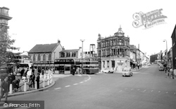
Beside the imposing 19th-century bank building, which overlooks the corner of Blackburn Road, rises a naked steel tower, a herald of the monotonous shopping developments that have robbed
This view looks south along Wigan Road to the Anderton Arms, now managed as an Italian restaurant.
The roads inland were narrow and uninviting.
The Georgian style can be seen following along the left side of Leys Avenue and on Station Road at Lloyd's Bank (left).
The New Inn can be seen in this photograph, on the right-hand side of the road.
This view shows the junction of the two roads, where The Vernon Arms has been offering refreshment to travellers for many years.
It remains a village of beautiful cottages on the high road between Exeter and Dorchester.
The white house across the road was, until 1908, The Sun - a rival for The Star (opposite).
This is the busy A390, but a lull in the traffic has allowed the photographer to stand in the middle of the road.
A visitor from 1955 would be rather confused by this view (taken from the gateway of Cotton End House), as the war memorial was moved in 2001 from the centre to the right-hand side of the road and
The attractive Beehive Cottage on the right was originally the lodge to Captain Stopford's house on Ashby Road. That house, alas, was demolished, and the site used to build the Community Centre.
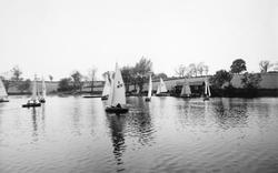
This one, on the Ashby Road, is still used by the Rugby and Daventry Sailing Club. The larger reservoir nearer to the town is now the centre of the country park.
A headline on a newspaper placard reads: 'Russia's terms to Britain', referring to Russia's desire to create a formal alliance against Nazi Germany.
Further down on the left is the road junction for Llangattock and Crickhowell just before the white building, the Beaufort Arms.
Just up the road is Greenway House, built by Sir Walter Raleigh's half-brother Sir Humphrey Gilbert, and later home to Agatha Christie.
This view looks towards the town from the junction of Anstey Road, Normandy Street and Paper Mill Lane.
These once quiet roads are now filled with heavy traffic.
In the week this photograph was taken you could enjoy a performance of the Royal Carl Rosa Opera.The other Leeds theatres were The Royal in Land's Lane,The Queen's in Meadow Road and the Empire Palace
The High Street, with many cars, and a tarmacadam road, is much changed from earlier pictures. Simonds Bank is now Barclays, and Armstrongs has become Eighteens.
An office block has replaced those quaint shops, but the Duke of York survives, now minus its covered porch, at the junction with the Frimley Road.
The buildings housing the premises of Hedges & Son (right), however, have been demolished and replaced by a road and open space leading to a pedestrian shopping precinct.
Cowplain developed because of the main road from Portsmouth to London; its name means 'a clearing for cows'.
This is the extremely busy A15 main road heading north to Folkingham, Lincoln and eventually the Humber Bridge and south (the way we are facing) to Market Deeping and Peterborough.
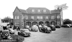
There were two hotels in the village, the Vine in the village centre and the Grange along Sea Bank Road just behind the sand hills.
Places (26)
Photos (14329)
Memories (11058)
Books (5)
Maps (476)


