

Places
26 places found.
Those places high-lighted have photos. All locations may have maps, books and memories.
- Town End, Derbyshire
- Town End, Buckinghamshire
- Town's End, Somerset
- Towns End, Dorset
- Town End, Merseyside
- Town End, Cambridgeshire
- Town's End, Buckinghamshire
- West End Town, Northumberland
- Bolton Town End, Lancashire
- Kearby Town End, Yorkshire
- Town End, Cumbria (near Grange-Over-Sands)
- Town End, Cumbria (near Bowness-On-Windermere)
- Town End, Yorkshire (near Huddersfield)
- Town End, Yorkshire (near Wilberfoss)
- Town End, Cumbria (near Appleby-in-Westmorland)
- Town's End, Dorset (near Melbury Osmond)
- Town's End, Dorset (near Swanage)
- Town End, Cumbria (near Ambleside)
- Town End, Cumbria (near Lakeside)
- Town End, Cumbria (near Kirkby Lonsdale)
- Town End, Cumbria (near Ambleside)
- Town's End, Dorset (near Bere Regis)
- West-end Town, South Glamorgan
- Townend, Derbyshire
- Townend, Strathclyde (near Dumbarton)
- Townend, Staffordshire (near Stone)
Photos
23 photos found. Showing results 3,601 to 23.
Maps
195 maps found.
Books
3 books found. Showing results 4,321 to 3.
Memories
3,719 memories found. Showing results 1,801 to 1,810.
St Marys Church South Tidworth
I lived in Tidworth Garrison as a child, (my name was Margaret Vincent then) and attended the Garrison Junior School and later Andover Grammar School. I grew up there enjoying the wonderful freedom that Salisbury ...Read more
A memory of South Tidworth in 1963 by
Childhood In Marlow
I grew up in Marlow during the 60s. I have wonderful memories of a really free childhood of bike rides, exploring the woods, rowing a very old boat on the river, even swimming which my mum never found out about , and just general ...Read more
A memory of Marlow in 1960 by
My Time At Studwell Lodge And In The Village Of Droxford
My family first came to live in Studwell Lodge, which they bought from the Bruce family, when my father retired from farming in Berkshire at the age of fifty five. It was then 1959 and I, as a ...Read more
A memory of Droxford in 1960 by
The Holborn Hill Evacuee.
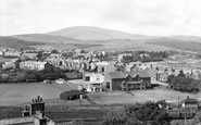
The view is looking over Holborn Hill towards Black Combe. Holborn Hill is old Millom, the new part of Millom was built when iron ore was discovered in 1855 at Hodbarrow and the iron works was built and Hodbarrow mines opened. ...Read more
A memory of Millom in 1940 by
Foreshore
I walked and played down here. My aunty and uncle owned one of the house boats nearby and my father worked at Marshalls quarry/mill for a while. The area has changed a lot ,mostly to car parking. We rode our bikes round Little Swits and often ...Read more
A memory of Hessle in 1959 by
Carefree Days
I was born in Maitland Buildings in Helensburgh in 1950 moved to Shandon and then moved to Queens Crescent. I went to primary school at Shore Road, I remember teachers were two sisters, I think they were called the Miss Robinsons. ...Read more
A memory of Garelochhead in 1960 by
Visits To Canvey Island
As a family, we used to visit Canvey quite often during the summers of the late 1950s and early 1960s, and getting onto Canvey from the A13 was quite stressful in those days, you had to turn at the Tarpots and follow the ...Read more
A memory of Hadleigh in 1958 by
Halcyon Days!
I was born in a newly built house in Laurel Avenue - and was told whilst being built my mum and dad had gotten to choose which one they wanted! The midwife who delivered me was Miss Reece, who I believe lived in Wickford until she ...Read more
A memory of Wickford in 1955 by
Moving To Dagenham
My family moved to Dagenham from Northampton in December 1953. My first real memory of the borough was being lost on the day we moved in, after being sent to get some milk and sugar from the local shops, which would have been in ...Read more
A memory of Dagenham in 1953 by
Shop
The white building on the right used to be called Chiesmans. Trams used to run along the street. In the 1950s in thick smog I had to wait for hours for a bus to eventually arrive to take me as far as Well Hall, where I had to walk from there to ...Read more
A memory of Lewisham in 1945 by
Captions
5,054 captions found. Showing results 4,321 to 4,344.

It is also the point where the town looks across to Portpatrick; the two islands are not 22 miles apart, and a long history of travel between the two was unavoidable .

This area has changed quite a lot, and has adapted to the extra traffic that has occurred during the past fifty years.

Famous as the birthplace of John Macadam in 1756 and of Robert Burns in 1759, Ayr was founded under a charter granted by William the Lion. This view looks towards the New Brig and Main Street.

In the background a trolleybus is about to pass a tram as it heads towards the Town Hall. Like the electric tramcar, the trolleybus drew its power from overhead and did not require rails.

The 12th-century tower and spire of St Mary's Church viewed from the Market Place, a symbol of the mediaeval prosperity brought to this little town from wool-trading.
Today this road has far more traffic than a solitary horse and cart. The buildings on the right stand at the junction with Belmont Road, and are now the Belmont Inn.

Gateway to the Dales and the first town in Airedale, Skipton was a centre for sheep and cattle rearing; even its name is derived from Sheeptown. In the distance is the tower of Holy Trinity Church.
But for a small section of the castle, the church remains the only tangible link with the old town's medieval past.

Situated on Abbey Street next to the Swan Hotel, the New Jerusalem Church was one of the most striking buildings in the town.

This event, staged on a hot June day, marked the acquisition of the sixty acres of Colley Hill, overlooking the town, by the National Trust after a lengthy fund-raising campaign to gather the £5000 needed

Their more knowledgable caddies have not been so foolhardy, and are well out of range. The Grand Hotel overlooks every amenity that the town has to offer.

The photograph shows Abbey Row; we are looking down towards the Triangle and the parish of Westport.

Looking across the Menai Straits to Anglesey, the city of Bangor is the largest town in the north-west corner of Wales, the former principality of Gwynedd, and home to an ancient diocese and the University

Parallel to Stratford Road and to the south of it is one of the grid of streets that were laid out for the town from the 1840s, starting at the east and then expanding westward as land was released

Detail abounds in this more intimate shot of the row of shops immediately east from the Town Hall and the Greyhound Hotel. All the windows are full of offerings from floor to ceiling.

The town of St Helens derives its name from the early chapel dedicated to the saint.

By its completion in December 1893, 17,000 'navvies' had shifted 54 million cubic yards of soil and rocks to create the 35.5-mile-long canal at the then staggering cost of £15 million.
The first stone castle was built by David I; it was extensively modified around 1411 following the sack of the town by the Lord of the Isles the previous year.

Its cabins were in keeping with the basic military hut- like look of so many institutions built during the First World War and afterwards.

Looking in the direction of the town, the Holt estate lay behind the trees on the left. Two large gas lamps flank the lych-gate to St Paul's church on the right.

The Market Square is at the busy cross-roads in the centre of this delightful small town.

During the Middle Ages, the town's prosperity grew with the woollen industry, and it became an important yarn market.

We are looking west from the canal towpath towards the town, with the church spire in the centre distance.

On the left is a terrace of brick houses and shops built c1865. Barclay's Bank closed in 2000, but the Co-op still trades from the ground floor, although it now has a mid-1990s shop front.
Places (26)
Photos (23)
Memories (3719)
Books (3)
Maps (195)

