Places
25 places found.
Those places high-lighted have photos. All locations may have maps, books and memories.
- East Wall, Republic of Ireland
- Pell Wall, Shropshire
- Wall, Northumberland
- Heddon-on-the-Wall, Northumberland
- Walls, Shetland Islands
- Wall, Cornwall
- Wall, Staffordshire
- East Wall, Shropshire
- Wall End, Kent
- Hobbs Wall, Avon
- Wall Bank, Shropshire
- Wall Nook, Durham
- Knowl Wall, Staffordshire
- Hazelton Walls, Fife
- Wall Mead, Avon
- Mid Walls, Shetland Islands
- Greetland Wall Nook, Yorkshire
- Aston le Walls, Northamptonshire
- Wall Heath, West Midlands
- Wall Hill, Greater Manchester
- Wall End, Cumbria (near Millom)
- Wall under Heywood, Shropshire
- Dale of Walls, Shetland Islands
- Bridge of Walls, Shetland Islands
- Hole-in-the Wall, Hereford & Worcester
Photos
516 photos found. Showing results 1,161 to 516.
Maps
172 maps found.
Books
Sorry, no books were found that related to your search.
Memories
1,989 memories found. Showing results 581 to 590.
Old Memories
I was born in Spring Hill nursing home in 1933, corner of Hill Lane and Howard Road, and I used to take short cuts via the bomb site on the way to school, sometimes I would find a coin or two. We lived near the Dell football ground ...Read more
A memory of Southampton in 1944 by
Additional Info...
Hi Martin, It was in fact Peter Frampton who lived there at number 12. His dad was the head of the art department at Ravenswood School for Boys (then Bromley Technical High), and I went to school at Pickhurst Primary with his younger ...Read more
A memory of Bromley by
Circus At The Village Hall C 1955
We lived in the village pub The Lifeboat Inn. I remember being flooded and all the beer barrels floating in the cellar, mum cooking mussels given in lieu of beer, which were left in the bath and climbed up the ...Read more
A memory of Brancaster in 1955 by
My Ancestors Are Said To Have Originated From The Walls Of Thurland Castle.
Around 1706, my Ancestors are said to have originated from the walls of Thurland Castle. gillentineje@yahoo.com if you would like to contact me.
A memory of Thurland Castle by
Just A Kibbuth Lad
For those who have never been to our village called Kibworth, it is worth noting locals call it "Kibbuth". You live in either "Top Kibbuth"- Kibworth Harcourt or "Bottom Kibbuth"- Kibworth Beauchamp. I myself personally, ...Read more
A memory of Kibworth Harcourt in 1973 by
Courtenay Park Salcombe
This view of Courtenay Park is quite poignant for me. It shows houses at the lower end of Devon Road and also the land on which Egremont Terrace was later built. My parents lived in no. 10 Egremont Terrace from the late ...Read more
A memory of Salcombe in 1950 by
Baldwin's Butchers Shop
I have this photograph on the wall as it reminds me of my dad, Arthur Edward Elson. He was born in Mill Lane in 1914 and worked as a 'butcher's boy' for Baldwin's which is just visible on the right of the photo. He delivered meat ...Read more
A memory of Ewell in 1920 by
Llangattock People
I did not know many of the people of the village or much of the history of the village. However there were some who stay in my memory and to this day I often think about them. All too often I cannot remember their names. I ...Read more
A memory of Llangattock in 1958 by
The Village
In 1959 I was 10 years old and the village was my big adventure trip out when I went to the shops for my mum. Upper Belvedere was always known as The Village when I lived there, is it still I wonder? I even went to school there too, ...Read more
A memory of Belvedere in 1959 by
Graham Clive Cale James
Between 1938-1949 I lived in Llanarth Road then at Bryn Road 1949-1959. There was no Springfield Estate (only Springfield Villas, about 6 houses). Tradespeople at that time were Davies the bakers with door to door ...Read more
A memory of Pontllanfraith in 1940 by
Captions
1,668 captions found. Showing results 1,393 to 1,416.
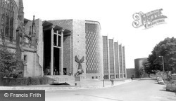
Spence said that his design came to him when he was under the influence of anaesthetic for toothache: he saw zigzagging walls and an altar ablaze with light.
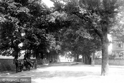
Meads Road, of course, had old trees already: a villa is seen on the right, and on the left carriages shelter from the sun alongside the flint wall fronting Saffrons Park, now a sports ground.
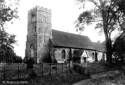
The nave of All Saints' Church is Norman, with later windows of c1300. Only the chancel is now used for worship; the rest of the building is in the care of the Redundant Churches Fund.
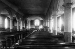
Before this, as we see here, the walls and nave pillars and arches were plastered and whitewashed.
The sign on the shop wall, where the tickets were sold, shows that admission to the Priory Church was 6d.
A great medieval port and a walled town, it declined as the sea retreated; by Victorian times it was mainly a prosperous market town for the surrounding area and the Walland Marshes.
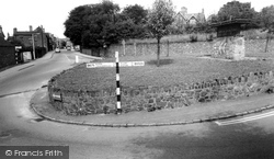
This traffic island at the south end of the High Street, with its random stone walling, double yellow lines, and Festival of Britain-style sign, somehow epitomises a rather unlovely village.
The upper storey was added in 1890, and the old walls encased with red brick and pediments in 1915.
It was then used by local families, who lived in tenements built within the walls; the last of these left in 1898.
This attractive group, which makes the most of the possibilities of tile-hanging walls, is on the Petworth Road just south-west of the Green.
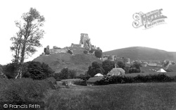
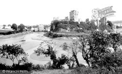
Masonry rises on the skyline from the Butavant Tower (left) and the walls of the west bailey to the 80ft-high keep and the south-west gatehouse.
It has an inner core divided into three stories, and around this core is an outer enclosing wall with a staircase in between.
As well as the Smiths Arms again visible in the centre distance, we can also see two more public houses here - the Hope and Anchor, the long white building on the right, and the Bull and Dog immediately
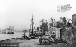
Set at the mouth of the River Conway, or Conwy, this mediaeval walled town with its famous castle, one of Edward I's 'iron ring' around Wales, is still remarkably self-contained.
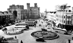
The Welsh had to live outside the town walls. Here we see the modern town square filled with coaches for holidaymakers and locals alike.
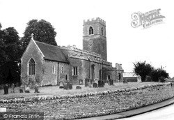
The busy A428 Northampton to Bedford Road winds through the village from west to east, curving round the parish churchyard's rubblestone retaining walls.
The scene is recognisable today, though the National Benzole petrol station on the left has gone, and so has the long stone wall on the right.
Southgate is a remnant of the old town walls.
Note the new prison (built 1820) to the left of the main castle buildings with its chimneys and observation tower, all of which have been removed.
The wall to the United Reformed Churchyard is on the right, and beyond is a terrace of three shops with flats over which was built about 1910. The rural calm of this view has long gone.
Its walls were the same thickness all the way up, which enhanced its defensive capabilities.
At the far left is the high churchyard wall to Holy Trinity church, yet another Surrey medieval church largely replaced in Victorian times.
This view looks north along Godalming Road with the 18th-century White Horse pub on the right, its Bargate stone walls painted white.
Stone sett paths and some flagstone walls dividing the back yards still remain today behind the stone terraces to both left and right.
Places (25)
Photos (516)
Memories (1989)
Books (0)
Maps (172)


