Places
7 places found.
Those places high-lighted have photos. All locations may have maps, books and memories.
Photos
264 photos found. Showing results 181 to 200.
Maps
28 maps found.
Books
Sorry, no books were found that related to your search.
Memories
357 memories found. Showing results 91 to 100.
Croydon Surrey Street A E Pearce
I have very fond memories of Croydon, especially Reeves Corner which has now been destroyed. I was born on Fairholme Road in 1974, but moved to Wallington when I was three. But we shopped in Croydon most Saturdays, ...Read more
A memory of Croydon in 1980 by
The Hill 1951 To 1965
Moved from the East End to Wigton Road in 1951. First memories; going to Romford market seeing the livestock by Laurie Hall. Playing in the woods behind Quarles, all types of street games. My best was book and skate belting ...Read more
A memory of Harold Hill by
Middle Rainton Part 4
Pathways were made up of compressed dirt, West Street (facing West Rainton), Back Row (facing the Meadow’s Pit), Lewis Street running parallel with Back Row) and Cross Street running parallel with West Street). Krone ...Read more
A memory of Middle Rainton in 1940 by
Childhood In Penygraig
I was born at Llwynypia Hospital on June 10th 1947, lived at 6 Bishop Street, Penygraig, went to school at Penygraig Infants in 1950 and Hendrecafn Juniors, Tai Juniors, Craig-yr-eos Juniors and Seniors. Bishop Street is ...Read more
A memory of Penygraig in 1947 by
A Lifehood Of Memories During The 1950s
orn in 1942 at 23 Park Avenue, Northfleet, I went to Dover Road School then Colyer Road Secondary School. Churchill's dairy used to be opposite Colyer Road School and allotments where we had a plot. The ...Read more
A memory of Northfleet by
Keppel Road
I grew up in Kepple Road at no 22, opposite the little flats between 1962/83. I went to Altmore/Napier-Nelson/EHGS/Langdon schools. I recall the High Street and I worked on the seafood stall outside the Cock for Pete. I remember the ...Read more
A memory of East Ham by
Corn Exchange
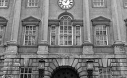
Before the railways (railroads) came, there was no particular reason why people in Bristol, England should keep the same time as people in London. At that time there was no practical way of communicating information about time over ...Read more
A memory of Bristol by
In Memory Of My Grandparents
Mr Gran and Grandad had their home in North Stoke, a Mr and Mrs Sallis (Elizabeth and Arthur). They lived in Calendula Cottage, as it was called then. My mother had three sons, Ray the oldest, Tony, and ...Read more
A memory of North Stoke by
Grandma Grandads House New Street
My grandma and grandad lived in New Street, Millbrook. I remember as a six-year-old going to see them and going to the 'swan pool' at the bottom of the road and feeding the swans. Grandma died in 1966 and Grandad ...Read more
A memory of Millbrook in 1965 by
Sir Oliver Leese
When I was a student I worked at the Cactus Gardens in the summer of 1957 and 1958. The gardens were owned by Lieutenant General Sir Oliver Leese and his wife, Margaret. They lived in the wonderful Lower Hall, behind the high wall ...Read more
A memory of Worfield in 1957 by
Captions
439 captions found. Showing results 217 to 240.
Located on the east side of Magdalen Bridge, The Plain signifies the boundary of the old city. Just out of sight, the River Cherwell flows under the easterly part of the High Street.
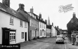
The High Street is part of the old London to Brighton route through Henfield, which lies to the east of the River Adur on a belt of Wealden clay behind the South Downs.
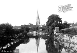
This view was taken looking along the backwater from Abingdon Bridge with the gardens of houses in East St Helen Street on the right and a then well-treed Nag's Head Island on the left.
Two views of this charming seaside village street, taken a decade apart, but in which little appears to have changed.
East of Crowborough the tour reaches Wadhurst, once a village of importance in the Wealden iron industry and now a quiet and typical High Weald village.
This village stands on Watling Street close by the Little Stour.
A little further east from Mistley is the village of Bradfield.
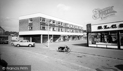
A rather flowery title for a small shopping development of the late 1950s on the Fairfield Estate, away to the east of the town's main shopping street. As
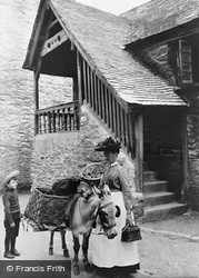
A lady in traditional dress poses with her pannier donkey in Higher Market Street, East Looe, outside the old 16th-century guildhall.
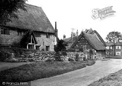
South of Kettering, the village of Isham's best parts lie east of the main Wellingborough Road. Here we look along Middle Street with Little Thatches on the left, its windows now painted white.
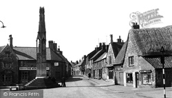
We are now standing in a position to the east of the Cross and are looking towards West Street, with Church Hill on the immediate right of the pantiled lean-to building and the Star Inn
In the 1960s two large housing estates were laid out on the east and west of the main street, and in 1972 a Village Society was formed to oppose the continued growth.
In the distance Crabbe Street, named after the local poet the Rev George Crabbe, who inspired the work of Benjamin Britten, leads down to the beach and the lifeboat station.
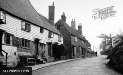
Byworth is a pretty village with a single winding street a mile east of Petworth; it is set on hilly ground above a small stream flowing in a steep valley towards the Rother.
The High Street is even busier by the mid-century, reflecting the growth of service industries in Aldeburgh and the gradual return to prosperity after World War II.
This view takes in the east end of the Market Place and Front Street. On the right is G W Roy's fancy repository and the post office, and just beyond that is the Black Horse pub.
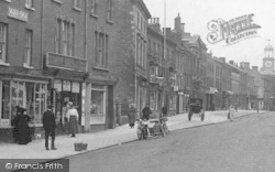
Looking north-east, this photograph shows a strangely deserted High Street. On the right is the junction with Station Road.
Henfield is a long, straggling village a mile or so to the east of the River Adur.
We are now standing in a position to the east of the Cross and are looking towards West Street, with Church Hill on the immediate right of the pantiled lean-to building and the Star Inn
Stramongate is the main approach road into Kendal from the north-east, and means 'the street of the straw men'. St George's Church is in the background.
East Grinstead, a Wealden market town founded during the early 13th-century woodland clearances, was recorded as a borough by 1235.
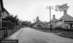
To the east of Stane Street, and four miles north of Billingshurst, is the village of Slinfold.
Polperro is the archetypal Cornish fishing village - a higgledy-piggledy maze of narrow streets leading down to a perfect, tiny harbour.
Stramongate is the main approach road into Kendal from the north-east, and means 'the street of the straw men'. St George's Church is in the background.
Places (7)
Photos (264)
Memories (357)
Books (0)
Maps (28)


