Places
26 places found.
Those places high-lighted have photos. All locations may have maps, books and memories.
- Town End, Derbyshire
- Town End, Buckinghamshire
- Town's End, Somerset
- Towns End, Dorset
- Town End, Merseyside
- Town End, Cambridgeshire
- Town's End, Buckinghamshire
- West End Town, Northumberland
- Bolton Town End, Lancashire
- Kearby Town End, Yorkshire
- Town End, Cumbria (near Grange-Over-Sands)
- Town End, Cumbria (near Bowness-On-Windermere)
- Town End, Yorkshire (near Huddersfield)
- Town End, Yorkshire (near Wilberfoss)
- Town End, Cumbria (near Appleby-in-Westmorland)
- Town's End, Dorset (near Melbury Osmond)
- Town's End, Dorset (near Swanage)
- Town End, Cumbria (near Ambleside)
- Town End, Cumbria (near Lakeside)
- Town End, Cumbria (near Kirkby Lonsdale)
- Town End, Cumbria (near Ambleside)
- Town's End, Dorset (near Bere Regis)
- West-end Town, South Glamorgan
- Townend, Derbyshire
- Townend, Strathclyde (near Dumbarton)
- Townend, Staffordshire (near Stone)
Photos
23 photos found. Showing results 3,481 to 23.
Maps
195 maps found.
Books
3 books found. Showing results 4,177 to 3.
Memories
3,719 memories found. Showing results 1,741 to 1,750.
Heswall Magazine
I run Heswall Magazine which is circulated around Heswall and the local area. You can view all copies on our website: www.heswallmagazine.co.uk I have some interesting pictures of Heswall including some of the Coronation Day ...Read more
A memory of Heswall by
I Lived In Hillview Cresent In The Fifties...
We moved to Farrington Gurney when I was 4 or 5... Other families I remember were the Burtons, Longs, Maggs and Chivers... I remember spending Saturday afternoons at the church... When there was a ...Read more
A memory of Farrington Gurney in 1955 by
A Step Back In Time
I was born in Denham village but brought to Rockingham Parade, Uxbridge when I was one year old. Windsor Street was my main walking route to the town, bus, railway station and the shops. Uxbridge was a lovely town to grow up in ...Read more
A memory of Uxbridge in 1966 by
Direct Enlistment
It was the 24th May 1955 when I arrived, with a number of other lads, at Inkerman Bks to begin eighteen weeks training that would "hopefully" see us depart with the somewhat doubtful tital of Military Policemen. My memories of the ...Read more
A memory of Knaphill in 1955 by
Lanfranc School
With the 50th anniversary of the tragic air crash involving my classmates in 2011 I thought I would add a few memories. I could so easily have been on that plane had it not been for the fact that I wanted to buy my first cycle. I ...Read more
A memory of Croydon in 1961 by
First Camp Site
Does anyone remember the old camp site run by Mr and Mrs Dymond? It was roughly where Woolacombe Sands is now, near the riding stables. I can recall it was a steep field (no terracing then!) and we used to walk down to the old ...Read more
A memory of Woolacombe in 1956 by
My Family In Kilkhampton.
My grandparents Tom & Minnie Croucher lived at Cross Cottage (between Stibb and Kilk), their youngest son Derek married Jette after meeting her during the war in Denmark. They lived at 21 North Close Estate for many ...Read more
A memory of Kilkhampton by
More Early Days In Colindale
Life in Sheaveshill Avenue in the early to middle 1950's still seemed to me to be quite rural and as I recall we still had gas lit street lamps - or at least electric lamps using the old standards. The milk was ...Read more
A memory of Colindale in 1954 by
Weston Favell Upper School 1966 1970
I went to Weston Favell Upper School in 1966 aged 11 of which I have very fond memories. I left at the age of 15 in 1970. In that time Weston Favell was on the Eastern edge of Northampton in Booth lane, The ...Read more
A memory of Northampton by
Roundshaw
My mum found this site, and wow. I lived in Instone when I was 7 on the 9th floor with my mum, brother and sister, then we moved to Vulcan Close. We used to spend all our time over the field and on the decks, there used to be a van that ...Read more
A memory of Wallington in 1970 by
Captions
5,054 captions found. Showing results 4,177 to 4,200.
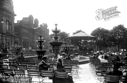
In 1891 the resident population of Southport was 32,191 and by 1901 it had grown to over 48,000. As can be seen in this picture, a large proportion of the audience is female.
In 1891 the resident population of Southport was 32,191 and by 1901 it had grown to over 48,000. As can be seen in this picture, a large proportion of the audience is female.
On the eastern edge of the beautiful Ashdown Forest, the town is now a commuter settlement.
Rebuilt in 1867 by John Loughborough Pearson, the architect of the eastern extension of Wakefield Cathedral, the parish church of St Helen looks down on the town's market place.
We head away from Cheddar to Wedmore, a small town in the fork of a valley on the north side of the ridge that stretches west from Wells. It looks across the Levels to the Mendips.
The area has tended to be a problem for the council, as there is a strong temptation to create a car park in front of the Town Hall, but praise be, at the moment it remains grassed and treed.
As a relatively new town, Bournemouth was able to develop as a holiday resort unencumbered by the street pattern and buildings of an older settlement; its main purpose has always been to cater for thousands
To the left of the River Stour is the Bell Hotel; the town records report that the mayor 'presented King Charles II with a glass of sack at the Bell tavern door' when his Majesty rode in
The Baker Street to Rickmansworth line had already been electrified using the London Transport Underground network in January 1925 as part of the programme to promote the new villages and towns of Metroland
Over the years the town has expanded considerably; nowadays, many local inhabitants commute to work elsewhere.
This town developed around the ironworks, which were founded by Crawshay Bailey in 1846.
Now demolished, the company operate a modern - and busy - factory on the edge of town.
At various times it incorporated a boarding school, shops, private residences and - as the name suggests - the town's museum. Central Park now extends to the iron bridge.
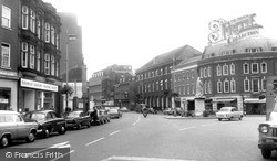
As we look west along Friar Street from in front of the Town Hall, the amount of rebuilding is evident: the occasional older building survives amid a lot of neo-Georgian dating from the 1920s to
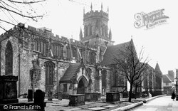
The nave of St Mary's acted as the parish church for the town, while the large chancel was used by a secular College of Canons, responsible to the King, whose duty was to pray for members of the
Business interests in the town realised they had to do something, and a canal was authorised by an Act of Parliament in 1793.
Dr Ingles was walking in the town when he heard pistol shots. A boy from the school, Astley, claimed that Mr Rowell, a grocer, had supplied him with gunpowder for a cork gun.
One in desperation has left his gear on the bank and has paddled into the river to assist the other hopefuls in an attempt to locate some fish.
The centre of Staines, like that of many other towns in the vicinity of London, has been rebuilt during the last century.
The station, on the branch line from Sutton to Epsom Downs, opened in 1865, and the white stuccoed house, now a builder's offices, dates from around the same time.
The Town Hall and the Market Hall stand out at the centre; the large building to the right of the Market Hall is Samuel H Facey & Son's brewery, which opened in 1862.
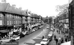
Many shops have changed today, and the Aberdare Furnishing Company store (third from the left) is now B Wise.
The London Crematorium Company had anticipated a population explosion and bought its land cheaply in 1902.
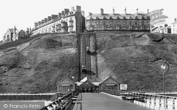
An excellent view of the cliff lift or 'incline tramway', still serving the needs of visitors to the town today.
Places (26)
Photos (23)
Memories (3719)
Books (3)
Maps (195)


