Places
26 places found.
Those places high-lighted have photos. All locations may have maps, books and memories.
- Cemmaes Road, Powys
- Six Road Ends, County Down
- Road Weedon, Northamptonshire
- Severn Road Bridge, Gloucestershire
- Roade, Northamptonshire
- Berkeley Road, Gloucestershire
- Harling Road, Norfolk
- Road Green, Devon
- Builth Road, Powys
- Cross Roads, Yorkshire
- Steele Road, Borders
- Cross Roads, Devon
- Four Roads, Dyfed
- Road Green, Norfolk
- Biggar Road, Strathclyde
- Clarbeston Road, Dyfed
- Five Roads, Dyfed
- Eccles Road, Norfolk
- Grampound Road, Cornwall
- Morchard Road, Devon
- Wood Road, Greater Manchester
- Four Roads, Isle of Man
- St Columb Road, Cornwall
- Clipiau, Gwynedd (near Cemmaes Road)
- New Road Side, Yorkshire (near Silsden)
- New Road Side, Yorkshire (near Cleckheaton)
Photos
14,329 photos found. Showing results 2,981 to 3,000.
Maps
476 maps found.
Books
5 books found. Showing results 3,577 to 5.
Memories
11,058 memories found. Showing results 1,491 to 1,500.
Town Hall
I think this a picture of Abergavenny Town Hall, but am not sure. When we were staying in Abergavenny we lived outside, in Albany Road, on the way to the Rholben and the Deri, which we often climbed and as we didn't go into the town ...Read more
A memory of Abergavenny in 1940 by
Claremont Aldershot Road
The house on the right hand side of this picture was called Claremont. We lived there in the early 60s. There were two cottages to the side. In one of those cottages lived a girl called Elizabeth Holland, she used ...Read more
A memory of Church Crookham by
Grandparents
My nanny & granddad lived in Orrell Park, Westfield Road. I remember very well growing up because I lived in Aintree at that time, visiting them with mum & dad. We would get the number 60 bus up to the corner of their road. ...Read more
A memory of Orrell in 1953 by
Growing Up In Barnes 1950s
We moved to Glebe Road in 1952 (Cousland) and it was a wonderful place for children. We had a back gate opening on to the common and made full use of it. The grass was cut every year and baled for hay and we used to rush out ...Read more
A memory of Barnes by
Growing Up With All My Relatives Living In Stramshall Parish
I was born in 1928, to John James and Olive Mellor, my grandfather was Percival Jackson Mellor, my grandmother Mary Ellen Mellor. They built with help Park Hill Farm, New Road, Uttoxeter, ...Read more
A memory of Stramshall by
Favourite Outing
My family and I often walked to the River Usk, going down Pentre Road and crossing the Brecon Road. We used to have picnics on the side nearest St. Mary's church in Llanwenarth, and look in the water for tiny fish and insects. I ...Read more
A memory of Abergavenny in 1949 by
Wickford And Runwell Hospital
I got a job as a Junior House Officer at Runwell Hospital in March 1958 and worked there for a year, initially living in the hospital residence and then, after I married in Dublin, Ireland later the same year, moved into ...Read more
A memory of Runwell in 1958 by
Little Foxes Hotel Charlwood Road Ifield Wood
I have been working at the above bed and breakfast for a number of years and am often asked by guests what was here originally. Is there any one out there that remembers the original building? I ...Read more
A memory of Charlwood by
Leos Cafe/Espresso Bar
Although I lived in Tooting, all my cousins lived on the Mitcham side! I was a tomboy and used to hang around over Figges Marsh, playing rounders or smoking illicit ciggies in the red shed! The Teddy boys (later the mods) used ...Read more
A memory of Mitcham in 1964 by
I Am A Beach Boy
I was born in July 1942 at 2 Church Road ,the youngest of eight children,the time I remember best is around 1952,being a kid in the Beach then was brilliant,so many things to do, Boating Lake,Minature Railway,Swimming ...Read more
A memory of Severn Beach in 1952 by
Your search returned a large number of results. Please try to refine your search further.
Captions
5,036 captions found. Showing results 3,577 to 3,600.
Further north-east along the High Street, Frith's photographer now looks back in the Clapham Common direction past Cato Road (left).
Not only Lord's Mill went: all the buildings in this view also went in the 1950s and 1960s for road improvements and were replaced by undistinguished modern houses.
This view looks to the north end of Silver Street and its junction with the High Street, the main Sleaford to Skegness Road.
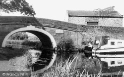
This fine stone bridge spans the Preston to Tewitfield Canal; alongside runs part of the A6 road. Railway trains travelling from London to Glasgow thunder nearby on a high viaduct.
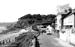
A great storm in the 1930s washed away some of the cottages that stood on the seaward side of this road.
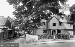
The timber framed jettied house called Whitehall, standing on the corner of Park Lane and Malden Road, is thought to have been built as a farmhouse c1500, and over the last five centuries it has undergone
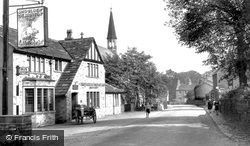
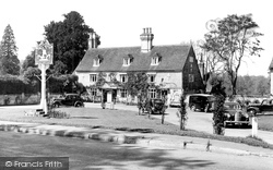
This is how we lived forty years ago: a quiet road, milk delivery by pony and trap to the pub, schoolchildren waiting for a bus - all bathed in sunshine.
The large building at the end of the road is the impressive Shire Hall, built 1789-1791; it serves as the courthouse.
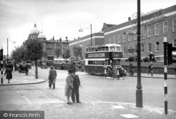
On the side of the bus is an advert for Timothy Whites & Taylors Ltd, who had premises in Calverley Road.
In 1906, Fletcher Dodd began to provide holidays for groups of socialists from the East End of London in the grounds of his house on Ormesby Road.
In the centre is a fish and chip saloon; to its right is the narrow wynd called The Bar, and on the railings is an advertisement for wet fish on sale in the basement of No 1 New Road.
Prominent in this view from Scout Road, which leads up through Hathershelf Scout Wood, south east of the village, is the Moderna Blanket Factory.
A parish to include New England was created in 1857, and St Mark's Church was built on the edge of Spital housing estate in Lincoln Road.
Nine miles from York on the road to Leeds, Tadcaster was once the Roman outpost of Calcaria.
The White Lion Inn Unfortunately, construction of Stafford's new road system was accompanied by another act of civic vandalism.
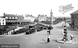
A roundabout has replaced the gazebo, and trees have been flattened behind the Albert Clock to improve road visibility. The building thus revealed is the Imperial Hotel.
When the cellar floor was dug up, the remains of a Roman road was discovered where the soldiers' feet would have been!
Pump Square, several establishments that did provide alcoholic drinks may be seen among the 18th and 19th century buildings, including the Crown Hotel and Joules' brewery further up the road
The photograph was taken from a bridge built in the 1930s to replace the delay-producing level-crossing which carried the Great North Road.
The scene is much the same today, with business continuing beside the busy main road.
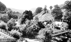
Here the railway, canal and Holyhead Road (A5) run beside the river amid the Berwyn Mountains, a wild heather-clad upland. King's Bridge spans the river on the left of the picture.
St Ann's Hotel, on the other side of the road, advertises medical, physical and therapeutic benefits.
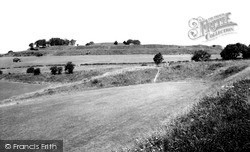
This fort is also the junction of four Roman roads and, after the Norman invasion, was the original Salisbury until the 13th century when a 'new town' was built.
The transporter remained in use until 1961, when it was replaced by a new single-span 1,082 foot-long road bridge.
Places (26)
Photos (14329)
Memories (11058)
Books (5)
Maps (476)


