Places
Sorry, no places were found that related to your search.
Photos
Sorry, no photos were found that related to your search.
Maps
7,034 maps found.


Books
163 books found. Showing results 3,913 to 3,936.
Memories
22,913 memories found. Showing results 1,631 to 1,640.
Fond Memories
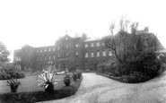
I remember St Faith's hospital very well. I was the Head Porter there for a number of years until it was closed down. I met my wife there. She was a catering assistant. We were engaged with two other couples in the social club.That ...Read more
A memory of Brentwood in 1985 by
Dunsmore People And Happenings Remembered
PREFACE TO THE SECOND EDITION In 1995, when the first edition of this history was published, it seemed incredibly optimistic to have had three hundred copies printed for a market which was ...Read more
A memory of Dunsmore by
Daisys Cottage
I was born in 1934 in my grannie's cottage which lay behind Daisy's in the Court, I used to go in to Daisy's to see and sometimes play with her son Bob who still lives in Torrington, I also remember well Mrs Edie Baker who lived next ...Read more
A memory of Taddiport in 1940 by
Childhood In Wreckenton
I started school at St Oswald's RC in 1944. We lived on Tanfield Road. I remember the head teacher was called Miss Wilfred, and later we had a headmaster called Mr Clancy. I remember when the war finished and we had to ...Read more
A memory of Wrekenton in 1940 by
Chickenley Hall
Hello. My father lived at Chickenley Hall in the 1940s as he was adopted and brought to the home by the Armitage family. He eventually came to Scarborough, North Yorkshire and has started to write his memoirs which are still in ...Read more
A memory of Chickenley in 1940 by
Wonderful Memories Growing Up In Bassaleg
I lived in Bassaleg from the age of 3, (1955), when Church Crescent and surrounding area was being developed. I lived in Church Crescent with my family until I left for Manchester in 1976. I went to the ...Read more
A memory of Bassaleg in 1966 by
Memories Of My Childhood
I was born in 1956, in Wiltshire, but my first memories are of Pawlett, where we moved, when I was very small. It was a smaller, quiter village than it is even now. I went to the village school, on the village green, next to ...Read more
A memory of Pawlett in 1961 by
The Old Mill Coytrahen
My memories of Coytrahen go back to the 1930s and 1940s. I was born in 1931 at The Old Mill, home of my Grandparents and spent many summers visiting there. The Old Mill was rather off the beaten track ,getting there from ...Read more
A memory of Coytrahen Ho in 1930 by
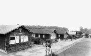
Dukeshouse Wood Camp School (Part Two)
My recollection of a dance that was arranged in the sports hall made me and another lad George Bishop decide to abstain from the proceedings as I think at the time, in fact I am sure about myself that I was very ...Read more
A memory of Hexham in 1940 by
Carol Singing
I too rememeber Rev Milner and his wife also going carol singing down Knatts valley before the war. Does anyone remember Mr Rudd who looked after the greens at Woodlands golf course, a little short chap he was? Also any memories ...Read more
A memory of Knatts Valley in 1930 by
Your search returned a large number of results. Please try to refine your search further.
Captions
9,654 captions found. Showing results 3,913 to 3,936.

Known as Wood Green High School today, the former boys' school was founded in 1924 at Wood Green Lodge, on a site which is now overshadowed by the M6 motorway.

The names of the hotels—the Imperial, the Majestic and the Grand - indicate that the resort could attract a cosmopolitan and wealthy clientele.

This view from the west shows John Smedley's massive Hydro on the opposite side of the valley, which brought spa town prosperity to the town after its erection in 1853.

Horses and carts no longer park outside the Wheatsheaf public house, however; but the spire of the parish church can still be seen in the background at the end of Burlington Street, which like the High

We can just see the Ladybower Dam at the end of the reservoir in this view from the Snake Road. The noble escarpment in the left background is Bamford Edge.
Bursledon consists of two distinct halves - the new and the old.

Note the sign on the telegraph pole on the right - 'telegrams may be telephoned.' Upper Clatford lies at the confluence of the River Anton and the Pillhill brook.

Just four miles west of Scarborough travellers were tempted to stop for refreshments at the Derwent Cafe. The cafe is now in the back part of the building, while the front is a general store.

At the end of Main Street is the entrance to Sewerby Hall, now a fine museum officially opened in June 1936 by the Hull-born aviator Amy Johnson (1903-41).

The ship on the beach is typical of the two-masted coastal schooners that plied their trade in the days before motor vehicles came to be used for the moving of commodities.

The cliff on the right now has a row of houses at the top.

Stone from Waddington Fell was used to rebuild the church of St Helen in 1901. Only the tower of the old church remains - it dates back to c1500. That too was built from Waddington Fell stone.

Looking up Millgate towards the same three-storey building that we see in 65469 (behind the horse and cart), on a day when the children were not at school.
Looking up Millgate towards the same three-storey building that we see in 65469 (behind the horse and cart), on a day when the children were not at school.

In the middle distance to the right are ships anchored in the Hamoaze, which turns north up the Tamar to Devonport Dockyard.

At this time, Easington was one of six large pits situated along the coast of County Durham; the others were Wearmouth, Vane Tempest, Dawdon, Seaham and Horden.

Gainford is noted for its 13th-century church, Georgian houses, narrow streets and one of the finest village greens in the southern part of the county.

The hedge at the right belongs to the churchyard of Holy Trinity, a somewhat unattractive Neo-Norman church of 1843.

The Ship Hotel on the immediate left, with its decorated signboard and the golden cockerel trademark of Courage's brewery, was originally an Elizabethan hostelry.

On the left, the east pier reaches out across the harbour towards the railway station complex, with the long stone pier carrying the line continuing on towards the small lighthouse at its end.

The river Burn runs through the villages of South and North Creake too. The road at the centre of the picture leads to the ruins of Creake Abbey, which lies in a beautiful setting beside the stream.

Here we see the chain ferry across the Great Ouse at Holywell.

Back in the days when taking a picture involved a large and unwieldy camera and tripod, a photographer tended to attract a good deal of attention, but at least there appear to be plenty of people

Cranham has not suffered too much at the hands of unsympathetic development over the years, partly because it is situated in a steep valley and surrounded by dense woodland.
Places (0)
Photos (0)
Memories (22913)
Books (163)
Maps (7034)

