Places
26 places found.
Those places high-lighted have photos. All locations may have maps, books and memories.
- Cemmaes Road, Powys
- Six Road Ends, County Down
- Road Weedon, Northamptonshire
- Severn Road Bridge, Gloucestershire
- Roade, Northamptonshire
- Berkeley Road, Gloucestershire
- Harling Road, Norfolk
- Road Green, Devon
- Builth Road, Powys
- Cross Roads, Yorkshire
- Steele Road, Borders
- Cross Roads, Devon
- Four Roads, Dyfed
- Road Green, Norfolk
- Biggar Road, Strathclyde
- Clarbeston Road, Dyfed
- Five Roads, Dyfed
- Eccles Road, Norfolk
- Grampound Road, Cornwall
- Morchard Road, Devon
- Wood Road, Greater Manchester
- Four Roads, Isle of Man
- St Columb Road, Cornwall
- Clipiau, Gwynedd (near Cemmaes Road)
- New Road Side, Yorkshire (near Silsden)
- New Road Side, Yorkshire (near Cleckheaton)
Photos
14,329 photos found. Showing results 3,481 to 3,500.
Maps
476 maps found.
Books
5 books found. Showing results 4,177 to 5.
Memories
11,058 memories found. Showing results 1,741 to 1,750.
The First Rural Council Houses.
This village has the very first Rural Council Houses in England,- not pictured in your photographs,- but situated in Stow Road. They were built by the Thingoe R.D.C. following a lengthy argument and legal demands by the ...Read more
A memory of Ixworth by
Prefabs Goodenough Way
I lived in a prefab at 234 Goodenough Way during the 1950's then moved to 102 Ellis Road. Nee Searle.
A memory of Old Coulsdon by
My Memory Of Chopwell
After reading the other accounts of Chopwell I decided to add my own, I hope I have got the names and dates right as I am doing this from memory, apologies if I get some of it wrong. All my mother’s side of the family were from ...Read more
A memory of Chopwell by
Duke Bar.
I was brought up on Cleaver St. Remember what a lovely shopping area Duke Bar was. .Mrs Tattersalls. Spencers Bakery .Dewhurst Butchers. Wilkinsons Dainty shop. Redmonds Grocers Mrs Bells and Rennie cloggers on Hebrew Road..Every Thing you needed on your doorstep.Brilliant.
A memory of Burnley
Hampton Wick Magolia Resturant
I'm christophers sister Valerie dunn was baggott.we loved living in Hampton wick .it was fun having dinner in the restaurant -we could order anything we wanted..i nearly allways had sausage beans and chips.we use to ...Read more
A memory of Hampton Wick by
Gone For Good
I still remember the uproar in Fleet when this church was demolished, and subsequently replaced with a Woolworths! There was a strong feeling that Fleet was on the downward path to hell - although the rot didn't really set in until many years ...Read more
A memory of Fleet by
Townsend Rd
I Was born in No 39 Townsend Rd until 1956 went to a private school by Southall Park then Beaconsfield Rd Primary School then on to Dormers Wells Secondary School. Remember at the top of the road was an ice cream shop used to take a basin on ...Read more
A memory of Southall by
Sutton In The 1950/ 1960,S
I attended the Infants/Junior school at New Oscott by the Princess Alice Orphanage before going to Boldmere High School 1953 /1957. On leaving school I joined the railway at Sutton Park Station home of the sorting ...Read more
A memory of Sutton Coldfield by
The Maternity Hospital.
Honeypot Lane was where I was born in 1954. I remember walking round this way by myself with my doll’s pram & thinking that the pregnant ladies would envy me with my baby! This seemed quite a way from my house in Brampton ...Read more
A memory of Kingsbury by
The First Attempt To Demolish Lawson School.
A young man called Howard Watson, lived in Dover Street, owned a convertible sports car. Beautiful thing,maybe a Triumph with a bonnet that opened forwards. His Dad was sitting in it on the top common and ...Read more
A memory of Cargo Fleet by
Your search returned a large number of results. Please try to refine your search further.
Captions
5,036 captions found. Showing results 4,177 to 4,200.
On the right-hand side of the road the shops in view and all beyond it have been similarly redeveloped.
Lowfield Heath is near the old London to Brighton main road. The White Lion Inn, left, also serves teas.The Stores, run by J F Mitchell, has the door open awaiting customers.
Chalets, a villa and the Bay View Hotel overlook the Hive and Burton Beach from the end of Beach Road. The sandy rocks of Burton Cliffs project towards Lyme Bay (left).
In fact, Disley has always been a roadside settlement: its existence goes back to a time when a Roman road came through here.
The Diamond stone sits alongside the Devizes to Swindon main road that goes through the village.
An Anglo-Saxon church was built across the road towards the castle, and burials are recorded here from AD700.
On the right, by the main road, which had not long been built at the time of this photograph, is a cluster of prefabs, temporary housing after World War II.
The High Street starts to curve its way around the church, and motorists were no doubt aided by the solid white line in the middle of the road.
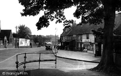
Framed beneath the spreading tree, which previously stood within the boundary of Whitehall before the road-widening process was embarked on in the 1930s, is this view of the Broadway looking south.
The Leeds-Liverpool canal runs behind the church and crosses this road via an aqueduct.
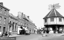
At the south end of the High Street the road widens to a pleasant green, formerly a market place.
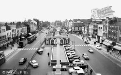
Beyond in the centre of the road is the original Shambles building, an enclosed market erected in 1825.
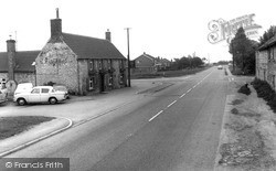
This stone-built pub on the main road between Grantham and Lincoln was probably built in the 18th century as a farmhouse.
Now on the B3254 to Bude, St Stephens Hill was one of the roads administered by the Turnpike Trust, who set the tolls.
This pleasant market town sits on the road from Thetford to Norwich, and was once a resting place for pilgrims – it still has a fine Guild Chapel dedicated to St Thomas à Becket.This well-maintained timbered
The bus stop is still in the same place, but today's vehicles would certainly not stop on the wrong side of the road!
The trees in the distance mark the site of Stamford School (note the old-fashioned school warning sign), which was rebuilt in 1874 set back from the road. The Shell garage is now a car wash.
It is now replaced by a block of flats, while the foreground field is now a tennis court; behind the photographer are now modern houses along Church Road.
The field in the foreground, with its flint wall, lies to the south of East Blatchington Farm; the view looks south down Blatchington Hill, the village main street, with Belgrave Road passing in front
For the next one hundred years, it carried all road transport serving the Isle of Thanet. Toll charges were imposed until the mid 1970s.
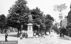
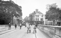
The girls certainly would not wheel their bikes in the middle of the road in the 21st century. Note the open-topped bus and the motor cars on the right.
The wall and trees on the right went for an access road to a public car park and library in the 1960s.
The narrow road has gone, widened in the name of progress.
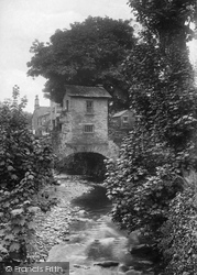
Straddling Stock Ghyll, which runs by the side of the main road, this curious little structure is probably the best-known feature of Ambleside.
Places (26)
Photos (14329)
Memories (11058)
Books (5)
Maps (476)


