Places
36 places found.
Those places high-lighted have photos. All locations may have maps, books and memories.
- Pentre-cwrt, Dyfed
- Pentre Halkyn, Clwyd
- Pentre, Mid Glamorgan
- Ton Pentre, Mid Glamorgan
- Pentre, Powys (near Llangynog)
- Pentre, Powys (near Guilsfield)
- Pentre, Powys (near Bishop's Castle)
- Pentre, Dyfed (near Pontyates)
- Pentre, Powys (near Newtown)
- Pentre, Clwyd (near Mold)
- Pentre, Clwyd (near Ruabon)
- Pentre, Shropshire (near Chirk)
- Pentre, Clwyd (near Hawarden)
- Pentre, Clwyd (near Chirk)
- Pentre, Clwyd (near Ruthin)
- Pentre, Clwyd (near Mold)
- Pentre, Shropshire (near Oswestry)
- Pentre, Powys (near Welshpool)
- Pentre, Clwyd (near Mold)
- Pentre, Shropshire (near Forton)
- Pentre Broughton, Clwyd
- Pentre Gwynfryn, Gwynedd
- Pentre Maelor, Clwyd
- Pentre-clawdd, Shropshire
- Pentre Galar, Dyfed
- Pentre Llifior, Powys
- Pentre-cefn, Shropshire
- Pentre-Gwenlais, Dyfed
- Pentre-Poeth, Dyfed
- Burntwood Pentre, Clwyd
- Pentre Berw, Gwynedd
- Pentre Hodre, Shropshire
- Pentre Llanrhaeadr, Clwyd
- Pentre-celyn, Clwyd
- Pentre Cilgwyn, Clwyd
- Pentre Morgan, Dyfed
Photos
98 photos found. Showing results 381 to 98.
Maps
316 maps found.
Books
2 books found. Showing results 457 to 2.
Memories
1,253 memories found. Showing results 191 to 200.
2 Clutterbuck Rd
We moved to 2 Clutterbuck Rd in 1954 by the little grass island and moved out in 1965 to Methuen Way,great memories of playing around the estate, back fields community centre Corsham park and stone quarries,my friends lived nearby, ...Read more
A memory of Corsham in 1954 by
55 Rusper Road (It Was 33 In The !920s)
I lived there until 1939 and was then with the 4th Royal Sussex . In the photo left centre you can see the old post office /store run in those days by my aunt and uncle (Sumerfields) our house was next door. Down ...Read more
A memory of Horsham by
Birkenhead In The 1950s
Birkenhead in the 1950s – it bears no resemblance to how it is today – it does’nt even look the same. Most of the places I remember are gone. The streets where I grew up have gone – the geography of the place has changed – ...Read more
A memory of Birkenhead by
Haydock Ave., Islip Manor, St.Vincents....What Memories....
I lived 8,Haydock Ave,.next to old peoples home, opposite the back of the shops service road, including the Cabin.1955 to 1967. My parents Reg & Bea with my older brother Terry. I was born Perivale ...Read more
A memory of Northolt by
Bedford Summer Holidays
My mother Dorothy was from Bedford and when she met my dad they lived there until the 60's. I used to go back every year with them to visit the relatives in the 70's and 80's...many many fond memories of the place... walks along ...Read more
A memory of Bedford by
Davyhulme Park And Around
Living on the Lostock Estate in a Council house on Radstock Road, I can remember being taken as a treat, to Davyhulme Park and the paddling pool/boating lake. What a big treat that was !! and then we used to, when older, go ...Read more
A memory of Stretford by
1950 1960
I remember Tommie's fish and chip shop on Old Hall Street (they were the best) we used to call in after the pictures and the swimming baths. In the winter the pool was covered and dances every Saturday night is where we did our 'boy ...Read more
A memory of Middleton by
Cronkeyshaw Junior School
I'm writing about my memories of Cronkeyshaw School. It was situated to the north of Rochdale Town Centre in the corner of a large open common grassland area, Cronkeyshaw Common, opposite Falinge Park. After school each day ...Read more
A memory of Rochdale in 1955 by
Court School Of Dancing
I used to go to The Court School Of Dancing in 1961, 1962 ,1963. This was above Burton's in the market square at the centre of Enfield. It used to be open 7days a week. The evening started with a lesson,and then practise of ...Read more
A memory of Enfield in 1963 by
Reading University In The 1950s
Great memories of my years as a student at Reading University in the 1950's. At that time there was only one campus, and on entering through the covered London Road entrance (on the left of the photo) the ...Read more
A memory of Reading in 1954 by
Captions
3,593 captions found. Showing results 457 to 480.
Letterfrack, situated in the heart of the National Park, is one of the major centres of Connemara.
It was once a substantial market centre, and in the 1890s had a small village hospital, a lecture-hall and a reading-room. Babies' Castle, a nursery home for infants, was opened here in 1886 by Dr?
At this date, Churchyard was a centre for bustling trade and commerce.
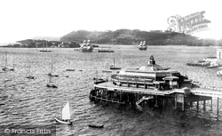
The rocks in the centre are where Tinside Pool now stands.
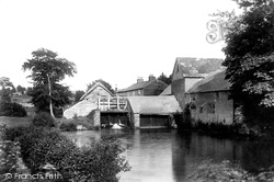
Here we see East Mill and its mill pool, looking eastwards from the north bank of River Asker, towards houses beside East Road (centre).
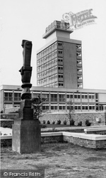
The Town Hall, opened in 1960 by Clement Attlee, is part of a group of buildings in the Civic Centre. The sculpture is 'Bronze Cross', by Henry Moore.
The parish church of All Saints is a familiar landmark in the centre distance.
Note the two cyclists scurrying across the street on the left and right, and the Ripon Road leading up the hill between the trees in the centre background.
Jeremiah's Tea House (centre) used to be one of the favourite places to drive out to from Cambridge in the 1960s.
Being within a few miles of the village, they helped Wroxham become the major centre for cruising that it is today.
Bartholomew Street, on the southern side of the town centre, was originally called West Street.
The tower of All Saints' is in the centre of the picture.
The centre aisle is the original church; the two side aisles were added in c1860.
Bartholomew Street, on the southern side of the town centre, was originally called West Street.
The entrance arch, with its green gates, was demolished in the 1980s to allow access for lorries building the new leisure centre.
Indeed, little has changed, save the re-routing of the main road that ran through the centre.
Victoria Park lies to the east of Newbury town centre.
Painswick was a market centre for the smaller villages along the valley.
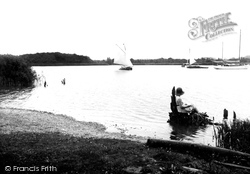
A boy is sat on a rock in the centre of the picture - are the shapes in the sand his handiwork?
At the centre of this picture is a distinctive stone lamp standard given by Edward Simeon in 1804 'as a mark of affection to his native town'.
This was the period when few supermarkets existed and those that did were built in town centres, as most people relied on public transport.
The post office stores stands on a corner in the centre of the village near the church, and is still trading today.
In 1857, Ingleborough Cave was made accessible; thereafter, Clapham became a centre for potholing. Nearby is Gaping Gill, which has an underground chamber large enough to house a cathedral.
Most of these build- ings on Long Row were soon to be rebuilt, including the fine white Georgian House in the centre.
Places (57)
Photos (98)
Memories (1253)
Books (2)
Maps (316)


