

Places
36 places found.
Did you mean: street or streetly ?
Those places high-lighted have photos. All locations may have maps, books and memories.
- Heathfield, Sussex (near Cade Street)
- Street, Somerset
- Chester-Le-Street, Durham
- Adwick Le Street, Yorkshire
- Scotch Street, County Armagh
- Friday Street, Surrey
- Potter Street, Essex
- Boughton Street, Kent
- Newgate Street, Hertfordshire
- Streetly, West Midlands
- Shalmsford Street, Kent
- Green Street Green, Greater London
- Boreham Street, Sussex
- Park Street, Hertfordshire
- Cade Street, Sussex
- Appleton-le-Street, Yorkshire
- Hare Street, Hertfordshire (near Buntingford)
- Romney Street, Kent
- Trimley Lower Street, Suffolk
- Streetly End, Cambridgeshire
- Hare Street, Hertfordshire (near Stevenage)
- Brandish Street, Somerset
- Colney Street, Hertfordshire
- Langley Street, Norfolk
- Silver Street, Somerset (near Street)
- Street, Yorkshire (near Glaisdale)
- Street, Lancashire
- Street, Devon
- Street, Cumbria (near Orton)
- Street, Somerset (near Chard)
- Bird Street, Suffolk
- Black Street, Suffolk
- Ash Street, Suffolk
- Broad Street, Wiltshire
- Brome Street, Suffolk
- Penn Street, Buckinghamshire
Photos
21,808 photos found. Showing results 3,721 to 3,740.


Maps
1,622 maps found.
Books
1 books found. Showing results 4,465 to 1.
Memories
6,666 memories found. Showing results 1,861 to 1,870.
Piddock And Smiths
My gt. grandfathers married sisters named Brothers. The three familes have been in and around Deal for centuries Gt. grandfather Maxwell was a Royal Marine, as was grandfather Piddock. My father 'Phys' Pidddock was welterweight boxing ...Read more
A memory of Deal in 1860 by
Glasgow Agency Of The Bank Of England
"The Old Lady of Threadneedle Street" as the Bank of England is known maintained a small office in Glasgow fir many years. It was on the north side of St VIncent Place and I worked there between 1975 and 1978. ...Read more
A memory of Glasgow in 1975 by
Sellincourt Road School
In 1932 I was taken to my first school just up the road from where we lived in Sellincourt Road. It seemed quite a forbidding place at the time but I can remember the head mistress whose name I forget as being rather a tall ...Read more
A memory of Tooting in 1930 by
Spooner's Corner
Living in Park Street Lane from 1940 to 1961 I passed this corner every day to go under the railway bridge to the recreation ground and school or on to the village. The branches of the Horse Chestnut tree in the foreground gave a ...Read more
A memory of Park Street in 1940 by
Courtlands Stores
The shop on the left was where I lived as a child. My father (Ron Stone) bought the property which was an old doctor' surgery and transformed it into a general store. My Mum and Dad used to open the shop in the evenings ...Read more
A memory of Milton Regis by
Thornton Heath, High Street
My family moved back to Thornton Heath, to 35 Gilsland Road, just off the High Street, at the end of the war and stayed until 1951. United Dairies was the shop on one corner and next to that a sweetshop and ...Read more
A memory of Thornton Heath in 1946 by
Holidays In Gorton
I am Kenneth Overend Edwards from LLandudno, north Wales, and my story about Gorton is surprising because from an early age I was sent by my mother Ellen Edwards (nee Overend) to stay with my grandad, Eric Theodore Overend, who lived ...Read more
A memory of Gorton in 1952 by
Those Were The Days
I was still a teenager, 17 years old and my baby brother at school at Bede Campus. I escaped the campus by virtue of it not having been completed when I passed the 11+. The town centre in Billingham was still being built, and ...Read more
A memory of Billingham in 1965 by
Family And Friends 1942 To 1961
I was born Cramlington 1942, my sister 1940. l have some happy memories of Blyth, lived with mam and dad and sister Betty in Cowpen Row. Dad was in the army so did not see much of him then, when he came ...Read more
A memory of Blyth in 1964 by
Church Town
In 1960 my home was just out of shot: next door to the house that is partly visible on the far right of the picture. I lived at number 18 Church Street, Church Street being the road that is accessed by turning right in the middle ...Read more
A memory of Minehead in 1960 by
Captions
5,381 captions found. Showing results 4,465 to 4,488.

The church with the central rose window and tower (left) is the Park Street Methodist church, built in 1885–86.

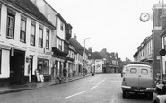
The High Street starts to curve its way around the church, and motorists were no doubt aided by the solid white line in the middle of the road.

He also, it must be said, made a fortune from the slave trade, both for himself and for the city of Liverpool, where there is a street named after him.

The High Street shows some splendid examples of Georgian and Victorian architecture; with the castle and priory, it would have been the focus of the ancient town for a thousand years.

The building looks much the same today, except for a row of old-fashioned street lamps lining the left-hand edge of the drive.

Stodman Street leads out of the south-west corner of the Market Place. Its most famous building is the Governor's House, a 16th-century timber-framed house with three storeys of coved jetties.

Grove Street runs east from the Market Square, a mix of 18th- and 19th-century buildings, and a mix of shops and houses.

At this date Church Street, leading out of the Market Place, was very narrow. It was widened in 1962. Cafés have always been a prominent feature in the town – there are at least three on the left.

It is claimed that Stockton has the widest High Street in England - a good example of early town planning!

This is the main street through the town. The steps used to lead into the post office, but it is now a restaurant and Tourist Information Office.

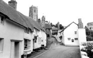
The streets and lanes here present a delightful medley of building styles, with their half-timbered houses and steep-roofed stone cottages.

Donkey Lane and Dormouse Cottage (right) can be seen here in the northern end of the High Street (centre) which bends to the west beside Pound House (centre) to become Barr Lane as it carries
Donkey Lane and Dormouse Cottage (right) can be seen here in the northern end of the High Street (centre) which bends to the west beside Pound House (centre) to become Barr Lane as

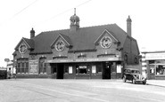
This is a much-changed scene along the road leading to Maidenhead Station, for virtually nothing now survives of King Street's earlier buildings.

West of the Queen Street junction the London-Bath A4 was remarkably narrow, but is now pedestrianised and by-passed. This view looks east.

The alley through the archway to its left leads to the Baptist Chapel built behind the High Street in the late 18th century, its roof seen on the left of view A148068.

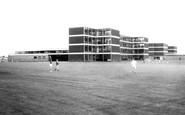
The red brick village, which has expanded to become interesting rather than beautiful, has excellent examples of Leicestershire vernacular, from the 17th-century Stuart House in Station Street to the
This view looks north along Trumpington Street, with Pembroke College on the right, and the Peterhouse Museum on the left.

The view of the Bear and the adjacent buildings on the right is now hidden by High Street Colonnade.

Here we look along the High Street, where most of the houses and cottages survive on the left but only No 62, then an antique shop, on the right.

On Main Street were the blacksmith, the wheelwright, the fishmonger, the butcher and the post office, which was run by Mr R Ireland in his general stores (right).

At the bottom of Maidstone High Street both the Queen's Head public house, on the left, and the Rose and Crown Hotel across the road have gone; the trolleybuses also went in 1966.

St Michael's parish church is north of the High Street, and a reminder of a pre- Rothschild era for the village, although the chancel was restored at his expense in 1877.

This view shows Middle Street and Village Road, between the flagstone-topped terraces of high raised pavements, looking towards the 1863-built spire of Holy Trinity parish church in the northern
Places (385)
Photos (21808)
Memories (6666)
Books (1)
Maps (1622)

