Places
36 places found.
Did you mean: street or streetly ?
Those places high-lighted have photos. All locations may have maps, books and memories.
- Heathfield, Sussex (near Cade Street)
- Street, Somerset
- Chester-Le-Street, Durham
- Adwick Le Street, Yorkshire
- Scotch Street, County Armagh
- Friday Street, Surrey
- Potter Street, Essex
- Boughton Street, Kent
- Newgate Street, Hertfordshire
- Streetly, West Midlands
- Shalmsford Street, Kent
- Green Street Green, Greater London
- Boreham Street, Sussex
- Park Street, Hertfordshire
- Cade Street, Sussex
- Appleton-le-Street, Yorkshire
- Hare Street, Hertfordshire (near Buntingford)
- Romney Street, Kent
- Trimley Lower Street, Suffolk
- Streetly End, Cambridgeshire
- Hare Street, Hertfordshire (near Stevenage)
- Brandish Street, Somerset
- Colney Street, Hertfordshire
- Langley Street, Norfolk
- Silver Street, Somerset (near Street)
- Street, Yorkshire (near Glaisdale)
- Street, Lancashire
- Street, Devon
- Street, Cumbria (near Orton)
- Street, Somerset (near Chard)
- Bird Street, Suffolk
- Black Street, Suffolk
- Ash Street, Suffolk
- Broad Street, Wiltshire
- Brome Street, Suffolk
- Penn Street, Buckinghamshire
Photos
24,921 photos found. Showing results 781 to 800.
Your search returned a large number of results. Please try to refine your search further.
Maps
1,622 maps found.
Books
3 books found. Showing results 937 to 3.
Memories
6,667 memories found. Showing results 391 to 400.
Dereham Norfolk
I was born in Dereham, Muriel Secker, and lived in Cowper Road. I went to the Infants School, near Bishop Bonners Cott, 1928-1932/3, then National School and finally was Head Girl at Crown Road School. 1939 I worked in Hobbies ...Read more
A memory of Great Dunham in 1930 by
Growing Up In Newton
I was born in the old cottage on the left, 175 High Street, in 1948, as June Glencross, my parents squatted there after the war, my dad became the local builder. In 1956 we moved up the road to the old congregational ...Read more
A memory of Newton-le-Willows in 1948 by
Chelmsford, Shire Hall 1895.
Many years ago the Shire Hall was where the Quarter Sessions trials were held. This would be the same as the Crown Court trials of to-day. The magistrates court was held in an old building which can still be seen in ...Read more
A memory of Chelmsford by
Crompton County Secondary Modern School. (T''central)
t'Central stood at the junction of Kings Road & Moor Street, almost on the bend.Compared to the junior school it seemed very modern and had only been open about twentyfive years. It had a ...Read more
A memory of Shaw in 1947
Ve Day Celebrations
I remember when I was seven years old Overton had a special carnival. I would love to see any old photos of this event. I was lucky enough to be one of the special attendants. We received ribbon for saches and extra clothing ...Read more
A memory of Overton by
Chelmsford, Tindal Street, 1919
This shows the view looking up Tindal Street from the London Road end. In the centre of the photo you can see a sign sticking out. This you can just make out is the Spotted Dog public house which was there until that ...Read more
A memory of Chelmsford by
Chelmsford, Shops In The High Streeet, 1919.
This view is taken from outside the island where the current Lloyds Bank stands, and shows the view down the High Street. In the background can be seen the spire, which was the Wesleyan Church, and to-day ...Read more
A memory of Chelmsford by
Coatbridge
I was born in my grandad's back room, 39 Cecil Street, Coatbridge. My mum was Jeanie Young who married Johnny Mclean my dad. My grandad Billy Young was a character who was well known about Coatbridge, I remember a pub he used to drink ...Read more
A memory of Coatbridge in 1970 by
Sainsburys And Hudsons
I also remember going into Sainsburys as a child in the 1960s when it was halfway up the High Street on the left, it had metal racks on the front of the counters to rest shopping bags on. The marble effect floors were a vivid ...Read more
A memory of Ashford in 1974 by
A Cold And Dim Visit To Banstead Asylum
I cannot remember the exact year but it was very cold. I was a TV repair man at Raylec in the High Street and we had a call from a doctor living in a house at the Asylum. She complained that the picture on ...Read more
A memory of Banstead in 1961 by
Captions
5,435 captions found. Showing results 937 to 960.
This lane is called Dam Street at its junction with the High Street.
The distance between the building lines on Lord Street is 88 yards, which makes it much wider than either Union Street, Aberdeen, or the Headrow, Leeds.
Fisherton Street was an important shopping street linking the railway station with the city centre.
Fisherton Street was an important shopping street linking the railway station with the city centre.
Frogmore Street begins near the bank on the right, site of the medieval north gate. The pedestrians walking towards the camera are heading for the High Street and, no doubt, the market.
Previously known as 'Bowrington Street' after Dr John Bowring, Commercial Street is still home to the Sawyers Arms.
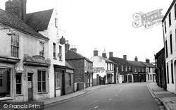
Looking east along the High Street, this view gives a good idea of the variety of buildings and building materials to be found in this street, which survived modern development.
West Street is quieter than the High Street and this view looks south-west past the village hall with its somewhat ungainly porch 'perched' on the roof.
Horse-drawn transport is still prevalent, but it is about to be phased out by the motorised vehicles which were taking over the streets of the old Cumbrian town.
Fisherton Street was an important shopping street linking the railway station with the city centre.
A Wesleyan church stood in South Street but was demolished in the late 1960s. John Wesley visited Dorking in January 1764 on one of many visits that he made to the town.
The open aspect of the street pictured here and familiar to us today originates from the demolition of older buildings in 1862 to allow road widening.
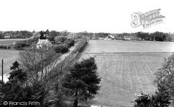
This photograph was taken from the church tower looking north towards the main street. The post mill, which stood to the north of the cottage, was built in 1829 and demolished in 1912.
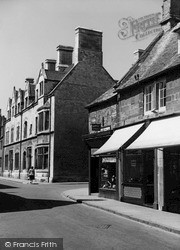
Here High Street meets Orange Street. Hudson's Cycles are on the corner, next door to a butcher's. Opposite is the fine limestone building known as Old Constables.
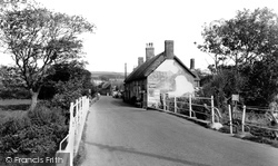
Taken from the bridge over the River Bride, this view looks northwards into the southern section of the High Street.
The Co-op dominated this street: drapery and millinery were at number 9 Cardiff Street, and the main part with food, ironmongery, and footwear was at numbers 3, 4 and 5.
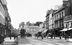
From early morning until midnight, The Strand is London’s busiest street and invariably congested with traffic.
The British School of 1859, demolished in the late 1960s, was much like the National School, now Andover Primary School (C of E Controlled) which still thrives today in lower East Street.
Bangor's main street runs between the station and the harbour. It is shown here crowded with shoppers and an early car. The street today has been partly pedestrianised.
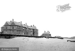
These have now been rebuilt as mighty ramparts, and you cannot see the sea from the streets of Mablethorpe.
The area known as Churchgate Street lies close to Old Harlow, and has the air of a quiet village.
Chapel Street and Duke Street run down towards Bildeston Hall (right). The burial ground of the Baptist chapel, rebuilt in 1844, is opposite the Hall.
Pleck Road through to Peel Street is just visible on the left of the photograph.
The Nottingham Co-operative Society (centre) is no longer on the left of the High Street - the building is now a pet shop, and the Co-op has moved to a more modern building across the street.
Places (385)
Photos (24921)
Memories (6667)
Books (3)
Maps (1622)


