

Places
2 places found.
Those places high-lighted have photos. All locations may have maps, books and memories.
Photos
3 photos found. Showing results 501 to 3.
Maps
29 maps found.
Books
1 books found. Showing results 601 to 1.
Memories
1,365 memories found. Showing results 251 to 260.
My Days At Ongar Secondary School And After
I attended Ongar Secondary School from 1945 to 1949. Some of the students I remember were Keith Mills (we were longtime friends, he passed away 2005), Len Shuttleworth, Hugh Brace, Brian Buttle, Jim ...Read more
A memory of Chipping Ongar in 1949 by
Wonderful Childhood Memories
I lived in Cannock from 1963 to 1970. We lived on the Longford Estate in Leamington Close, we were the first family to live in that house after it was built. I went to Bridgetown Primary School and started year 1 in ...Read more
A memory of Cannock in 1860 by
From The 2nd World War
My grandparents lived at The Cottage in South View, Uppingham for 40 years from 1908 where he was a well known Director of Music at the public school. From a very early age during the second world war I made my first visit. ...Read more
A memory of Uppingham in 1943 by
Bombing In Petts Wood
The night our ceiling fell in, is vivid in my memory, I lived in Fieldway, Petts Wood which backed on to Eastbury Avenue, on the night of the bombing a bomb fell in Eastbury Avenue, my parents, myself, brother, sister ...Read more
A memory of Petts Wood in 1940 by
My Birthplace
I was born at Orchard Bakery Cottages which is beyond the trees to the right of this photo. Many generations of my family attended the school. My great Aunt May (Skilton) in the early 1900s; various of my Uncles (Pat & Geoff ...Read more
A memory of Holmwood Corner in 1958 by
Aston Terrace
I was born in Aston Terrace in 1954 and remember running to the bridge to see the steam trains and also the big slag heap that my brothers used to slide down. I also remember the gas man that used to light the street gas lamps outside our ...Read more
A memory of Aston in 1954
Growing Up In Gildersome
I was born in 1952 and lived in Gildersome until I was 19 years old. My name until then was Lorraine Thompson. I have many happy memories of living in the village. Until I was 4 years old I lived in a terrace called Green ...Read more
A memory of Gildersome in 1952 by
Good Memories
My grandma, Mary Bowers, worked at Parkside Hospital in the 60's & was there the day Neil Armstrong took the first steps on the moon in 1969. Mum talks of Grandma & how she found it so funny as the patients were all sat ...Read more
A memory of Macclesfield in 1969 by
Photos Of The House I Grew Up In On Crown Road
My brother Don Quarterman sent me to this web site. What an amazing collection of photographs! So I have to talk about two that show the house we grew up in, Mulberry Cottage. The earlier one shows ...Read more
A memory of Wheatley in 1953 by
The Highway 1957
This is a photo full of memories for me, too. We lived in Tatling End (Brokengate Lane) from 1941 to 1954, so Gerrards Cross was more than familiar to me! In the photo on the right, you can see the garage/petrol station where ...Read more
A memory of Gerrards Cross by
Captions
918 captions found. Showing results 601 to 624.

In the distance we can see the spire of the Congregational Church. Notice the horse- drawn trap and the pedestrians in the road—the modern visitor would risk life and limb to do the same.

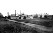
Here we see the construction still under way. It is said that Quilter added a new tower for each million he made - by 1905 there were nine towers.

In the background we can see the funicular railway for those not wanting to make the 485-foot walk up Constitution Hill.
 c.1960, Felsted")
In this photograph, we see the original school building, known as the Old School House, facing the camera.

These have now been rebuilt as mighty ramparts, and you cannot see the sea from the streets of Mablethorpe.

Looking southwards along Church Lane, we see the thatched Glebe Cottage, which was originally two dwellings. Beyond it is Wickham Cottage, which has since undergone major restoration.

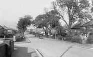
Halfway down the village street on the left we can see the white-painted Fauconberg Arms.

At the right we can see the medieval arches of St John's Hospital at ground floor level with the sashes of the former Council Chamber above; the stone external staircase was added in 1958.

Here we see the villagers enjoying a sunny day. The blinds are up over the shop windows.

We can see the remains of the circular dovecote on the left of the photograph.

On the left we can see the pediment and roof of the Baptist Chapel, built in 1856 on the recently-constructed Station Hill.

It is quite remarkable to see the crowds of Londoners poured into Southend by steamboat and excursion train on a fine summer's day.

In this later view, we can see the Guildhall on the left side of the riverbank. As well as an underground passage opening right onto the water's edge, the Guildhall has two secret rooms.

On the left we can see the long, steeply pitched roof of the Methodist church on Kents Bank Road.

The timber palisade was replaced by a stone curtain wall in the early 13th century; here we can see the remains of the 12th-century keep.

Preston was the centre of a wheel of railway transport: spokes went off to Blackpool, Lancaster, Blackburn, Manchester, London, Liverpool and Southport.As we can see, the river was used for pleasure

Here we see the entrance lodge to Corporation Park.

Here we see the funfair actually on the sands above the high water mark, including a helter-skelter tower.

We can see the stone mullion windows and low doorways of this former almshouse, which was built under the will of Robert Napier in 1616.

In this carefully composed picture we see the lower part of the village. The two men, one holding the horse and one with his dog, are everything a photographer could want in a village scene.

Through the famous Cow and Calf Rocks high up on Ilkley Moor, we can see the estate of Denton Park, once the home of the Fairfax family.

We can see the steepness of the streets by comparing the level of the Laurel Inn with the houses rising up behind.

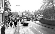
We can see the signboard for the new Fountain public house on the left beside the street lamp, but the pub is set back out of sight. The major roundabout is visible at the end of the road.

On the left up the street we can just see the end gable of the Brunswick Methodist chapel - a very thriving church in the earlier history of the town; it still survives, but as a carpet warehouse.
Places (2)
Photos (3)
Memories (1365)
Books (1)
Maps (29)

