

Places
36 places found.
Those places high-lighted have photos. All locations may have maps, books and memories.
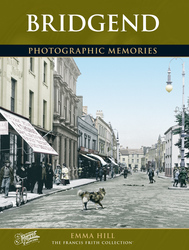
- Bridgend, Mid Glamorgan
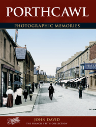
- Porthcawl, Mid Glamorgan
- Maesteg, Mid Glamorgan
- Pontycymer, Mid Glamorgan
- Bridgend, Dyfed
- Bridgend, Strathclyde
- Pencoed, Mid Glamorgan
- Aberkenfig, Mid Glamorgan
- Nant-y-moel, Mid Glamorgan
- Blackmill, Mid Glamorgan
- Nottage, Mid Glamorgan
- Merthyr Mawr, Mid Glamorgan
- Bryncethin, Mid Glamorgan
- Bridgend, Devon
- Newton, Mid Glamorgan
- Wig Fach, Mid Glamorgan
- Ogmore Vale, Mid Glamorgan
- Caerau, Mid Glamorgan (near Maesteg)
- Sarn, Mid Glamorgan
- Tondu, Mid Glamorgan
- Mawdlam, Mid Glamorgan
- Coity, Mid Glamorgan
- Llangynwyd, Mid Glamorgan
- Kenfig Hill, Mid Glamorgan
- Cefn Glas, Mid Glamorgan (near Bridgend)
- Llanilid, Mid Glamorgan (near Bridgend)
- Candleston Castle, Mid Glamorgan
- Glynogwr, Mid Glamorgan
- Abergarw, Mid Glamorgan
- Pant-yr-awel, Mid Glamorgan
- Price Town, Mid Glamorgan
- Brynmenyn, Mid Glamorgan
- Bridgend, Strathclyde (near Kirkintilloch)
- Bridgend, Tayside (near Kirriemuir)
- Bridgend, Lothian (near Linlithgow)
- Bridgend, Cumbria
Photos
193 photos found. Showing results 1 to 20.


Maps
520 maps found.


Books
2 books found. Showing results 1 to 2.
Memories
349 memories found. Showing results 1 to 10.
Harry Street
My gran lived on Harry Street in the 1960's and early 70's. I remember playing near the Trafford swing bridge and the excitement when it was opened. Old terraced houses slums by then. Corner shops and the horrible smell from the canal. ...Read more
A memory of Salford by
Mitcham
I lived in Manor Road in the late fifties and then Lymington Close until the end of the sixties, it was a great place to live then. We played on Mitcham common going to the seven island ponds on our bicycles and the old gun site. Mr ...Read more
A memory of Norbury
My Memories Of The Coronation 2nd June 1953
My memories of the Coronation-2nd June 1953 While I was studying at the Bridgend Preparatory and Commercial School two events happened which changed the course of history for Great Britain. In February ...Read more
A memory of Aberkenfig in 1953 by
Happy Childhood Holidays
I say 1950 for the year my memory relates to but in fact my memories cover from around 1946 to 196 I've only just found this web site for "Memories" although have looked at the site before and what nostalgia it has evoked ...Read more
A memory of Llwyngwril in 1950 by
Penton Camp Club
The Penton Camp Club started in about 1903. Its members included the Manager of Martin's Bank, London, the manager of the Drury Lane Theatre and many other rich men. They would come by train to Staines, the old station at the ...Read more
A memory of Penton Hook in 1900 by
Cub Camp Seasalter In The 50's
Living in Hackney in east London as a kid at that time surrounded by bomb sites, it was great when being in the 6th Hackney cub pack, we were told we could go to Seasalter in Kent for a weeks camp. Coach down there, and ...Read more
A memory of Seasalter by
Driftbridge Stables
I was too young in the 1950’s to use the Hotel and pub but I learnt to ride at the Driftbridge Stables, that used the land, stables and coach houses from when the hotel had been a Coaching Inn. Having learnt to ride on Nutmeg, I ...Read more
A memory of Drift Bridge by
Childhood
Having just stumbled across this website and viewed the photographs, I immediately went into nostalgia mode. I was born in Alrewas in 1938 in one of the small cottages in Main Street just down from Mansell's bridge, and then moved to The Old ...Read more
A memory of Alrewas in 1940 by
The Rec!
Ah yes, The Rec! Scene of many a battle and many a cup final, in later years there was romance! You could get through the hedge and down onto the railway line to put halfpennies on the line that got flattened by trains as they ran over ...Read more
A memory of Little Sutton by
Good Times
I lived at 14 oak street Chapel of Ease. I can remember the two estates being built and the bridge in the photo is also the way I went to school at the west end primary school. The red phone box is still there I believe, in the photo the high ...Read more
A memory of Abercarn by
Captions
154 captions found. Showing results 1 to 24.

Situated two miles south-south-west of Bridgend, Ogmore was originally a ringwork with a timber palisade built in 1116 by William de Londres to guard crossing points on the rivers Ewenny and Ogmore.

The landlords of the Bridgend Inn, the rear of which is on the left, were George and Betty Dobson, and the busy boat hire business operating from the hut further down the towpath was owned by a Mr
Two miles south-south-west of Bridgend, Ogmore was originally built in 1116 by William de Londres to guard crossing points on the rivers Ewenny and Ogmore.
The landlords of the Bridgend Inn, the rear of which is on the left, were George and Betty Dobson, and the busy boat hire business operating from the hut further down the towpath was owned by a Mr Price

The National Provincial Bank commenced business in Bridgend in 1835. There is a plaque in Bridgend library to honour Dr Richard Price of Tynton Farm in the Garw valley.

The canal runs through Gilwern; it is very picturesque, and there are now moorings in Gilwern for pleasure boats outside the Bridgend Inn. This view was taken further along the canal.

Five miles south-west of Bridgend, this crenellated mansion was built on the site of a former medieval fortress for Thomas Wyndham MP between 1802 and 1806.

Situated five miles south-west of Bridgend, the Dunraven in our picture is the 19th-century castellated mansion built for Thomas Wyndham MP between 1802 and 1806 on the site of a medieval fortress.

This bridge, from which Bridgend derives its name, was probably constructed after Owain Glyndwr's uprising. It was partly demolished by a large flood on 21 August 1775.
Five miles south-west of Bridgend, this 19th-century crenellated mansion was built on the site of a former medieval fortress for Thomas Wyndham MP between 1802 and 1806.

The population of Bridgend at this time was approximately 6,000.

Ogmore lies two miles to the south-west of Bridgend.
Ogmore lies two miles to the south-west of Bridgend.

The village of Pyle is situated north of Porthcawl just off the M4 between Bridgend and Port Talbot.

The Welsh name for Bridgend is 'Yr Hen Bont'.

Coity Castle stands less than two miles to the north-east of Bridgend. There is a legend of how Payn de Turberville acquired Coity following the Norman conquest of Glamorgan.

Coity Castle is roughly two miles to the north-west of Bridgend; a somewhat unusual feature is that the castle was not built on the highest ground on this site - there is higher ground nearby.

Bridge End is on the south bank of the Avon, where all the roads from the south previously met to cross into Warwick.

Bridge End may have escaped major development, but the house on the right is a 20th-century addition, built onto the end of the terrace (compare this photograph with 72355, above).

These two views both feature the fine Georgian river bridge and the southern part of Riverside, sometimes called Thames Side; by this date it was solely used for mooring and hiring pleasure craft,

Well south of the bridge and 'Roytown', the parish church sits aloof.
This photograph was taken from Lambeth Bridge, and shows the Houses of Parliament before Victoria Tower Gardens were laid out on Millbank.

Alas, the upper bridge and pathways no longer exist.

The promenade - Undercliff Walk - alongside the Archbishop's Palace, looking north towards Maidstone Bridge and the chimneys of the industrial area beyond.
Places (108)
Photos (193)
Memories (349)
Books (2)
Maps (520)

