Places
36 places found.
Did you mean: street or streetly ?
Those places high-lighted have photos. All locations may have maps, books and memories.
- Heathfield, Sussex (near Cade Street)
- Street, Somerset
- Chester-Le-Street, Durham
- Adwick Le Street, Yorkshire
- Scotch Street, County Armagh
- Friday Street, Surrey
- Potter Street, Essex
- Boughton Street, Kent
- Newgate Street, Hertfordshire
- Streetly, West Midlands
- Shalmsford Street, Kent
- Green Street Green, Greater London
- Boreham Street, Sussex
- Park Street, Hertfordshire
- Cade Street, Sussex
- Appleton-le-Street, Yorkshire
- Hare Street, Hertfordshire (near Buntingford)
- Romney Street, Kent
- Trimley Lower Street, Suffolk
- Streetly End, Cambridgeshire
- Hare Street, Hertfordshire (near Stevenage)
- Brandish Street, Somerset
- Colney Street, Hertfordshire
- Langley Street, Norfolk
- Silver Street, Somerset (near Street)
- Street, Yorkshire (near Glaisdale)
- Street, Lancashire
- Street, Devon
- Street, Cumbria (near Orton)
- Street, Somerset (near Chard)
- Bird Street, Suffolk
- Black Street, Suffolk
- Ash Street, Suffolk
- Broad Street, Wiltshire
- Brome Street, Suffolk
- Penn Street, Buckinghamshire
Photos
21,808 photos found. Showing results 4,281 to 4,300.
Maps
1,622 maps found.
Books
1 books found. Showing results 5,137 to 1.
Memories
6,666 memories found. Showing results 2,141 to 2,150.
Part 13
He then ran a wet fish trade from a horse and cart, but also ran a fish and chip shop. Last time I was in Houghton the fish shop was still there. In Newbottle Street, just up from the school and on the same side. Gran was very proud ...Read more
A memory of Middle Rainton in 1945 by
Fullerton Road
I was born and lived for 12 years of my life in Fullerton Road, I lived with my parents sister and brother in my nan's house number 19. My uncle and aunt lived at the bottom of the cul-de-sac, I had an aunt in Stretton Road ...Read more
A memory of Addiscombe by
Trevone
We emigrated to Pennsylvania from Accrington in June, 1954; I was seven years old. One year later we returned to England and settled in Farnborough in May, 1955. My father worked for Turk, Krish and Barstow, Solicitors, who were located ...Read more
A memory of Farnborough in 1955 by
Berry Street
Hi, moved to Gorton when I was 5 yrs old, lived on Berry Street in the shadow of St James church. Loved playing in the grave yard, cobbled street back yards, outside loo, them were the days. Went to St James school, had a friend called ...Read more
A memory of Gorton in 1970 by
Part 11
And had an inter-house sports day annually that was highly contested. The school was divided into four houses, St Columbus, St Aiden, and St Patrick and St Cuthbert’s. Church attendances were very high, poor Fr. Tuohey had to give ...Read more
A memory of Middle Rainton in 1945 by
Kennards
At the same time in Wimbledon, there was also another Kennards and like the poster said, he used to go to Kennards with his mum and nan and so did I (to the Kennards in Wimbledon). I was about 4 or 5 then, just after the war and when I first ...Read more
A memory of Croydon in 1957 by
Ryde
I was born in Longmead Road, Ryde, and remember frequenting the local band's venues, The 69 club at the Ryde Castle and the Royal York Hotel, also The Seagull at the end of Ryde Pier and the Babaloue? at Ryde airport. Ryde had many famous bands ...Read more
A memory of Ryde in 1961 by
Traffic Lights At The Top Of The High Street
I lived in nearby Shirley and in the late 1950s I used to cycle through West Wickham to a fish and chip shop in Glebe Way on a Saturday evening for the family supper. I was in my teens at the time and ...Read more
A memory of West Wickham by
Pilgrims Hatch/Childhood.
I was born in London in 1937 and moved to Days Lane, Pilgrims Hatch in that year,so all my childhood years were spent around the Pilgrims Hatch area. Dad was always sharp of the mark and a couple of steps ahead so foresaw ...Read more
A memory of Brentwood in 1940 by
Our First Home
We bought 8 Alexandra Street in November 1957, four months before we were married. In November 1959 our daughter Alison was born. People were friendly, our neighbours were kind and always on hand to help. Alison had a ...Read more
A memory of Victoria Garesfield in 1958 by
Captions
5,381 captions found. Showing results 5,137 to 5,160.
On St Matthew Street opposite once lay Gilbert's Rugby Football Museum, where rugby balls had been made by hand since the first half of the 19th century.
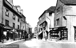
The slate-hung buildings are 11 and 13 High Street, two of the oldest in town.
The slate-hung buildings are 11 and 13 High Street, two of the oldest in town.
The leafy High Street rises away from the village to become the main road to Ashby-de-la-Zouch.
The camera looks east down the High Street, which opens onto Church Gate and Derby Road. Kegworth's origins lay in its medieval weekly market and annual fair.
Until the A6 was pushed between the two villages, it made its way via their narrow rather tortuous streets. At the end of the 20th century, unfortunate changes were inflicted on this view.
South Luffenham on the river Thater is a 7th-century Saxon settlement with North Luffenham, now adjacent to the A6121 Uppingham to Stamford road to the north, an attractive village of narrow streets and
This view shows the western end of East Street, with a closer look at the Town Hall clock-tower and cupola, and Colmer`s Hill forming the conical eminence in the distance (centre).
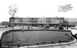
The parade of shops shown here was added to the infrastructure when it became obvious that the existing retail function based on the High Street could not cope with demand and was too far away from the
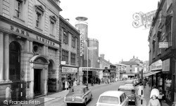
The only real change today is that the brick building just to the right of the two cars, which was home to a butcher's shop, was demolished in the early 1970s to widen the entrance to Water Street
Note the painted wooden Manchester Warehouse Co. sign under the chimneys on the left, the ladder against the building further up the street, and the Royal Gatehouse Hotel carriage on the right
This view shows the western end of East Street, with a closer look at the Town Hall clock-tower and cupola, and Colmer`s Hill forming the conical eminence in the distance (centre).
The shoes were made just round the corner in Market Street until the 1930s.
The only real change today is that the brick building just to the right of the two cars, which was home to a butcher's shop, was demolished in the early 1970s to widen the entrance to Water Street.
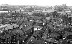
This unusual view looks north-west from the tower of St Mary Magdalene's church across the pantiled and slate roofs of the town; the streets and lanes are mostly as laid out by Alexander, Bishop
The name 'Finkle' comes from a Viking word meaning 'angle' or 'corner', and this less than straight street has not changed its line since those times.
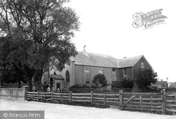
The first is down Market Street. The Baptist church was built early in the19th century; it was attached to a farmhouse, the tile-hung building to the right.
This view of the High Street, looking south from the Station Road crossroads, changed dramatically when the M23 and M25 by-passed the town; much has been pedestrianised and demolished.
The relatively narrow main street carried heavy traffic to Nottingham, the north, and the east coast.
This follows the course of the old Roman road from London to Chichester, called Stane Street, which is nowadays the busy A24 road from London to Worthing.
Rye is rich in medieval houses and quaint streets; the Landgate is the only surviving town gate of the original four; dating from 1329 or 1381, it had a portcullis and a drawbridge, and is a most imposing
Photographed before its conversion to a one-way system, the High Street appears a quiet market town thoroughfare.
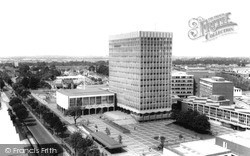
Moving away from the seaside, via Southend High Street, the Civic Centre is to be found in Victoria Avenue.
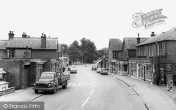
with builders materials, Charles Love & Son's ironmongery and radio/TV engineer's (right), Lisles petrol station (near right), and further down the road, car sales showrooms as well as the usual high street
Places (385)
Photos (21808)
Memories (6666)
Books (1)
Maps (1622)


