Places
36 places found.
Those places high-lighted have photos. All locations may have maps, books and memories.
- Cardiff, South Glamorgan
- Barry, South Glamorgan
- Penarth, South Glamorgan
- Rhoose, South Glamorgan
- St Athan, South Glamorgan
- Cowbridge, South Glamorgan
- South Molton, Devon
- Llantwit Major, South Glamorgan
- Chipping Sodbury, Avon
- South Chingford, Greater London
- South Shields, Tyne and Wear
- Ayr, Strathclyde
- St Donat's, South Glamorgan
- Llanblethian, South Glamorgan
- Thornbury, Avon
- Llandough, South Glamorgan
- Fonmon, South Glamorgan
- St Nicholas, South Glamorgan
- Jarrow, Tyne and Wear
- Penmark, South Glamorgan
- Font-y-gary, South Glamorgan
- Maybole, Strathclyde
- Yate, Avon
- Oxford, Oxfordshire
- Torquay, Devon
- Newquay, Cornwall
- Salisbury, Wiltshire
- Bournemouth, Dorset
- St Ives, Cornwall
- Falmouth, Cornwall
- Guildford, Surrey
- Bath, Avon
- Looe, Cornwall
- Reigate, Surrey
- Minehead, Somerset
- Bude, Cornwall
Photos
5,607 photos found. Showing results 21 to 40.
Maps
2,499 maps found.
Books
23 books found. Showing results 25 to 23.
Memories
1,580 memories found. Showing results 11 to 20.
Club Outing
Our ciu club in Watford came here for a weekend break. It was the Toby Club, as was called, that raised money for the old folks Xmas party. As we were from South Wales, my husband suggested we come down. What agreat time we all had!
A memory of Porthcawl in 1990 by
The Bell Inn
I moved to Outwood 10 years ago to work at the Bell Inn. With its own unique charm I was taken with it from the moment I entered. Originally run by a Mr. John Lane the pub was sold a few years later to a private investor and was sold ...Read more
A memory of Outwood in 2008 by
The Slate Islands Easdale
THE SLATE ISLANDS By Walter Deas Some 24k (15 miles) south and west of Oban lies an area with interesting old ...Read more
A memory of Easdale in 2005 by
Hobbs Farm
Our family moved from Bognor to Yapton in 1951 just before my 10th birthday. I was only 13 and attending Chichester High School for Girls when I started working weekends at Hobbs Farm, Bilsham Corner. It was a pedigree Jersey dairy farm and ...Read more
A memory of Yapton in 1954 by
My Apprentice Days With Northmet Electricity (Eeb)
I was born in Elmgrove Crescent Harrow in 1933 and lived in Pinner Road North Harrow, moving to Wealdstone in 1934. I started at Bridge Scool in 1938 and followed on to Belmont Sec. Modern School until ...Read more
A memory of Kenton in 1948 by
Growing Up At Coombe Place
My family and I moved to a bungalow at Coombe Place in 1960. My father, Walter Motley, took up the post of farm manager on this 100 acre dairy farm with a herd of Jersey cattle. Coombe Place is set on the side of the South ...Read more
A memory of Offham in 1960 by
Lawrence And Peggy Berg
My uncle Lawrence married Peggy Smurthwaite in about 1935 and took over the Hinchley Wood Hotel. It was already well-known to him and his brother, Ellis, because he was a partner in the building firm E & L Berg which ...Read more
A memory of Hinchley Wood in 1930 by
Stanley Road, South Harrow
I lived with my foster family in Stanley Road South Harrow, during the war. Our house backed on to the gas works and I always wanted to climb the gasometer which I did eventually with a friend from across the road. At ...Read more
A memory of South Harrow in 1940 by
Basset Street School
I remember this school so well, my first born went to this school in 1983 and so did my daughter, it's a shame they pulled part of it down. I remember walking the children over to what is now the infant school to use their ...Read more
A memory of South Wigston in 1983 by
Homes Boy
I entered White's Children's Home and Mission (known as CH&M) in June of 1945 having come from Surbiton, Surrey. I was 9 years old. The home was situated in Church Rd opposite "The Pond", it is now a CO-OP supermarket. There was a large ...Read more
A memory of Tiptree in 1945 by
Captions
2,476 captions found. Showing results 25 to 48.
Nine Mile Ride runs east to west from south Easthampstead to south of the Arborfield Garrison, originally cutting through Windsor Forest; it is now developed with long lines of bungalows.
The lozenge-shaped washroom windows can be seen (centre, 72159) on the south side of Old Quad.
South Road became so dominant that it altered the character and subsequent development of other areas within the town such as Commercial Square, Boltro Road, and the Broadway.
Here we see the abbey from the south, featuring the great 12th- century south porch with its elaborate figurative carving. The church was repaired during 1822 and 1823 and in 1903.
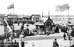
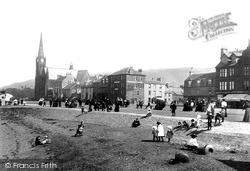
A delightful study of people taking the sea air and enjoying the view over South Bay. It provides a detailed study of both clothing and baby carriages of the period.
Two miles south-south-west of Bridgend, Ogmore was originally built in 1116 by William de Londres to guard crossing points on the rivers Ewenny and Ogmore.
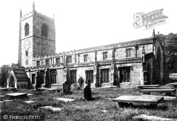
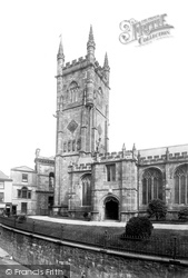
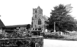
A view from Church Street showing the ornate tower, the south porch with a priest's chamber above, and the crenellated south aisle.
A number of neighbourhoods—Fryerns, Barstable, Kingswood and Lee Chapel South—were in place by 1958. Then, the government issued plans for increased house-building all over the country.
Lydford was once an important halt on the South Western Railway, which skirted round Dartmoor to the north and passed through Tavistock and Bere Alston on its way to Plymouth.
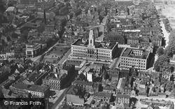
This aerial view of the South Yorkshire town of Barnsley centres on the imposing white stone Town Hall with its monolithic central clock tower.
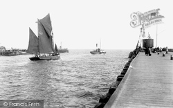
A brisk south-westerly wind snatches sails and flags, rippling the surface of the sea and causing both the sail- and power-driven craft to pitch and roll easily.
The pier opened in 1868 as the South Pier, then changed its name to Blackpool Central when the Victoria (now South) Pier opened.
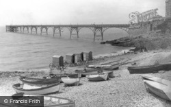
This elegant pier was built using rails torn up from the South West Railway, and opened in 1867.
South Street, however, showed more architectural consistency than Fore Street, or even High Street.
Largs was well-served by steamers from all parts of the Clyde, and by the Glasgow & South Western Railway to Ardrossan, via Fairlie and West Kilbride.
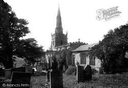
The south tower is ashlar-faced, with big buttresses; it is Perpendicular, as is the north arcade and the clerestory.
Largs was well-served by steamers from all parts of the Clyde, and by the Glasgow & South Western Railway to Ardrossan via Fairlie and West Kilbride.
This attractive village retains its quiet rural atmosphere; it is ranged along its north-south street about a mile to the south of Kibworth Beauchamp.
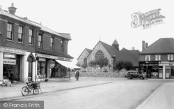
Between 1921 and 1951 the population of Lancing nearly quadrupled, resulting in a rapid increase in the number of shops, businesses and houses in South Lancing.
The pier opened in 1868 as the South Pier, then changed its name to Blackpool Central when the Victoria (now South) Pier opened.
South Wingfield's parish church of All Saints dates mainly from the 13th century.
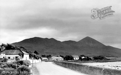
Situated about six miles south-west of Westport, it rises just over 2,500 ft from the south shore of Clew Bay.
The path (foreground) is now part of the South-West Peninsular Coast Path, Britain's longest national trail, all the way around the South-West Peninsula from Shell Bay to Minehead.
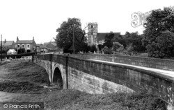
The parish church of St Helen stands sentinel over the bridge in the village of Stillingfleet, south of York.
Places (15471)
Photos (5607)
Memories (1580)
Books (23)
Maps (2499)


