Places
3 places found.
Those places high-lighted have photos. All locations may have maps, books and memories.
Photos
68 photos found. Showing results 1,121 to 68.
Maps
12 maps found.
Books
15 books found. Showing results 1,345 to 15.
Memories
7,562 memories found. Showing results 561 to 570.
When I Was 12
I was born in Dublin, Ireland. My mother was born in Six Bells. Her name was Olwen Roche, nee Griffiths. In 1959 my mother took myself and my brother to stay with my grandparents who lived at no 9 Griffin Street. I will never forget ...Read more
A memory of Six Bells in 1959 by
Top Of Valence Avenue
I lived at the top of Valence Avenue, which was 1.1/4 miles long. I was nearly into Chadwell Heath, but my address was Dagenham (and proud of it!) . I used to go to Lymington Road School and we went to Valence Swimming Baths ...Read more
A memory of Dagenham in 1943
Visits To Captain Digby In 1960s
I remember our annual holiday to Kingsgate in the 1960s. We stayed in various guest houses in Percy Avenue and often walked down to Kingsgate Bay for a day on the beach. In 1965 I was aged 7 and remember the pub ...Read more
A memory of Kingsgate in 1965 by
Fetcham In The Forties And Fifties
This parade of shops is in my memory for ever - my family moved to Orchard Close - which starts just beside the post office on the right of the picture - in 1946. My brother was five and I was six months old. We ...Read more
A memory of Fetcham in 1950 by
Early Years In Park Road
Born in 1947 to Ted & Cred Fowles, I lived in 3 Park Road until 1955 when I moved down the hill to Southsea. I started Tanyfron primary school in 1951 and went on to Penygelli Secondary school, Coedpoeth, in 1958. When ...Read more
A memory of Tanyfron by
Shewan Banchory Ternan Parish
My genealogical journey has brought me to Banchory Ternan Parish of yesteryear ... Two of my Shewan-surnamed folk were born there : William Shewan in 1883 , and one of his sisters Isabella Shewan , in about 1885. Two of ...Read more
A memory of Banchory in 1880 by
The 1950s
I was born at the maternity hospital in 1951, we lived at 3 St Oswalds Crescent and my granny and grandad lived close by on Park Road. I attended St Oswalds C of E School - I had a lady head teacher whose name escapes me before moving up ...Read more
A memory of Ashbourne in 1958 by
Wraysbury School.
I went to Wraysbury School and one day came late. Everyone was gathered in the canteen for morning assembly, and when I got there, everyone clapped and I was pushed up to receive a large brown envelope. Going back to my place, I ...Read more
A memory of Wraysbury in 1947 by
Licensed Game Butcher
Our gt uncle Edward Cope Statham, born in Barrow in Furness, was a licensed game butcher in Longton. He is on the 1901 census, aged 24, as lodging in Trentham Road so don't know if the shop was there too but we do have a photo ...Read more
A memory of Longton in 1900 by
Stubbington House School Teachers
I read with interest Peter Madden's memories. I remember Madden, we were all known by surnames. Just to jog a few more memories, there was Miss Critten's partner Miss Stapleton, they taught the juniors - Donkey ...Read more
A memory of Stubbington by
Captions
2,501 captions found. Showing results 1,345 to 1,368.
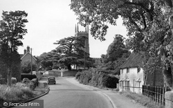
Heading south towards Bourne, the route diverts north-east of the town to Edenham, a delightful village on the east bank of the winding East Glen River, whose church has many remarkable monuments to the
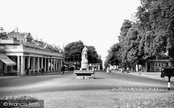
The gardens are on the right of the picture; together with the Imperial Gardens, they testify to Cheltenham's love of flowers. The rotunda (now occupied by a bank) can be seen on the left.
Just six miles from the Borde, the village of Ford sits on gently rising ground on the right bank of the Till.
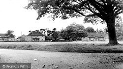
Revesby is an estate village, and the Estate Office on is the nearby A153 main road. The village was laid out in the 1850s around a huge green.
The town-village grew up where the Roman Stane Street crossed the River Arun.
The 1890s terrace with its four gabled full-height bay windows steps down the hill; the left-hand one on the corner of Outwood Lane is now no longer a Barclays Bank, but the offices of financial consultants
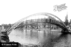
This is downstream beyond the 1813 Ouse bridge to the Embankment area, with a view of the parks and gardens mostly laid out during Joshua Hawkins's mayoralty in the 1880s.
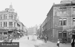
The Cash Clothing building (left) later became Lloyds Bank.
On the right are Rayner's, an electrical shop, and Thomas the ironmonger. To the right, the long building is the former 15th-century Guildhall.
The village stands on the north bank of Doulting Water, also known as the River Sheppey. Thus the name of the village may also derive from the words 'dun', meaning 'a hill', and 'dwr', 'water'.
At the west end of Lumley Road there were a few shops in 1899, but the view is utterly transformed now from Roman Bank, a reference to the old Roman sea wall.
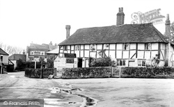
The weavers' cottages (right) are reminiscent of Kersey and Lavenham. They were restored in about 1960, when seven dwellings were reduced to three.
Following the death of the owner, the site was acquired by the town and first opened to the public in 1960.
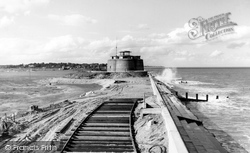
This is the last and most northerly of just over a hundred Martello towers, built to keep Napoleon at bay. This one was constructed well after the invasion threat.
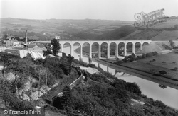
This new viaduct across the Tamar has just been opened, linking Plymouth to the district around Gunnislake and Callington.
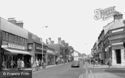
High Street North is a relatively undistinguished and typical London suburban shopping street: the exuberance of the Town Hall complex is forgotten.
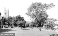
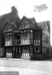
This wonderful timber-framed building dates from the 1400s. It sits opposite the church, and was once the vicarage. It has also been known as the Red House.
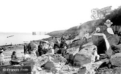
On weekdays, the main railway line from the Rhondda valley to Barry carried coal to the docks, but it was used on Sundays and bank holidays by excursion trains to the seaside.
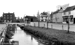
The brook here somehow appears to be little cared for, with its chipped concrete posts arrayed along weedy banks.
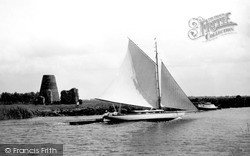
A yacht in full sail races past a well-known landmark on the lower Bure, pulling its dinghy behind. A motor cruiser chugs its way along the north bank.
We are looking up New Road, with W C King & Sons, ironmongers, on the left. Further up we can see the sign of the Black Horse. According to the deeds, this was built in November 1843 as a beer house.
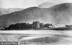
The 13th-century fortress at Inverlochy is a quadrangular enceinte with a round tower at each of the angles; the largest of these is known as Comyn's Tower, and forms the donjon.
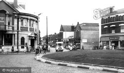
The roundabout was removed in 1979 to make way for a new road junction.
Market stalls were supposed to be erected and removed either side of market days, but inevitably it became easier to leave them stacked for use (left).
Places (3)
Photos (68)
Memories (7562)
Books (15)
Maps (12)


