

Places
Sorry, no places were found that related to your search.
Did you mean: north ness or na h ness or nook ness ?
Photos
12 photos found. Showing results 1,301 to 12.
Maps
9,582 maps found.


Books
Sorry, no books were found that related to your search.
Memories
4,597 memories found. Showing results 651 to 660.
Florence Gibson Ward
Hi all, I was there about 1961, I think it was late summer, I'd just got out of Myrtle Street Hospital in Liverpool, and instead of going home to terrible accommodation in Liverpool 8, they (whoever "they" were) sent me to Heswall to ...Read more
A memory of Heswall by
Brimscombe Corner & Burleigh 1910 62690
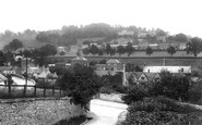
This photo is taken 100 yards up Brimscombe lane, looking back across the Golden Valley. The lane itself leads back up to Thrupp Lane & Dark lane, which is on its way to Quarhouse and the Lypiatt Manor, (the ...Read more
A memory of Brimscombe by
The Joys Of Delvering Groceries!!
In the mid 50`s, I delivered groceries on a trade bike to places in Glen Faba, from Noyes shop, in Rye Road, squatters had moved into many places and were customers. They kept Alsatian dogs to keep anyone in authority ...Read more
A memory of Hoddesdon by
Best Guinness In Town!
The little white building in the middle is the Lamb & Flag. I spent many a happy lunchtime & evening there in the '80's. It was a Marstons pub, run then by Don & Sheila Jones, an Irish couple who I think had been ...Read more
A memory of Worcester by
Fond Memories
My uncle was also a train driver out of Feltham in the 50’s and 60’s even drove the old steam trains. I caught many a 152 bus from Feltham Station. Attended Cardinal Road School from 1955-1961 then Lafone from 1961-1966. Worked in the ...Read more
A memory of Feltham
Orange Hill
Hi there... great to read these posts. Seems like most are from alumni who attended earlier than me but clearly some of those teachers had been there forever. I started in the second year in 1964, and immediately started a friendship with ...Read more
A memory of Burnt Oak by
Leverington Nus Camp
One year I arrived early the day befor the camp was due to open.With nothing much to do I gave Joan I think that was her name .She was to be in charge of the camp .That night we all went to the pun in Wisbech .When there Joan ...Read more
A memory of Leverington by
Conkers And The Pram Race
Hello, my name is David Clarke. I lived in Barlborough from 1972 to 1978. We lived at 12 Westbridge Rd during that time frame. I went to Barlborough Primary School and so did my brother until my family moved to the U.S. in ...Read more
A memory of Barlborough by
Pavenham 1945 1970
This is the village where I grew up, my parents moving into their very old, somewhat dilapidated cottage at the end of the war. This was 'The Folly' at the eastern end of the village opposite one of Tandy's farms. Why it had that name ...Read more
A memory of Pavenham by
Schooling
We moved from Chelmsford to Radcliffe in 1968 - I was 2 years old. I went to Lorne Grove Nursery and my memory of that was the Rocking Horse Toy. I hated sharing it!! I was about 3 or 4 and I remember being so upset at being taken ...Read more
A memory of Radcliffe on Trent by
Captions
1,652 captions found. Showing results 1,561 to 1,584.

On the left in this picture is the branch of the Leeds Industrial Co-operative Society. Every customer had a membership number against which all transactions were logged.

The church is a short distance from the Nower, another one of Dorking's parkland areas.
On the left in this picture is the branch of the Leeds Industrial Co-operative Society. Every customer had a membership number against which all transactions were logged.

Thus Glasgow ended up with four railway termini but not a single through line, and to this day passengers have to walk or take a shuttle bus between Central and Queen Street.

Laid down at Plymouth Dockyard as HMS 'London' in 1819, her name was changed during her somewhat slow construction; she was not launched until July 1828.

These chapels are normally constructed at the eastern end of cathedrals, and not at the west.
On the left in this picture is the branch of the Leeds Industrial Co-operative Society. Every customer had a membership number against which all transactions were logged.

His task was overwhelming, for most of the Island was in league with the smugglers to one degree or another.

We are looking north-westwards up Bell Street from the Assembly Rooms. Middle Row juts out (bottom left), and the raised pavement leads to Bell Cliff (bottom left).

Another recreation ground available to Rugbeians was the Whitehall Recreation Ground on Hillmorton Road, which housed a 28-ton, armoured First World War tank presented to the town in 1919,

Many of the shops on both right and left had only recently been, or were yet to be, converted from private dwelling houses.

Inns and beer houses served the needs of travellers and waggon drivers - the Chequers stands on the left and the George and Dragon faces us in the distance.

Here we see King Street before the Post Office moved to the High Street in 1919.

On the extreme right is Kemplah House, a private preparatory school run by Miss MacDonald and originally the residence of Mr Clarke.
She led an army of charioteers to sack Colchester, London and St Albans before heading north through Milton Keynes city area along the high streets of Fenny and Stony Stratford.

By the time of this photograph Cromer had experienced a continuing building boom, which included new premises for fashionable stores such as Jarrold & Sons (left), who are still flourishing both in Cromer

The Corporation's policy of providing a sufficient number of public parks and recreation grounds for both residents and visitors was actively pursued during this period of expansion.

'Church' is a Northumbrian word and 'Kirk' is Mercian; both words mean 'a place of worship'.

During the Civil War, Newnham, like many Royalist garrisons surrounding Gloucester, was on the receiving end of a raid mounted by Colonel Edward Massey's forces.

It became the gatehouse to the palace of the Archbishop of Canterbury during the 14th century. It is now used as the tourist information centre.

Victorian iron screens are on the west, north and south of the chancel.

supplied 500 police batons; later it became Oxley's Mineral Water factory, and in 1943 even produced Coca Cola for American troops stationed nearby; during the war German prisoners were quartered here, and another
This caused the Sardinian Chapel to be moved several hundred yards north.

By 1937 the town was being promoted as both a summer and winter resort, and hotels now occupied much of the sea front and the area behind it.
Places (0)
Photos (12)
Memories (4597)
Books (0)
Maps (9582)

