Places
36 places found.
Those places high-lighted have photos. All locations may have maps, books and memories.
- Bangor, County Down
- Newcastle, County Down
- Greyabbey, County Down
- Donaghadee, County Down
- Downpatrick, County Down
- Portaferry, County Down
- Dromore, County Down
- Downings, Republic of Ireland
- Hillsborough, County Down
- Killyleagh, County Down
- Ardglass, County Down
- Rostrevor, County Down
- Dundrum, County Down
- Newtownards, County Down
- Warrenpoint, County Down
- Ballygowan, County Down
- Ballywalter, County Down
- Ballyward, County Down
- Bishops Court, County Down
- Boardmills, County Down
- Culcavy, County Down
- Katesbridge, County Down
- Killough, County Down
- Millisle, County Down
- Portavogie, County Down
- Saul, County Down
- Seaforde, County Down
- The Diamond, County Down
- Audleystown, County Down
- Kearney, County Down
- Annaclone, County Down
- Ballyhalbert, County Down
- Ballymartin, County Down
- Clare, County Down
- Conlig, County Down
- Dollingstown, County Down
Photos
1,089 photos found. Showing results 1,041 to 1,060.
Maps
459 maps found.
Books
47 books found. Showing results 1,249 to 1,272.
Memories
8,147 memories found. Showing results 521 to 530.
Fedsden 1957 Onwards
Just seen this thread - but can’t find the Facebook site mentioned. Have been looking at the description of Parndon Hall on the Heritage Open Days website for Harlow - sounds like it is now rather run down and in need of tlc. ...Read more
A memory of Great Parndon by
Geneva House School
I went to the school when I was about 4 or 5, it was situated near Exeter road, near Kilburn Underground Station on Shoot up Hill. My memory is a bit vague but it closed down & they built Telephone House on the ...Read more
A memory of Kilburn by
1996/97/98 Explored The Ruins
I went to Kingsmead Secondary School 1996-2001. It was exhilarating exploring the locked up ruins of the old outdoor pool next to our school. I loved imagining the fun and memories of past customers and wished we'd been able ...Read more
A memory of Enfield by
Salfords School
I was born in 1951 in Copsleigh Avenue (No 42). I must have started at the 'old' Salfords School in 1956. (My sister Jennifer was born in 1947 and was there too.) The photograph shows its location being just about deserted, apart from ...Read more
A memory of Salfords by
Coney Hall Resident 1966 1988
I've great memories of jumping through those bushes in the central reservation, before the zebra crossing, and subsequent Pelican crossing, was installed connecting the Post Office to the Co-Op on the corner facing the ...Read more
A memory of West Wickham
St. George's School, Flower Lane, Mill Hill, London, Nw7.
I too was a pupil at St. George's, probably from 1944 to certainly no later than 1950 when I was shipped off to a boarding school in Sussex where I remained until leaving at age 17 in 1956. I was ...Read more
A memory of Mill Hill by
Stubbers Youth Camp Site In The 1960s
Stubbers outdoor youth camp is a far different entity than it was "when I was a gal". My good freind Monica Knapp and I borrowed Andrew Bloor's small, 2 man, canvas tent, caught the 370 bus ...Read more
A memory of Stubbers (Outdoor Pursuits Centre) by
Into The Woods
As a child of the Fifties I spent many a school holiday and weekend exploring and playing in our local woods with two chums. We knew them separately as Bostall, Abbey and Lesnes woods, before they were known collectively as Lesnes ...Read more
A memory of Bexleyheath by
Brampton Road Primary School
I began my school days during the 1950's at Brampton Road Primary School, Bexleyheath. My over-riding memory is a time of innocence, wonder and happiness, where we were given freedom to learn and be creative in a ...Read more
A memory of Bexleyheath by
View Down Onto Umberleigh Bridge, Showing Village Square
It is with great interest we see your picture of the village square, showing what is now the Post Office and largest post code sorting office in England. It also shows the Regency Gables Tea ...Read more
A memory of Umberleigh by
Captions
2,258 captions found. Showing results 1,249 to 1,272.
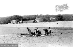
Formerly, it was a sea mill: the tide entered the pool, now ornamental, above it and then drained back down again. The building is now much altered in appearance.
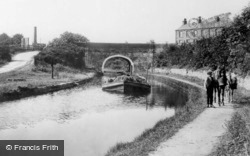
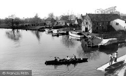
Here we see a barge loaded down with hay, with the two horses taking a break as the photographer creates his picture.
This view is taken further down West Street, with the churchyard on the left and the boundary walls of the Victorian Baptist Church on the right.
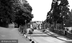
Despite additional building and road widening, this scene is still easily recognisable, although a walk down the centre of the road (as the two men are doing) is not advisable.
Owing its rapid development to the Industrial Revolution, the town's streets and buildings tended to be functional rather than attractive.
This view was taken from underneath the railway bridge looking down towards the Wharfe and the next village, Middleton.
As we walk down Northgate Street from the cross, and turn right by Debenhams, we will enter the relatively new area of Kings Square.
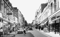
A little further down the street, a boy carries a billboard advertising 'Hilton's Boot Sale'. Note the building in the centre by the attractive street lamp - we will see it again.
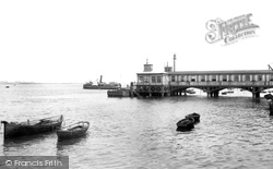
Gravesend has two Victorian piers: the Royal Terrace Pier of 1843 lies to the east of the slightly earlier Town Pier we see in this view.
The warehouse on the right is now the Riverside Free House, but it and the dock reflect the commerce that made Lechlade a prosperous medieval town, where wool and cheese were loaded onto barges for shipment
We are in a large village at the foot of the Downs, which has several commons. The Premonstratensian monastery of Our Lady of England is still in use.
Along this stretch of the river, the tan-sailed barges carrying cargoes of paper and timber, and the 'stumpies', or narrow boats, used to convey bricks from the kilns down river, were once a familiar
A splendid panoramic view, taken early in the year, of the Stour Valley looking across to the Julliberrie Downs, with the 14th-century tower of Chartham church rising above the trees.
The town originally grew up around the burial place of the Celtic Saint Tydfil.
There were ten locks at the end of the Bridgewater Canal linking it with the docks below; figures for 1883 show that in that year alone 60,300 craft passed up and down.
Unfortunately, the Beacon fell down during as storm in the 1930s, and was replaced by a simple memorial plaque.
The bypass on the south side of town was opened in 1926; it was much needed to relieve the narrow streets of both local china clay and through traffic.
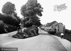
The descent from Barkway, the second highest point in Hertfordshire, down to Royston, one of the lowest places in the county, was a nightmare for horse-drawn traffic and cyclists.
We are looking down from the Triangle, and we can see the Freeman, Hardy & Willis shoe shop on the left, AJ Perham's Hair Cutting Rooms on the right, and the South Western Gas Board at the end of the street
The terrace of shops stepping down the High Street, beyond the busy junction with Carshalton Road and William Pile Ltd (the stuccoed corner building), was erected in 1880.
Most shops still have awnings, ready to pull down if the sun gets strong. Leons Café, in the distance on the right, offers luncheons and teas.
The occasional soldier can still be seen marching down the street.
Weeke Primary School is down this road - today it has about 280 pupils.
Now all of that has changed, and so has Bridge Street, for it has virtually all been knocked down for redevelopment. On the left is now either cleared or a car park, and the road is much wider.
Places (198)
Photos (1089)
Memories (8147)
Books (47)
Maps (459)


