Merry Christmas & Happy New Year!
Christmas Deliveries: If you placed an order on or before midday on Friday 19th December for Christmas delivery it was despatched before the Royal Mail or Parcel Force deadline and therefore should be received in time for Christmas. Orders placed after midday on Friday 19th December will be delivered in the New Year.
Please Note: Our offices and factory are now closed until Monday 5th January when we will be pleased to deal with any queries that have arisen during the holiday period.
During the holiday our Gift Cards may still be ordered for any last minute orders and will be sent automatically by email direct to your recipient - see here: Gift Cards
Places
36 places found.
Those places high-lighted have photos. All locations may have maps, books and memories.
- West End, Gwynedd
- West End, Hampshire (near Southampton)
- West End, Surrey (near Camberley)
- West End, Hampshire (near Medstead)
- West End, Leicestershire
- Ward End, West Midlands
- Shard End, West Midlands
- West End, Gloucestershire
- West End, Dorset
- West End, Strathclyde
- West End, Mid Glamorgan
- West End, Gwent
- West End, Hertfordshire
- West End, Suffolk
- West End, Sussex
- West End, Lancashire (near Morecambe)
- West End, Yorkshire (near Tadcaster)
- West End, Avon (near Nailsea)
- West End, Somerset (near Wells)
- West End, Oxfordshire (near Wallingford)
- West End, Berkshire (near Wokingham)
- West End, Norfolk (near Great Yarmouth)
- West End, Bedfordshire (near Great Staughton)
- West End, Kent (near Sittingbourne)
- West End, Yorkshire (near South Cave)
- West End, Avon (near Yate)
- West End, Wiltshire (near Shaftesbury)
- West End, Wiltshire (near Bowerchalke)
- West End, Berkshire (near Bracknell)
- West End, Yorkshire (near Driffield)
- West End, Yorkshire (near Hedon)
- West End, Lincolnshire (near Boston)
- West End, Cumbria (near Carlisle)
- West End, Yorkshire (near Cleckheaton)
- West End, Yorkshire (near Horsforth)
- West End, Oxfordshire (near Hardwick)
Photos
279 photos found. Showing results 1,261 to 279.
Maps
1,651 maps found.


Books
19 books found. Showing results 1,513 to 19.
Memories
2,057 memories found. Showing results 631 to 640.
Another Coulsdon Playground
I lived in Tollers Lane, Old Coulsdon 1946-59 before moving to Coulsdon Rise. Farthing Downs was one of our favourite play spaces. Walking down the rough lane opposite our house to Tollers Farm, on down into Happy Valley ...Read more
A memory of Coulsdon in 1952 by
Birchington, Epple Bay And Minnis Bay
Birchington with two bays and a village atmosphere 'in town'. A rail station with the most wonderful ice cream parlour opposite - wicker chairs on those old fashioned curved steel bases and circular wicker ...Read more
A memory of Birchington in 1955 by
A Lovely Devon Village
We moved to No. 6 Tipton Vale in 1950. Maureen a baby, myself (Valerie) and parents Eric and Joan White fom Fenny Bridges. The house was a new council house, pink and blue. Dad dug out a bank at the rear and we found ...Read more
A memory of Tipton St John in 1950 by
Osterley Park
In 1930 I was born at Northumberland Avenue, Isleworth: parallel to the Great West Road and behind St Francis Church. As Osterley Park was so near I used to play, with my chums, frequently in the grounds of the park. We had many happy ...Read more
A memory of Osterley in 1945 by
Growing Up In Bletchley From 1953 Onwards
My parents moved to Bletchley from London early 1953, they first lived in St George's Road before moving to 35 St John's Road when I made my appearance shortly after Christmas. So much has changed since ...Read more
A memory of Bletchley in 1953 by
Moon Family
Although I do not know West Harptree very well, my great-grandmother and great-grandfather are buried here, and there is a memorial to my grandfather William Moon in the church, he died in 1915 in India while in the army. If anyone ...Read more
A memory of West Harptree in 1910 by
Aerco
Aerco was started by my grandfather, Thomas Ricketts after the war. He was an engineer and Aerco sold and repaired early radios and the first TVs, hence the name Addlestone Electrical Radio Company! I believe there were two locations for the ...Read more
A memory of Addlestone in 1949 by
Bywell
My ancestors The Bywells were originally from Wensley in the 1700's and then moved to Middleham and also west Witton. I wonder if any Bywells still live there
A memory of Wensley by
My Great Grandmothers Baptism
The date was actually March 1, 1857. No church is named on the copy of the Baptismal Certificate that I have. The certificate states that it is from Page 31 and is No. 243. Ada Maria, daughter of James (a laborer) ...Read more
A memory of Littlebourne in 1860 by
Convalescence At St. Mary's, Broadstairs
I have vivid memories of my time at St. Mary's and they are not particularly nice. I can recall the large dormitory where we had a midday nap after first being put in our pyjamas. It must have been autumn ...Read more
A memory of Broadstairs in 1952 by
Captions
1,993 captions found. Showing results 1,513 to 1,536.

Further west, the High Street meets Abingdon Road (right) and Steventon Road (left) in a small green.

As well as being in the West Riding, Saddleworth was also in the wapentake of Agbrigg. Wapentake literally means 'show of weapons', and was the old Danish way of voting.

Lord Rodney, who died in 1792, is particularly remembered for his victory at the Battle of the Saintes in the West Indies, which led to peace terms with the French (for a time!).

Stodman Street leads out of the south-west corner of the Market Place. Its most famous building is the Governor's House, a 16th-century timber-framed house with three storeys of coved jetties.

West of the Queen Street junction the London-Bath A4 was remarkably narrow, but is now pedestrianised and by-passed. This view looks east.

Note the Beach Cafe (left) and the groynes on Charmouth beach; we are looking eastwards to Cain's Folly (centre) and Golden Cap (right). Offshore are the Mouth Rocks.

Monk's Buildings 1894 From Angmering we head north across the Downs to Storrington, now a large village that started its expansion in late Victorian and Edwardian times.

This narrow gateway, constructed of cobbled flint and brickwork, was built in the 13th century to defend the northern entrance of this well-preserved town, which was also fortified by earthworks connected

Woodham Lane, between New Haw and Woodham, is semi-detached country served by two railway stations: Byfleet and New Haw, and West Byfleet.

Batchworth Lake is the easternmost of a chain of four lakes west of the town and sandwiched between the Grand Union Canal and the River Colne.

Gregory Gregory, a bachelor, was probably responsible for as much of the design as his architects, Anthony Salvin and later William Burn, as it rose slowly throughout the 1830s and 1840s.

The picturesque growth of trees and ivy which has been allowed to flourish unchecked took its toll on the brick structure, and the church, probably designed by Nicholas Stone and consecrated by Archbishop

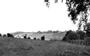
This photograph shows a very different picture from today's carefully mown and tended lawns.

Mansfield lies some 14 miles north of Nottingham and to the west of Sherwood Forest.

The church and a cluster of old houses are at the top of the hill, and more old buildings are on the river bank, east and west of the Bognor Road river bridge.

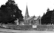
We can see the porch attached to the west tower, and also the good proportions of the building. Inside, the wide three-bay nave is tall and light with thin piers.

This is a detail of the chalet zone which sprang up behind the 1897-built Esplanade (right), between the waterworks and the Salt House on Pitfield Marsh (left).

In the late 15th century the Cheynes built the first part of the house, the hall, tower and the rest of the west range in the distance, an amorphous shape in brick under all the ivy, but

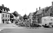
We are west of Addlestone. Here the A320 Guildford Road meets the A319 Chobham Road and the B3121, Murray Road, from Addlestone at what is now a large roundabout.

The Cathedral 1888 A springtime photograph of the massive and imposing cathedral, the first in Britain and the seat of the Primate of All England, as well as one of Europe's most celebrated places

Heading north-west roughly parallel to the River Witham, we reach two small towns on either side of the River Bain, which meets the Witham a mile away at Dogdyke.

The west tower was built in the 15th century as an addition to the 13th-century church. In the 16th-century nave roof there are six carved figures.

On the west coast of England, the old fishing communities tended to be housed in cottages with thatched roofs.

Redevelopment in the 1970s has swept away many of the buildings on the west side of Crib Street.
Places (99)
Photos (279)
Memories (2057)
Books (19)
Maps (1651)

