Places
26 places found.
Those places high-lighted have photos. All locations may have maps, books and memories.
- Cemmaes Road, Powys
- Six Road Ends, County Down
- Road Weedon, Northamptonshire
- Severn Road Bridge, Gloucestershire
- Roade, Northamptonshire
- Berkeley Road, Gloucestershire
- Harling Road, Norfolk
- Road Green, Devon
- Builth Road, Powys
- Cross Roads, Yorkshire
- Steele Road, Borders
- Cross Roads, Devon
- Four Roads, Dyfed
- Road Green, Norfolk
- Biggar Road, Strathclyde
- Clarbeston Road, Dyfed
- Five Roads, Dyfed
- Eccles Road, Norfolk
- Grampound Road, Cornwall
- Morchard Road, Devon
- Wood Road, Greater Manchester
- Four Roads, Isle of Man
- St Columb Road, Cornwall
- Clipiau, Gwynedd (near Cemmaes Road)
- New Road Side, Yorkshire (near Silsden)
- New Road Side, Yorkshire (near Cleckheaton)
Photos
14,329 photos found. Showing results 2,401 to 2,420.
Maps
476 maps found.
Books
5 books found. Showing results 2,881 to 5.
Memories
11,058 memories found. Showing results 1,201 to 1,210.
Howe's Garage, Longfield
Rather than Longfield Hill, this looks more like Longfield itself with Howe's Garage in the centre foreground. My Dad worked here from the late 1930s to when he retired in 1973; it was run by his uncle Frank Howe and ...Read more
A memory of Longfield Hill in 1960 by
Frees Post Office And Grocery Longworth
Having spent the first seven years of my life in Longworth, I remember Free's shop vividly. The Frees were friendly, welcoming people. Mr Free had curly hair and wore a tan-coloured kind of overall-coat. Mrs ...Read more
A memory of Longworth in 1960 by
Summer Holidays At The Avon Water
I would have been about ten years old and I remember on a lot of hot sunny days packing some jam "pieces" and filling an empty bottle with some diluting orange juice or even just water if there was no juice, ...Read more
A memory of Maddiston in 1975
Station Road
The railway is now behind the photographer, who is looking down High Street at the height of its Victorian expansion with the street dominated by tall telegraph poles. Thorley’s, the cattle feed merchants, has gone, to be replaced by 1970s ...Read more
A memory of Horley
Summertime
When I was a girl we used to make dams in the river, and climb the mountain at the back of Duffryn Hotel at Coegnant colliery. It was a magic place to grow up in. I lived in Glanafon Terrace, and went to Tonna Road School. Horn was the place ...Read more
A memory of Caerau in 1957 by
Childhood In The Village!!
I was devastated in 1964 when my mother told me we were to leave the village so that my mother could pursue her dream of owning her own small business elsewhere. It was a dreadful culture shock, one that has remained with ...Read more
A memory of Mollington in 1961 by
The Steel Houses
Having lived in Brymbo in a very damp two up two down house in 'The Green' my parents were 'over the moon' to be given a new three bedroomed house; 23, Bryn Hedd, Southsea, (which means peaceful hill) became their home for ...Read more
A memory of Southsea in 1950 by
The Shops On Yardley Road
I remember when all shopping was done by visiting independant local shops. The shops I remember going to with my mother on Yardley Road were Alldays butchers, Timms greengrocers, The Bargain Shop, Terry Lovetts Sports, ...Read more
A memory of Acock's Green in 1976 by
Aveley Village A Special Place
Year ranges from 1961 to present really. My nan and grandad lived in Aveley, the Harmans, in Central Avenue. I have fond memories of staying with my nan and grandad, and the house in Central Ave, and across the road were ...Read more
A memory of Aveley in 1963 by
Your search returned a large number of results. Please try to refine your search further.
Captions
5,036 captions found. Showing results 2,881 to 2,904.
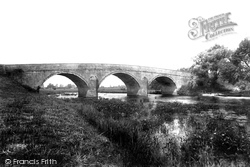
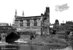
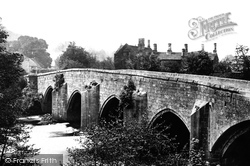
Canford Bridge has three arches of Portland stone over a languid length of the River Stour, and carries the road from Wimborne to Poole.
The village shop still has its awning out, but the sign now reads H T Houghton.
photos, although from the same vantage point, span a period of 60 years.They show many changes in some of the buildings and in the mode of transport.Two horse-drawn vehicles can be seen on the road
Over to the right once stood the massive King's Mill, used for grinding corn from 1872 until 1933, when it was demolished to make way for the parallel new road bridge.
The old parish church of St Tydfil was restored and re-built in the 1890s; its graveyard was greatly reduced in 1902 to construct the road to Cardiff.
It overlooks Kingsway, a dual carriageway originally called St Bede's Road.
Like Finchingfield, this village is based around a triangular green - though Wethersfield`s is smaller than it once was, owing to road widening.
It still carries a large volume of traffic, although all is quiet here – we are looking down Penwinnick Road.
It was built in the early 17th century, and was widened in 1925 from 16 feet to 40 feet to carry the increased traffic on the A6 trunk road between Derby and Manchester.
It is hole in the road time again as the lads from Stourbridge gas works prepare to do their stuff.
There is a larger shop across road. A woman waits patiently against the fence by the pond; she has just come from the swimming pool area.
On the road behind the houses there is a mouldering old Sherman tank. It was lost during the 1944 rehearsals, and only recovered in 1988.
The estate vilage of Arlington with the old post office - now Mill Cottages - lies alongside the Lynton to Barnstaple road.
This street, now pedestrianised, was a busy part of the A30 trunk road. It was widened a century ago to cope with the increasing traffic.
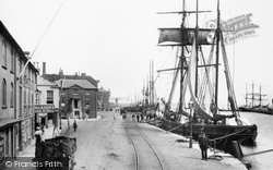
Ships' chandlers and coal merchants line the waterside, and a coal cart stands idle at the side of the road.
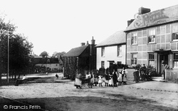
It has not been long since a horse or two trotted along this Edwardian street, as the evidence in the centre of the road reveals.
In 1896 Salisbury Road was constructed, bisecting Moseley Hall Park. The northern part was bought by a consortium of businessmen who built houses overlooking it.
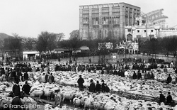
Huge sheep markets were held here, and the farmers and buyers refreshed themselves in the Woolpack, a convenient public house across the road from the castle.
The terrace of shops stepping down the High Street, beyond the busy junction with Carshalton Road and William Pile Ltd (the stuccoed corner building), was erected in 1880.
There is a pub of the same name in Redditch situated on a former turnpike road, and it is believed to have taken its name from the turnpike gate, but that is unlikely to be the case here.
Situated six miles west of Darlington, Piercebridge is unusual in that the village was built within the ramparts of a Roman fort that once guarded the bridge over the Tees carrying the road between York
This photograph shows the centre of the busy High Street, with the road to Bexley and London ahead and the turning to Crayford visible on the right.
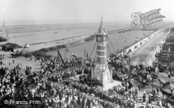
A vital landmark building in trying to relate these early views to present-day Skegness is the Jubilee Clock Tower, erected at the junction of Lumley Road with the then seafront's Grand Parade and South
The coffee merchant E W Coleman's van is parked outside his shop (centre); beside its window is an LNER train timetable - Station Road is off to the left.
Places (26)
Photos (14329)
Memories (11058)
Books (5)
Maps (476)


