Places
36 places found.
Those places high-lighted have photos. All locations may have maps, books and memories.
- Cardiff, South Glamorgan
- Barry, South Glamorgan
- Penarth, South Glamorgan
- Rhoose, South Glamorgan
- St Athan, South Glamorgan
- Cowbridge, South Glamorgan
- South Molton, Devon
- Llantwit Major, South Glamorgan
- Chipping Sodbury, Avon
- South Chingford, Greater London
- South Shields, Tyne and Wear
- Ayr, Strathclyde
- St Donat's, South Glamorgan
- Llanblethian, South Glamorgan
- Thornbury, Avon
- Llandough, South Glamorgan
- Fonmon, South Glamorgan
- St Nicholas, South Glamorgan
- Jarrow, Tyne and Wear
- Penmark, South Glamorgan
- Font-y-gary, South Glamorgan
- Maybole, Strathclyde
- Yate, Avon
- Oxford, Oxfordshire
- Torquay, Devon
- Newquay, Cornwall
- Salisbury, Wiltshire
- Bournemouth, Dorset
- St Ives, Cornwall
- Falmouth, Cornwall
- Guildford, Surrey
- Bath, Avon
- Looe, Cornwall
- Reigate, Surrey
- Minehead, Somerset
- Bude, Cornwall
Photos
5,607 photos found. Showing results 321 to 340.
Maps
2,499 maps found.
Books
23 books found. Showing results 385 to 23.
Memories
1,580 memories found. Showing results 161 to 170.
Webbs Brewery Six Bells Colliery
I grew up in Aberbeeg as Pat Howells. Everyone knew the Howells as my dad, Doug, was one of 8 children. My uncle worked in the brewery for many years and I grew up in Woodland Terrace and had to pass the brewery at ...Read more
A memory of Aberbeeg by
Look For Mrs Mitchell Teacher
I responded to a memory in another album, South Bragar: they mention Mrs Mitchell the teacher there. Mrs Mitchell was my Aunty Jean so please go along to that Album to see my own mini memories of having relatives in ...Read more
A memory of South Uist by
'goldcrest' On The A 287
I was evacuated from Battersea, South London, in 1944 to a large house named 'Goldcrest' on the Hindhead Road not far from Beacon Hill and have some happy memories of that time although as it was wartime everything seemed ...Read more
A memory of Hindhead in 1944 by
Bedford....Happy Childhood Memories.
I am now in the process of establishing Samuel and Florence DAYS, then address with the Records Office at Bedfordshire County Council. Apparently Sandy Lane and Cardington Lane were mentioned many years ago as well as ...Read more
A memory of Bedford in 1953 by
Birth Place
I have been told by my mother that I was born in St Mary's Hospital in South Croydon and I am not sure if it still exists or if there are any photos of it. Can anyone help?
A memory of South Godstone in 1952 by
Childhood In The 1950s
It breaks my heart to see how the years, short-sighted councillors and rapacious businessmen have ruined this once noble and beautiful seaside resort. How could anybody have countenanced destroying this view for the ...Read more
A memory of Bridlington by
A Yokels Tale
A Personal Recollection of growing up during the last days of the pedestrian era in rural England by Tom Thornton A Yokel's Tale My earliest recollection of my Thornton grandparents, Alice and Tom, dates back to my pre-school ...Read more
A memory of Owslebury in 1941 by
The Milk Bar In South Street
We used to go in there often, and I remember one time being very confused when asked whether I wanted lemonade, cherryade, limeade or Whipsnade, 'cause I knew that was a zoo and I didn't quite get the idea of puns. ...Read more
A memory of Dorchester in 1974
Coming To Devon
We were living in Barry Island in south Wales, I was getting ready to take the 11 plus, one day when I came home from school my dad was waiting to tell me that we were on the move to Devon. We had spent four years on the Nells ...Read more
A memory of East Prawle in 1946 by
The Good Old Days
I lived in Streethouse but when I was 4 we moved to the newish estate at the top of the 'Knob' (North Featherstone). We lived at 49 Manor Drive, next door to the Simkins. My dad was a miner at Sharlston and Snydale ...Read more
A memory of Featherstone by
Captions
2,476 captions found. Showing results 385 to 408.
This picture shows the River Ebble and the A354 Blandford Road running side- by-side through the village of Coombe Bissett, a couple of miles south of Salisbury.
Cleckheaton is another former textile town, five miles south of Bradford, which has had to find a new role during the late 20th century.
Crickhowell Castle lies twelve miles south-east of Brecon. Originally it was a timber stronghold of the motte and bailey, and belonged to the de Turberville family.
The Hartmoor area of Devizes lies to the south. This photograph is a revealing view of old England.
The gap in the buildings marks the south side of the green, down the middle of The Steyne, laid out in 1807; it copied that in Brighton and borrowed its name.
Most rooms have the benefit of the views to the South Downs.
By 1914 the Cinema De Luxe had appeared at the south end of London Road.
Giltar Point is an expanse of limestone projecting out into the sea at the end of Tenby's South Beach.
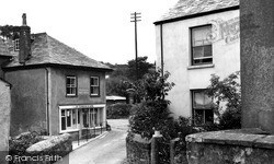
The Post Office and stores, now painted white, is still a lifeline in this village south-west of St Austell.
The Hartmoor area of Devizes lies to the south. This photograph is a revealing view of old England.
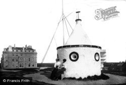
The Beacon, just south of the Atlantic Hotel (in the background) was once a Coastguard lookout. Its place is now occupied by the town war memorial, which incorporates the lookout in its structure.
The inn, one of the most famous in the area, lies on the Berkshire's border with Hampshire, just to the south of Newbury.
Looking south down the wonderful architectural hotch-potch of Trinity Street, with the medieval church of Great St Mary in the distance.
This lovely photograph shows a broad on the upper Bure, possibly South Walsham, showing water lilies which were common on many broads early in the 20th century.
Looking south down the wonderful architectural hotch-potch of Trinity Street, with the medieval church of Great St Mary in the distance.
1925 saw a part of the south green made into a bowling green, and three years later a rather rough, but functional putting- green was made next to it.
The 'Miners' Welfare' was the community and cultural centre for many South Yorkshire and other coal mining villages.
Bradwell is one of a group of villages just south of Great Yarmouth which were in Suffolk until boundary changes of 1974 brought them into Norfolk.
The 15th-century spire soars above the River Wreake on its south side, with the now rather mundane Village Street to its north.
The green is fronted by North Terrace, East Terrace, South Terrace and West Terrace. Here we see North Terrace and East Terrace.
A west gallery was added in 1693 and a gallery on the south side in 1698, but both were removed in 1855. The north aisle was rebuilt in 1856 and a clerestory was added.
The parvise above the south porch was believed to have been used as a gunpowder store during the Civil War in the 17th century.
This is a general view of Kendal from the south, with the Lakeland hills in the background.The town of Kendal was founded on the west bank of the River Kent, although the earliest settlement around
Swimbridge was the next village along the Barnstaple to South Molton road after Landkey. In this 1890s picture, there are roadside poles. Are they for gas lighting, or telephones even?
Places (15471)
Photos (5607)
Memories (1580)
Books (23)
Maps (2499)


