Places
36 places found.
Those places high-lighted have photos. All locations may have maps, books and memories.
- North Walsham, Norfolk
- North Berwick, Lothian
- North Chingford, Greater London
- Harrogate, Yorkshire
- Whitby, Yorkshire
- Filey, Yorkshire
- Knaresborough, Yorkshire
- Scarborough, Yorkshire
- Clevedon, Avon
- Weston-super-Mare, Avon
- Selby, Yorkshire
- Richmond, Yorkshire
- Ripon, Yorkshire
- Scunthorpe, Humberside
- Pickering, Yorkshire
- Settle, Yorkshire
- Skipton, Yorkshire
- Saltburn-By-The-Sea, Cleveland
- Norton-on-Derwent, Yorkshire
- Rhyl, Clwyd
- Chester, Cheshire
- Llandudno, Clwyd
- Grimsby, Humberside
- Durham, Durham
- Nailsea, Avon
- Southport, Merseyside
- Brigg, Humberside
- Colwyn Bay, Clwyd
- Redcar, Cleveland
- Bath, Avon
- Grange-Over-Sands, Cumbria
- Cleethorpes, Humberside
- Sedbergh, Cumbria
- Barrow-In-Furness, Cumbria
- Barmouth, Gwynedd
- Dolgellau, Gwynedd
Photos
2,569 photos found. Showing results 1,841 to 1,860.
Maps
9,439 maps found.
Books
Sorry, no books were found that related to your search.
Memories
1,548 memories found. Showing results 921 to 930.
Cousins Family
I am the Great Great Grandson of John William Cousins and Esther Ellen Brown. They lived in Low Lanes and in North Halls at one point. Their daughter Martha (Dot) was my Great Gran. Does anyone have any memories/photographs of the Cousins family?
A memory of Binbrook by
S T Joseph's Salesian School Burwash
I was a boarder at St joseph's from 1947 to 1951. We lived in Lincolnshire. My father was an OLD BOY of the Salesian School at Battersea and this was my start to follow him there. We traveled in special compartments ...Read more
A memory of Burwash by
Early Life
Otterington Hall is close to South Otterington, North Yorkshire and dates from the early 19th century. I was born in the gatehouse of the Hall, The Lodge, in 1947. The owners were the Furness family (involved in shipping), Sir ...Read more
A memory of Otterington Hall
Nelson Grammar School Reunion 1989
My name was Jean Wignall. I married Peter Tunstill (who was also at NGS ) in 1970. In January 1989, I attended a 21-year Nelson Grammar School reunion at the Keirby Hotel in Burnley. I believe that the event ...Read more
A memory of Brierfield by
Born And Bred In North Harrow
I lived in The Ridgeway, schooled at Longfield in Sunflower House , motto 'Cheerfulness' which has endured with me as my favourite flower, I grow monsters and matches the attitude Itry to have still! Miss Perks was the ...Read more
A memory of North Harrow by
A Long Time Ago!
Hi everybody, only just found this site and so interesting to read the comments. I was at Tiffield in the old Victorian "fridge" they called the main building from early 1957 to approx middle 1959. Mr Turner was head (nice chap) but ...Read more
A memory of Tiffield by
Came Back In 2009 ........ What A Shock :)
We lived on Normanshire Dr early 60s. Went to school on the New Rd then to Wellington Ave; at that time Wellington Ave boys and girls were separated. Loved the fish and chip shop and Rossi's ice cream. Went to the Odeon ...Read more
A memory of Chingford by
New House.
My parents and I moved to Swindon in 1961 from Edmonton, London to a brand new three bedroom house ( think). My father worked at Pressed Steel were they made car body panels for Austin, and Morris, and I used to cycle halfway to the factory ...Read more
A memory of Swindon by
London Road Portsmouth.
Does anyone remember around 1977/78 "Dart Discount" drug store ran by Arthur and Diane Garner ? They also had a second smaller shop up towards the Gladys Avenue roundabout, on the right hand side as you travel North. Dart Discount was almost opposite Mark's and Spencer
A memory of Portsmouth
Growing Up In Farnborough
I lived in farnborough for first 28 years of my life, got married and had 4 children there. Grew up on the Sinehurst Estate then moved to Grange then Hawley estates. Went to Farnborough Grange Schools when they were still ...Read more
A memory of Farnborough
Captions
2,645 captions found. Showing results 2,209 to 2,232.
Findon is on the top of the Downs, just north of Worthing, and was noted for an annual sheep fair. Now horse breeding and training is an important local activity.
For this 1960s view, Frith's photographer is looking north from the upper floor of the quite new Woolworth's towards the horse chestnut trees edging Parsonage Field - they screen the Comrades
The hamlet is centred upon a long hour- glass-shaped green; this view was taken at its north end, with Shophouse Lane on the right and August Lane on the left.
This view looks north-east along Chertsey Road (now one-way and traffic-calmed) away from the station, which fuelled the commuter-based growth of the town.
We are looking north-east from the green in front of The Abbey's large grounds; this view is remarkably unchanged since 1890.
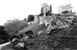
Curtain defences include the Butavant Tower (top left), South Tower, North Tower, South-west Gatehouse, Fourth Tower, Third Tower and Second Tower (centre right).
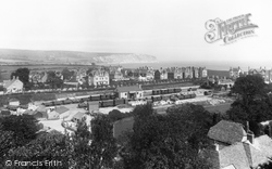
The view is north- eastwards from the tower of St Mary's Church to the double sidings of the goods yard (centre) and site of James Panton's Swanage Brewery which was demolished in 1893.
Archaeologists say that during the Dark Ages the village centre was north of the church, around what is now the car park opposite the Civic Hall.
A mile or so south of Quorn, the camera looks north towards the weir, with Hawcliff Hill and Buddon Wood to the left.
This, the south gate to the castle keep, is today the main entrance, but it is thought that in the castle's heyday the north gate was the main access.
Apart from the loss of some railings, little in this view from the north-west has changed, although it is now a Polish Roman Catholic Church serving Bedofrd's quite sizeable Polish community.
East of the church and the Moot Hall, a jettied timber-framed building of about 1500, standing in its green, is the main north-south village road, the High Street.
Here we look south down North Bridge Street towards that junction with High Street.
This view is taken looking south towards Oving from Bowling Alley's junction with the North Marston to Whitchurch Road.
The nave became the north aisle during the rebuiding, while the granite-built south aisle (seen here) became the nave and chancel, so it is offset from the tower.
The south porch is timber, and in the north aisle there are two wooden posts. The stained glass windows were designed by Gibbs.
It is mostly Perpendicular, but has a 13th-century chancel wall and a Decorated north chapel. Most of the church was demolished and rebuilt, faithfully, in 1850.
The tower is late Norman, except for the top; the arcades are Early English, and the aisle wall and windows, the clerestory, and the north chapel are Perpendicular.
Apparently one of these stones still exists and can be seen on the north side of Ivelet Bridge.
Hunstanton is unique for north Norfolk resort towns in that it looks west across the sea and not east. It was a quiet village of simple fishermen's cottages until the coming of the railway in 1862.
The house was begun by William Cavendish, fourth Earl and later first Duke of Devonshire, in 1687 and completed in 1706; the north wing was added between 1820-30.
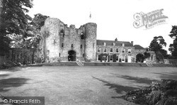
Situated on the north bank of the Medway, the original motte and bailey castle was replaced with stone by the early 13th century, when the shell keep was built.
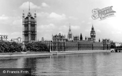
A little further north along Albert Embankment we get this wonderful view of the houses of Parliament.
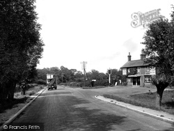
A double-decker open-topped bus travels north along the A24 on its way to Dorking and its terminus at West Croydon.
Places (9301)
Photos (2569)
Memories (1548)
Books (0)
Maps (9439)


