Places
26 places found.
Those places high-lighted have photos. All locations may have maps, books and memories.
- Cemmaes Road, Powys
- Six Road Ends, County Down
- Road Weedon, Northamptonshire
- Severn Road Bridge, Gloucestershire
- Roade, Northamptonshire
- Berkeley Road, Gloucestershire
- Harling Road, Norfolk
- Road Green, Devon
- Builth Road, Powys
- Cross Roads, Yorkshire
- Steele Road, Borders
- Cross Roads, Devon
- Four Roads, Dyfed
- Road Green, Norfolk
- Biggar Road, Strathclyde
- Clarbeston Road, Dyfed
- Five Roads, Dyfed
- Eccles Road, Norfolk
- Grampound Road, Cornwall
- Morchard Road, Devon
- Wood Road, Greater Manchester
- Four Roads, Isle of Man
- St Columb Road, Cornwall
- Clipiau, Gwynedd (near Cemmaes Road)
- New Road Side, Yorkshire (near Silsden)
- New Road Side, Yorkshire (near Cleckheaton)
Photos
14,329 photos found. Showing results 3,601 to 3,620.
Maps
476 maps found.
Books
5 books found. Showing results 4,321 to 5.
Memories
11,058 memories found. Showing results 1,801 to 1,810.
Hornbeam Road
Having accidentally found this forum today, and added a few memories of Queens Road toy shop. I have now had some time to read most of the contributions. There are so many memory joggers here from the likes of David Killen and ...Read more
A memory of Buckhurst Hill by
Cullercoats Personal Links
My Nana Simpson (nee Brunton) was a fisherwoman who used to sell fish on the front from a creel on her back years before I was born. My Grandad contracted Polio in his 50's and Nana had to work hard long hours to bring ...Read more
A memory of Cullercoats in 1949 by
Next Best Thing To The Toy Shop!
The next best thing to the toy shop was Guyatts Pet shop, almost at the top of Queens Road on the right hand side of the street. On the right hand side of the shop was a pathway that lead to a back yard that may ...Read more
A memory of Buckhurst Hill by
Surbiton Lagoon
When I was 4 years old I lived in Hut No.3 Raeburn Avenue, Surbition with my three brothers, two sisters and my Mum. I was known as Clive Isgrove then. I know these huts were across the road from the lagoon. I have a National ...Read more
A memory of Surbiton in 1951 by
Albert Road
Born in 101 Albert Road moved to Charlton House and lived in flat No.38; the Whitby's, Streets, Watsons, Sullivans, Corrs, Reynolds, Ryans, Butchers, were all my neighbours. I went to St Marys School, Granville Road then ...Read more
A memory of Kilburn in 1950 by
My Ancestors Lived And Worked Here!
In the 1881 Census, Elizabeth Mitchell is listed as the head of the household and a widow aged 54 as her husband John Mitchell had died in February of that year and so running the Six Bells Beer House along ...Read more
A memory of Billingshurst in 1920 by
Rememberinggraysandrookhalldellroad
I wasn't born in Grays. In fact had a very disrupted childhood due to my father initially being in the army. However I spent one week at Quarry Hill Primary school at the end of the school year before moving to Grays ...Read more
A memory of Grays in 1953 by
Born In 1955 In Kiveton Park
I was born in 1955 at KIlton Hospital in Worksop but lived in Kiveton for 23years before moving away...I lived with my parents peter and joan spacie and my brother jonathan on Highfield Avenue...on the estate just ...Read more
A memory of Kiveton Park by
Memories Of Aberkenfig
I think this was in the mid fifties. We lived at 15 Dunraven Street and at the top of the street there was quite a steep hill (it's all closed off now) and at the top of the hill was an entrance to the Forestry Commision ...Read more
A memory of Aberkenfig by
Glenmount Road
Does anyone remember Glenmount Roard at all? I live at Number 12. So far I have been told that the house I live in used to be a bottling plant for a dairy, and that the oldest house in the road is at the end...which used to be a ...Read more
A memory of Mytchett
Your search returned a large number of results. Please try to refine your search further.
Captions
5,036 captions found. Showing results 4,321 to 4,344.
Further along Station Road are a pretty thatched building, a good turn of the 19th century local granite house, and the 18th-century Dower House.
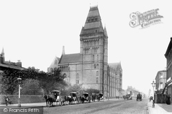
Here we see the front face of Owen's College on Oxford Road, and you can see similarities to the Assize Court, and even the Town Hall, all of which were designed by Alfred Waterhouse.
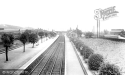
This view is looking down from the road bridge; things have changed greatly at Sandy.
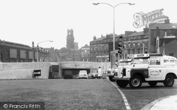
This was the first road tunnel under the River Mersey, and was opened by King George V and Queen Mary in July 1934.
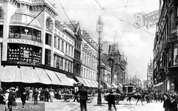
This cross-roads was nick-named 'Holy Corner': (Our) Lord Street, Church Street, (White) Chapel and Paradise Street met here.
We are now in the centre of Eastleigh; in fact, we are looking from the station along Leigh Road, originally a farm track but steadily improved and extended as the town grew.
On the other side of the road was a garage, which is now the Job Centre and the Sue Ryder shop. Then comes the HSBC bank followed by a building dated 1789 which now houses Calthop, solicitors.
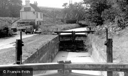
This view is not of the 15th-century bridge at Culham, but of the one on the road that crosses the Culham Cut, with Culham Lock a hundred yards behind the photographer.
Opposite it there is now a large petrol station, as well as a road junction that leads onto the Common.
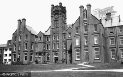
The Royal Liverpool Children's Hospital, Heswall was opened in 1911 on a 9-acre site bordering Telegraph Road.
We can just see the second Hunsdon public house, the Fox and Hounds, in the distance on the left, with houses in Tanner's Way (on the opposite side of the road) behind.
This photograph was taken from Pirbright Bridge, where Queens Road leaves the A324 and leads to Pirbright Barracks and the Bisley rifle ranges.
North of Fir Tree Road and just beyond Banstead railway station is Cuddington Park Golf Course; the name is a reminder of the parish and village of Cuddington, which was cleared for Henry VIII's Nonsuch
Until 1883, only its tower was visible; then two pubs which jutted into the street, one on each side, were demolished for road improvement.
This view looks at what amounts to 19th-century small-scale development along the Fleckney Road; the whole adds up to a very cordial rural scene, common over southern Leicestershire.
Further along Station Road are a pretty thatched building, a good turn of the 19th century local granite house, and the 18th-century Dower House.
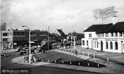
The Stone and Eccleshall roads used to divide in front of the Waggon and Horses public house, but by this time a roundabout had been built to the rear of it, on the left.
Looking east from the western end of the village, we can see the road junction beside what has become a single Burwell Cottage (centre). Rectory Lane used to be called Duck Street.
Much survives, but in this view from the junction with Gore Road, the Slough and District Co-op on the left and the buildings beyond have all gone, although those on the right remain.
All the main roads converge here, and Ampthill's history as a coaching stop is still visible in the form of the White Hart hotel on the right of the picture.
We are looking up New Road, with W C King & Sons, ironmongers, on the left. Further up we can see the sign of the Black Horse. According to the deeds, this was built in November 1843 as a beer house.
The Pier Hotel (left of centre) opened in 1881, the same year as the pier on the other side of the road. The hotel is pictured here after its reconstruction in the 1950s.
The High Street was laid out in 1826 as New Road, but development off the hill was slow.
Here we see Victoria Buildings on the corner of the road to the sand dunes, known as Formby Hills, and to Mad Wharf beyond them.
Places (26)
Photos (14329)
Memories (11058)
Books (5)
Maps (476)


