Places
36 places found.
Those places high-lighted have photos. All locations may have maps, books and memories.
- Cardiff, South Glamorgan
- Barry, South Glamorgan
- Penarth, South Glamorgan
- Rhoose, South Glamorgan
- St Athan, South Glamorgan
- Cowbridge, South Glamorgan
- South Molton, Devon
- Llantwit Major, South Glamorgan
- Chipping Sodbury, Avon
- South Chingford, Greater London
- South Shields, Tyne and Wear
- Ayr, Strathclyde
- St Donat's, South Glamorgan
- Llanblethian, South Glamorgan
- Thornbury, Avon
- Llandough, South Glamorgan
- Fonmon, South Glamorgan
- St Nicholas, South Glamorgan
- Jarrow, Tyne and Wear
- Penmark, South Glamorgan
- Font-y-gary, South Glamorgan
- Maybole, Strathclyde
- Yate, Avon
- Oxford, Oxfordshire
- Torquay, Devon
- Newquay, Cornwall
- Salisbury, Wiltshire
- Bournemouth, Dorset
- St Ives, Cornwall
- Falmouth, Cornwall
- Guildford, Surrey
- Bath, Avon
- Looe, Cornwall
- Reigate, Surrey
- Minehead, Somerset
- Bude, Cornwall
Photos
5,607 photos found. Showing results 1,521 to 1,540.
Maps
2,499 maps found.
Books
23 books found. Showing results 1,825 to 23.
Memories
1,578 memories found. Showing results 761 to 770.
South Africa Lodge
I lived in Stakes Hill Road between 1957 and 1970. I used to play with Tamblyn Thornton who Lived in South Africa Lodge and Alex Robertson who lived in the flint cottage in front of South Africa Lodge. Our house was No 54 ...Read more
A memory of Waterlooville in 1960 by
Brooks And Pearson Families
My great great grandmother Selina Brooks was born in Cheap Street, Hunslet, in 1875 to an unmarried mother from London named Elizabeth who already had a toddler son out of wedlock. Her stepfather later became William ...Read more
A memory of Hunslet in 1880 by
New Money
I travelled to Collyer's School in Horsham from Holmwood between 1967 and 1972. I would leave my bike at a house around the corner after having cycled from Broome Hall, and hopefully be in time for the 8.32. If I missed that, it ...Read more
A memory of Holmwood Corner in 1971 by
Seaton Sluice Billy Mill
My grandfather John Johnson was born around 1900 and lived all his early life around Billy Mill and Seaton Sluice. He told me that as a boy of about eleven he spent two weeks' holiday with his friend, the lighthouse ...Read more
A memory of Seaton Sluice in 1900 by
Crabtree Lane
Hi, the house in this picture is called Ralphs Cross. The road that runs up next to it is now Crabtree Lane. I lived there from 1968 until 1983, near the top, no 43, on the corner of Halepit Road. It was a nice bungalow and I ...Read more
A memory of Great Bookham by
Tappa's Tump Nw Morris Hold A Dance Workshop In Loddon Hall Road
What an amazing day! One moment Twyford is enjoying a quiet Sunday morning on a cool February day and then dozens of cars arrive from all over the south of England delivering Morris ...Read more
A memory of Twyford in 2010 by
Happy Days In Woodford Bridge
I've just come across this site. My memory years are really from 1938 up to 1958, when I married and left Crownhill Road, but I have returned several times recently, as it draws me back to 'home', although we ...Read more
A memory of Woodford Bridge in 1940 by
Nursery School 1943 50
I spent some classic country living in Ansley Common during the later war years. Walking home from nursery school I would often be ducking for cover under hedges as low flying fighter planes would scream overhead. The ...Read more
A memory of Ansley Common by
Early Days
I was born at home in Coleford Bridge Road in 1935 and grew up there, went to school in Frimley and lived in Mytchett until emigrating to Australia in 1964. In those early days life seemed very simple, only a handful of cars, making ...Read more
A memory of Mytchett in 1940 by
Wonderfl Memories Of My Childhood
I was born in March 1947. I believe it was snowing heavily! My mother and father ran their butchers business in the village and my Uncle Don had a commercial painting and decorating business. My Aunty Gwen ...Read more
A memory of North Somercotes in 1955 by
Captions
2,476 captions found. Showing results 1,825 to 1,848.
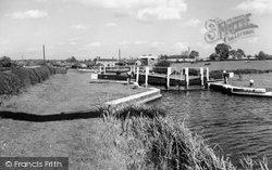
bypasses Fleckney on its eastern side; the photograph looks north east across Second Lock, towards Kibworth bridge and Bridge House, as the waterway winds towards Newton Harcourt and South
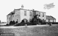
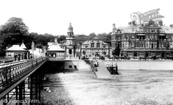
The old Beach Hotel seen here gave visitors good views south across The Green to the Promenade and the coastal shipping coming in and out of the harbour to the west.
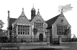
The library needed funds, so Sketchley approached the South Kensington Museum and persuaded them to lend various bits and pieces for an exhibition.
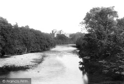
Situated to the south-east of the town on the left bank of the river Teith at its junction with the Ardoch, Doune Castle derives its name from the Gaelic word 'dun', meaning a fortified place.
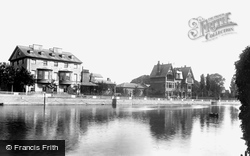
In this view, looking north-east from the bridge on the south bank of the Ouse, the Swan Hotel is seen without ivy.
Three miles south of Sandy we reach Biggleswade, now by- passed by the A1.
Being on a headland, there are two shores here - north and south. Along the latter runs the wide Esplanade, with extensive views across the Bristol Channel.
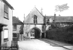
This 15th-century gatehouse is in the village of Kingswood, one mile south of Wotton; it is part of the Cistercian abbey which existed here until the Dissolution.
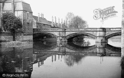
The chimneystacks of Lord Burghley's Hospital are an eye-catching feature along the south bank of the Welland.
Situated 4.5 miles south of Birmingham, Bournville was chosen by George Cadbury in 1879 as the site for his new factory and for a model village for his workers.
To the south-west of the town stands the ruined Dilston Hall, home of the Earls of Derwentwater, the last of whom was executed for his role in the Jacobite rebellion of 1715.
Watling Street, three miles south-west of Gravesend. It gained its name from a river passage that once reached it from the Thames at Northfleet.
100 acres was considered enough for a park, and the rest was made available for what was to become Park Road with North and South Parades.
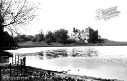
The Palace is situated upon the south shore of Linlithgow Loch. King David I built the first manor house at Linlithgow, and the church of St Michael next to it.
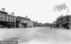
In this view, the market place is mostly a car park, with market stalls along the south side of the Square - one is visible at the left.
The fishing village of Robin Hood's Bay lies just a few miles to the south of Whitby. Also known as Bay Town, the village became a favourite haunt for artists and holidaymakers alike.
It was the country seat of the Duke of Leeds, who lived at Kiveton Park in south Yorkshire. Down by the beck is the 17th-century corn mill, once owned by the Neville family of Middleham Castle.
The parish church is on Horebeech Lane, a turning a little to the south of the shops in view H329029 (on pages 64-65), and dates from the decade after the railway arrived.
This view looks south-west down Loxwood Road towards the parish church, whose spire can just be seen amid the trees behind the last chimney-stack.
This view looks south. The High Street runs from the parish church, with its white-painted weatherboarded tower, to the Guildford road in the distance.
Nork is a suburb that merges south into Burgh Heath in the large triangle between Reigate Road, Brighton Road and Fir Tree Road, the north boundary of Nork.
Moving south-east and still within Wonersh parish, we reach Shamley Green, in 1965 still a remote Surrey hamlet loosely built around its triangular green.
This view shows the spot where the south lane curves north to meet the main through east-west lane; the wall to the left to Aldsworth is now reduced in height by half.
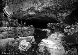
Actually this picture was taken a mile south of the hamlet of Ystradfellte at the place where the River Mellte tumbles into the dark mouth of this cave, which in English means White Horse Cave.
Places (15471)
Photos (5607)
Memories (1578)
Books (23)
Maps (2499)


