

Places
36 places found.
Those places high-lighted have photos. All locations may have maps, books and memories.
- Pentre-cwrt, Dyfed
- Pentre Halkyn, Clwyd
- Pentre, Mid Glamorgan
- Ton Pentre, Mid Glamorgan
- Pentre, Powys (near Llangynog)
- Pentre, Powys (near Guilsfield)
- Pentre, Powys (near Bishop's Castle)
- Pentre, Dyfed (near Pontyates)
- Pentre, Powys (near Newtown)
- Pentre, Clwyd (near Mold)
- Pentre, Clwyd (near Ruabon)
- Pentre, Shropshire (near Chirk)
- Pentre, Clwyd (near Hawarden)
- Pentre, Clwyd (near Chirk)
- Pentre, Clwyd (near Ruthin)
- Pentre, Clwyd (near Mold)
- Pentre, Shropshire (near Oswestry)
- Pentre, Powys (near Welshpool)
- Pentre, Clwyd (near Mold)
- Pentre, Shropshire (near Forton)
- Pentre Broughton, Clwyd
- Pentre Gwynfryn, Gwynedd
- Pentre Maelor, Clwyd
- Pentre-clawdd, Shropshire
- Pentre Galar, Dyfed
- Pentre Llifior, Powys
- Pentre-cefn, Shropshire
- Pentre-Gwenlais, Dyfed
- Pentre-Poeth, Dyfed
- Burntwood Pentre, Clwyd
- Pentre Berw, Gwynedd
- Pentre Hodre, Shropshire
- Pentre Llanrhaeadr, Clwyd
- Pentre-celyn, Clwyd
- Pentre Cilgwyn, Clwyd
- Pentre Morgan, Dyfed
Photos
98 photos found. Showing results 1,661 to 98.
Maps
316 maps found.
Books
2 books found. Showing results 1,993 to 2.
Memories
1,253 memories found. Showing results 831 to 840.
The Scene Today
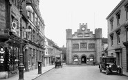
The old town hall in the centre has changed little although at the time this photo was taken the town hall was in the building to the left known then as the Anchor Hotel, now Bar Vin. The fine building to the right has gone to be ...Read more
A memory of Horsham by
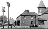
The Bakery, Tatsfield
Hi My family (The Watsons) owned the bakery which was a substantial building in the village centre. It housed the bakery itself (my Uncle Dick Watson was the baker in those days). It was also a hotel with six bedrooms, plus it ...Read more
A memory of Tatsfield in 1955 by
Our Part In Hitlers Downfall
Tettenhall was a logistical centre for the Normandy Landings. Americans were stationed in Danescourt House - long since demolished. However several of the troops have returned over the years, some of whom were "mothered" ...Read more
A memory of Tettenhall in 1944 by
I Remember It Well
1947 was the year my parents, sister aged 4 and myself aged 10 moved from living in two rooms in a shared house in Pricetown to a rundown three-storeyed rented house in Llewellyn Street, Nantymoel. It had three bedrooms, without ...Read more
A memory of Nant-y-moel in 1947 by
Ford Park Cemetery
The Cemetery, popularly known as Ford Park Cemetery, and owned by the Plymouth, Devonport & Stonehouse Cemetery Company finally went into liquidation in 1999 owing to the decline in burials following the opening of the two ...Read more
A memory of Plymouth by
Up The Hammers
My grandfather, John Williams, lived in a victorian terraced house in Seymour Road with his parents and four brothers. The house was knocked down and replaced with the large block of flats you can see in the distance to the centre of the ...Read more
A memory of East Ham in 1940 by
Scene Of High Street, St. Mary Bourne, Hampshire
This photograph shows the thatched house of Mr and Mrs Hansford on the right, on the opposite side of the road to the village stores owned by Roy and Ruth Wells. In the centre of the picture, in the ...Read more
A memory of St Mary Bourne in 1955 by
Postman Standing On The Corner Of Galgate West With John Street
The Postman is believed to be John Blenkinsop. Five of the entrances to ‘Barney’ have the word ‘gate’ (meaning ‘way’) in their street names. Galgate is the northern way into the ...Read more
A memory of Barnard Castle in 1890 by
Abbotsham School In The 1960's
Growing up at Fairy Cross, Alwington and as our village school had closed in the late 1950s we had to catch the school bus daily morning and afternoon to Abbotsham Primary School. (Shown in the centre back of the ...Read more
A memory of Abbotsham by
Life As A Young Boy In Saltdean
THE LIFE & TIMES OF DONALD CHARLES WILLIAMS Personal recollections from Don Williams from Hailsham who lived in Saltdean from 1937 to 1952 - Many thanks for these wonderful stories & photo's of Saltdean in the ...Read more
A memory of Saltdean in 1940 by
Captions
3,593 captions found. Showing results 1,993 to 2,016.

The Windmill Garage and Store (centre left) now supplies UK Petroleum. This is the A1031 coastal road to Grimsby, with the sea to the right.

After belonging to various owners it was purchased by the YMCA, and has become an international training centre with many and varied courses available for young people of all ages and nationalities.

Many of the sturdy, timber-framed cottages in the centre of this lovely village have been reinforced and decorated with brickwork during the 18th century.

The crane (centre right) was used to position long timbers across the harbour entrance to provide shelter during rough weather; today a swinging gate performs the same function.

Land opposite often saw overspills of crowds from town centre events such as the unveiling of the war memorial until it was developed as St Chad`s Gardens in 1925.

One would not now dream of walking down the centre of this road. The line of the paling on the left marked the boundary of the old Borough of Petersfield.

This view looks across the harbour and the boating pool from the pier.The clock-tower is just to the right of the centre of the picture, and we can see the entrance tower to the Dreamland amusement

For a few brief years Rotherham became a centre of learning, until the college was closed during the Dissolution.

It operates on the Fell system, whereby a third rail is laid in the centre of the track.

There was no problem with parking at this time, in what is now a very busy area, within walking distance of the main shopping centre. Attractive lamp posts line the pavement.

In the centre of the picture is St Martin-in-the-Fields, the Royal parish church, photographed at the time when Dick Sheppard was the vicar.

This is the main automotive route north from the city centre yet pedestrians appear happy to saunter UP the road rather than across it!

In the centre stands Howell's 1930s extension - a stylish addition much lauded by architecture and design historians.
A waterbus (centre) enables exploration of its eight-mile waterfront. The St David's Hotel & Spa (second from right) was completed along with the barrage in 1999.
Golden masonry radiant in the sunshine and the cool green shade of the old cemetery make the area a city centre oasis. It now even boasts a café popular with both workers and tourists alike.

The Highland Fling hotel and café (left) spent some years as an extremely large antiquarian bookshop and antiques centre before reverting back to being a café.

The centre of the village dates from the restoration and repairs begun in 1752 by Lord Crewe's trustees.

Wrexham's prosperity was founded on its position at the centre of the north Welsh coalfield, which fed local iron-, steel- and gasworks.

Centre right is the Ship Inn, and on the left the Lifeboat House. Porthleven's first lifeboat, in 1863, was the 'Agar Robartes', which was replaced in 1882 by the 'Charles Henry White'.

This view looks south-west along the Bulbourne Road, with 1890s cottages on the left and the New Mill Social Centre on the right.

In the form of a cross, it is built in the Corinthian style, and surmounted by the giant dome which rises on arches over the centre.

Leeds also became the leading centre for the manufacture of ready-to-wear clothes.
Completed in 1841, the Parish Church is now at the centre of much riverside regeneration. Back in Victorian times it was surrounded by a degenerate Leeds, including drinking-houses and prostitution.

At its centre is the square Market Place with a medieval market cross whose shaft can be seen to the left.
Places (57)
Photos (98)
Memories (1253)
Books (2)
Maps (316)

