Places
17 places found.
Those places high-lighted have photos. All locations may have maps, books and memories.
- Bridge End, Oxfordshire
- Bridge End, Lincolnshire
- Bridge End, Essex
- Bridge End, Bedfordshire
- Bridge End, Clwyd
- Bridge End, Warwickshire
- Bridge End, Surrey
- Bridge End, Durham (near Frosterley)
- Bridge End, Northumberland (near Hexham)
- Bridge End, Hereford & Worcester (near Tirley)
- Bridge End, Hereford & Worcester (near Bosbury)
- Bridge End, Shetland Islands
- Bridge End, Cumbria (near Carlisle)
- Bridge End, Northumberland (near Hexham)
- Bridge End, Devon (near Kingsbridge)
- Bridge End, Devon (near Sidmouth)
- West End, Yorkshire (near Pateley Bridge)
Photos
40 photos found. Showing results 1,341 to 40.
Maps
520 maps found.
Books
2 books found. Showing results 1,609 to 2.
Memories
1,925 memories found. Showing results 671 to 680.
Doctors Pond
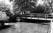
I walked across this bridge four times every day, on my way to and from school (I used to go home for lunch). Home was Abberd Way, and the school was on the Green. I used to stop there to watch trout, and I can still recall the smell of ...Read more
A memory of Calne in 1952 by
So Different Now
I used to live at 22 Clifton Road. Tin baths, outside loos, newspaper on a nail in toilet, all of that. I went to Clifton Road School so I only had to skip a few yards to get there. I remember a teacher called Mrs De Orfe and the ...Read more
A memory of Southall in 1952 by
Wandsworth Market
I remember that little market where the Arndale Centre now stands. Also the swimming baths. The bakers on the bridge was a family firm and there was a fish and chip shop in the market. Plus a small pet shop which I later ...Read more
A memory of Wandsworth in 1952 by
Happy Holiday Times
My childhood holidays were spent each year at Lower Largo from 1952 until 1960. Mum, Dad and I lodged with a family called Robertson where we had a room and meals cooked for us by Mrs Robertson. Every year the same families ...Read more
A memory of Lower Largo in 1952 by
First Visit To Mr Leys Caravans
Mr Ley, ex Army Major who along with his family started probably one of the first Holiday Caravan sites at Par Sands. Mr Ley always drove a yellow Rolls Royce when he arrived to clean the vans. On the entrance to the site ...Read more
A memory of Par in 1952 by
Greengrocers Shop
My dad Eddie had a greengrocer's shop in Upminster in 1952, the year I was born. I know we lived in the flat above the shop, and it was quite near Upminster Bridge. Does anyone remember the shop?
A memory of Upminster in 1952
On The Move
In the summer of 1952 I learnt that my parents had decided to move from our home in the Midlands to the West Country as my father wished to return to where his relatives lived. It came as no surprise therefore, when one day they ...Read more
A memory of Dartmouth in 1952
Short Memories Of Burnt Oak
Writing this is difficult. I lived in Burnt Oak as far as I know from 1949 to 1953. I recall living in a top floor flat in 100 Littlefield Road. I attended a school off Gervas Road but cannot remember the name. I do ...Read more
A memory of Edgware in 1951
Training To Be A Bricklayer
During my chidhood I was to perform lots of different tasks that would make life for my mother a little easier. I did not know it at the time but she was actually training me for my working life. Not ...Read more
A memory of Intake in 1951 by
Hill House
I moved back to Hill House, with my brothers, Adrian, Anthony & Twins Russell & Howard. Micky , John & Julian arrived a few years later. I lived there untill 1963, when I got married, and moved to a flat at Kelsale court. I ...Read more
A memory of Kelsale in 1951 by
Captions
1,770 captions found. Showing results 1,609 to 1,632.
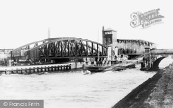
This view shows the two bridges at Barton upon Irwell both swung to let the paddle steamer 'Ivanhoe' pass.
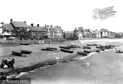
Before the wall was built, much of the sea front was marshland and sand dunes, and subjected to constant flooding.
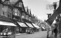
The steep roofs and gables in the Dutch style overlook a hive of activity in this street scene.
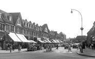
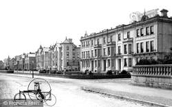
Road-side lamps have also changed in style, and traffic includes a heavy motor lorry (just visible in the distance) and a vintage invalid carriage (left).
Newark is a town with a wealth of historic buildings, and it is relatively little changed compared with Grantham or even Nottingham.
As we come away rfom the main shopping centre, the buildings become less imposing and only two stories in height; but still the stone facades prevail.
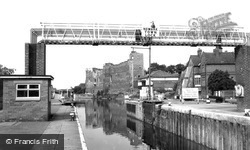
This photograph was taken from the old footbridge, of which only the central pier and abutments remain; the cast iron section was added in 1869.
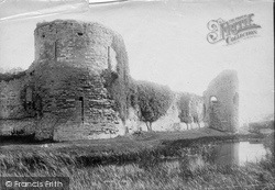
An earth and timber castle was established here by the Normans in 1110. After several attempts, the Welsh took it in 1165, rebuilt it in stone and held the first Eisteddfod within its walls in 1176.
In Roman and medieval times the castle was on the sea, but this has retreated half a mile away.
In 1965, when Greater London was created, Surrey crossed the River Thames and gained a segment of the former county of Middlesex.
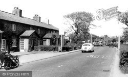
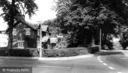
Outside Holroyd's shop and post office is a sign warning of a low bridge ahead. Opposite this leafy corner was the vicarage, now a private house.
Although they are outside the City of Nottingham's boundaries, Carlton and Gedling are really its eastern suburbs.
Near the Wharfe and overlooking the 1592ft Simon's Seat, Appletreewick was the resting place of monks on their journey between Bolton Abbey and Fountains Abbey.
An earth and timber castle was established here by the Normans in 1110. After several attempts, the Welsh took it in 1165, rebuilt it in stone and held the first Eisteddfod within its walls in 1176.
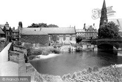
This photograph must have been taken from the Trinity Bridge. On the left, Parnell's shop is now the Ideal Shop, still selling newspapers.
South-east of the town, along the valley of the River Ise and west of Barton Seagrave village, is The Wicksteed Park with the river dammed to form a large lake as the centrepiece.
This photograph must have been taken from the Trinity Bridge. On the left, Parnell's shop is now the Ideal Shop, still selling newspapers.
Several of Frith's 1921 views of the river have the same river launch loitering in the foreground (compare with 70432, 70435 and 81732, a return visit by the same photographer in 1929?).
Beyond the tithing of Barton and after crossing water meadows, we come to the pretty village of Bishopstoke.
Victorian engineering may have had its successes with its railways, bridges and steamships, but not every invention made it into the handbook of classic designs.
Within five years he had been declared bankrupt, and the village became part of the Londesborough estate. The village school for up to 54 children was open from 1854 to 1958.
It was a popular place for holidays when this picture was taken, even though the village was disfigured by a ruin of an alum works and an iron bridge carrying the LNER railway line from Whitby to Saltburn
Here we see the bridge over the River Greta in the busy little market town of Keswick in the northern Lakes.
Apart from the battle, Powick's other main claim to fame is Powick Mills next to the bridge where the battle took place.
Places (17)
Photos (40)
Memories (1925)
Books (2)
Maps (520)

