Places
36 places found.
Those places high-lighted have photos. All locations may have maps, books and memories.
- Cardiff, South Glamorgan
- Barry, South Glamorgan
- Penarth, South Glamorgan
- Rhoose, South Glamorgan
- St Athan, South Glamorgan
- Cowbridge, South Glamorgan
- South Molton, Devon
- Llantwit Major, South Glamorgan
- Chipping Sodbury, Avon
- South Chingford, Greater London
- South Shields, Tyne and Wear
- Ayr, Strathclyde
- St Donat's, South Glamorgan
- Llanblethian, South Glamorgan
- Thornbury, Avon
- Llandough, South Glamorgan
- Fonmon, South Glamorgan
- St Nicholas, South Glamorgan
- Jarrow, Tyne and Wear
- Penmark, South Glamorgan
- Font-y-gary, South Glamorgan
- Maybole, Strathclyde
- Yate, Avon
- Oxford, Oxfordshire
- Torquay, Devon
- Newquay, Cornwall
- Salisbury, Wiltshire
- Bournemouth, Dorset
- St Ives, Cornwall
- Falmouth, Cornwall
- Guildford, Surrey
- Bath, Avon
- Looe, Cornwall
- Reigate, Surrey
- Minehead, Somerset
- Bude, Cornwall
Photos
5,607 photos found. Showing results 821 to 840.
Maps
2,499 maps found.
Books
23 books found. Showing results 985 to 23.
Memories
1,580 memories found. Showing results 411 to 420.
Caroline Street
My grandma was a Bell before she married Harry Davison and eventually went to live in South Market Street. She, her parents and siblings had lived at 32 Caroline Street, until they all married. Lizzie Maddison (my great-aunt ...Read more
A memory of Hetton-Le-Hole in 1950 by
Ww2
When I was about 5 years old I remember my mum picking me up from Smallfield school on her bike, I was in the back on a little seat when a doodlebug roared overhead, and the engine switched off ... My mum panicked, and pushed me off the bike ...Read more
A memory of Smallfield in 1943 by
Halcyon Days In The 1950s
What fantastic days they were, despite the hardship. We were a family of 9 Seven children Allan Joy,twins Michael and David, myself Sam and a second set of twins Kathryn and Brian I too remember Mrs Greys shop, also ...Read more
A memory of Wrottesley Park in 1955 by
Frenchay Hospital, Bristol Built By The American Army
Frenchay Hospital in Bristol was built by the American Army during the Second World War. Frenchay Hospital is a large hospital situated in Frenchay, South Gloucestershire, on the (NE) outskirts of ...Read more
A memory of Frenchay by
Grandparents
I was in Featherstone at the weekend and visited Cressys Corner as my grandparents lived there in the 1960s. I'm doing our family tree and visited various places in Featherstone. It all looks so different to when I was growing up ...Read more
A memory of Featherstone by
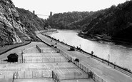
Tennis Courts Portway Bristol
These Clifton Tennis Courts alongside Bristol's Portway road were built just after the road was opened. The new built Portway from Bristol to Avonmouth a very modern road in its day. The wide A4 Portway trunk road passes ...Read more
A memory of Bristol in 1930 by
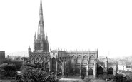
Bristol's Loveliest Church, St Mary Redcliffe.
St Mary Redcliffe Church. Bristol's loveliest church, St Mary Redcliffe, was described as 'the fairest, the goodliest and most famous parish church in England' by Queen Elizabeth I in 1574. Thanks to ...Read more
A memory of Bristol in 1880 by
Recollections Of Pitsea From 1941 Onwards
Born in Northlands Drive, Pitsea in 1938, my first recollection was aged 3 years when I remember being put to bed in a cot under the kitchen table during an air raid. We had an Andersen shelter in the garden ...Read more
A memory of Pitsea in 1940 by
Re. Where's Our Susan?
I was looking at the old Co-op photo of Widnes. I was amazed when I read about Susan. I too lived in South Street. I lived at number 4. It's been many years but I'm almost certain I know you all! Lol! By the way my name is Charlie I was 6 in 1960.
A memory of Widnes by
Early Childhood In Romford
I was born in 1953 and lived for the first 3 years in an old house in Junction Road (Number 8) with my parents and Mum's mum (Granny). The back garden of the house seemed to be a jungle and had its end boundary with ...Read more
A memory of Romford by
Captions
2,476 captions found. Showing results 985 to 1,008.
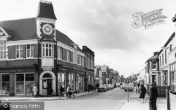
This view of Station Road looks south-west past the junction to Havelock Street, with the imposing clock tower of the 1903 Co-op store.
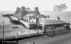
The South Parade pier is the more traditional of Southsea's two piers. It was opened in 1879 by Princess Saxe-Weimar, and it was extensively rebuilt in the Edwardian era after a fire in 1904.
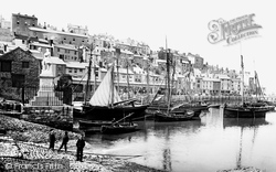
Brixham is located at the south end of Tor Bay. Its natural harbour, sheltered by the limestone cliffs, made it ideal for settlement.
Just five miles south of Huddersfield on the road to Wakefield, Kirkburton in the 19th century was just as polluted by smoke as its near neighbours.
This was once an important stopping place on the main road from Taunton to the north Devon area; now, a new road further south has removed much of the traffic from this place.
The first structure was a toll bridge; today the river is spanned by various busy roads and a motorway - a far cry from the days centuries ago when this river and many others like it on the south coast
Excavations undertaken in 1892-93 revealed a medieval priory on the east and south side of the parish church.
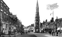
This view looks north along South Gate past the extraordinarily grandiose statue in its towering medieval-style spired canopy to a 19th-century MP, Henry Handley, which dates from 1850.
The High Street is part of the old London to Brighton route through Henfield, which lies to the east of the River Adur on a belt of Wealden clay behind the South Downs.
Two of the girls have come down from the bridge and are inspecting the ruined south-west towers.
The church has a Norman nave and chancel, with Norman mouldings to the south door and chancel arch. The porch is Tudor.
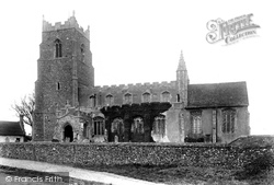
The south porch dates from 1466. The tower has stone figures at the corners instead of pinnacles. The whole church was restored in 1872. The vicar in 1906 was the Rev John Brown.
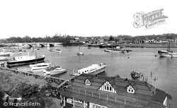
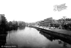
We are looking towards Ouse Bridge with South Esplanade on the right.The view has remained virtually the same, except for the difference in the river traffic and a change of use for some of the
We are looking towards Ouse Bridge with South Esplanade on the right.The view has remained virtually the same, except for the difference in the river traffic and a change of use for some of the
Beckbury, just a mile or so to the south, can certainly be described as a village, and it still retains its pub, the Seven Stars.
As Reading expanded south, St Giles', decaying and small, proved unable to cope, and Christchurch was built in 1861-2.
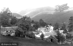
At the south end of the village is Townend, a typical Lakeland statesman's house, now in the care of the National Trust.
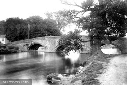
Eamont Bridge, just south of Penrith on the A6, takes its name from this splendid three-arched bridge across the River Eamont.
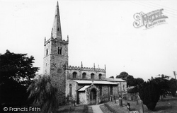
In this view we look past the Horse and Jockey pub towards the south of the village; the church is beyond the high tree on the left.
Since 1955 a new residential block has been built in the background of the picture, whilst a new library to the south of the chapel has appeared.
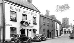
Ahead is the 17th-century timber-framed White Horse and the Victorian South View Cottage. The road to the left leads to the former Independent Chapel of 1750.
Carfax stands at the crossing point where the original north to south and east to west routes ran through Oxford.
By 1955 a new station had been built on the corner of Brooke Road and South Street. In recent years this has been considerably modernised.
A half-mile south along London Road, it was built in 1861 by the school usher, Rev W J Earle, in brick with a subdued polychromatic treatment by a Birmingham architect.
Places (15471)
Photos (5607)
Memories (1580)
Books (23)
Maps (2499)


