Places
36 places found.
Those places high-lighted have photos. All locations may have maps, books and memories.
- Shanklin, Isle of Wight
- Ventnor, Isle of Wight
- Ryde, Isle of Wight
- Cowes, Isle of Wight
- Sandown, Isle of Wight
- Port of Ness, Western Isles
- London, Greater London
- Cambridge, Cambridgeshire
- Dublin, Republic of Ireland
- Killarney, Republic of Ireland
- Douglas, Isle of Man
- Plymouth, Devon
- Newport, Isle of Wight
- Southwold, Suffolk
- Bristol, Avon
- Lowestoft, Suffolk
- Cromer, Norfolk
- Edinburgh, Lothian
- Maldon, Essex
- Clacton-On-Sea, Essex
- Norwich, Norfolk
- Felixstowe, Suffolk
- Hitchin, Hertfordshire
- Stevenage, Hertfordshire
- Colchester, Essex
- Nottingham, Nottinghamshire
- Bedford, Bedfordshire
- Bury St Edmunds, Suffolk
- Aldeburgh, Suffolk
- St Albans, Hertfordshire
- Hunstanton, Norfolk
- Chelmsford, Essex
- Bishop's Stortford, Hertfordshire
- Peterborough, Cambridgeshire
- Brentwood, Essex
- Glengarriff, Republic of Ireland
Photos
9,106 photos found. Showing results 1,001 to 1,020.
Maps
181,006 maps found.
Books
11 books found. Showing results 1,201 to 11.
Memories
29,054 memories found. Showing results 501 to 510.
1901 Census
This is actually a memory of my father, who is listed in the census of Wales for 1901 as being a quarryman, lodging at Cidwyn View, Betws Garmon aged 21. I hope to visit the village (?) this Sept. and also the quarry. I would love to know if this house still stands.
A memory of Betws Garmon in 1900 by
Mill Street Clowne. 1950
The gentleman pushing a cart in the foreground of this picture is my grandfather, Ernest Pearce (1895-1970). The cart was used to transport bundles of sticks that he cut for sale as firewood. They were sold for 4d a bundle. This ...Read more
A memory of Clowne in 1950 by
My Grandparents Home
My grandparents Isabella and Jack Lymer and my Uncle Victor Lymer lived above the cafe until my nan's death in 1968. When I was young it was the flat to the left as you look at the picture. It is now the hairdressers. My mum ...Read more
A memory of Newbiggin by
1901 Wickhambreux
Sarah Clayden Rudd nee Wacey and her daughters lived in Wickhambreux. They were listed there at the time of the 1891 census as living 'the green' and in 1901 she and her daughters, Sarah and Rebecca, are living there and ...Read more
A memory of Wickhambreaux in 1890 by
North Road Looking North From Church Street, Fen Street Junction
Previous memories talk about The Talbot Inn and on the left hand corner (Church Street Corner) Marshall's the newsagents . Before the village was bypassed around 1956 the Newsagents had ...Read more
A memory of Stilton in 1954 by
Even Better Today
I still visit this church, although it is locked much of the time. It looks even better today than it did way back then. The village of 'Send' was supposed to have been built around this church (I am told), however it ended up a ...Read more
A memory of Send by
Where I Grew Up
I lived most of my life in Sible Hedingham, as a family we moved there from London in 1962. I was just 2 years old at the time. My father Robert Farren, "Bob" as he was best known and my mother Ivy, took over the licence of ...Read more
A memory of Sible Hedingham in 1962 by
Living In Wickford
I lived in Wickford until 1963. My sisters and I would walk down London Road to the high street, first stopping at the little sweet shop and then looking into the windows of Prentice. I got my first 2 wheeler there in 1954. We ...Read more
A memory of Wickford in 1954 by
Growing Up In Westend In The 70s And 80s
I was born in 1965 and grew up in Westend. I moved to America in 1988 and have only been back to visit once since then back in 1989/90. I can't really imagine how much the village has ...Read more
A memory of West End by
Inherited Postcard
I have an original postcard of this picture from the Frith Series. It is unstamped and printed on the card is "Affix Half Penny Stamp". Handwritten on the card is "The seat of Mr Tremayn & about one mile from here" Also printed on the card is F. Frith & Co Ltd, Reigate, No 21284
A memory of Morval by
Your search returned a large number of results. Please try to refine your search further.
Captions
29,158 captions found. Showing results 1,201 to 1,224.
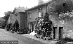
Lying at the foot of wooded limestone slopes to the east of Cringlebarrow, these rendered stone cottages, with pronounced dripstones protecting their windows and doorways from the rain, are typical of
Fortunately, there is no traffic as the farmer herds his small herd of cows in the middle of the road at the bottom of Town Hill beside the Peterville Inn.
This lovely village is said to command one of the finest views in Kent across the Weald towards Ashdown Forest. It sits alongside the Surrey boundary, two miles north of Edenbridge.
In the 1920s the future looked very bright for Loughborough, but the Depression of the 1930s came as a cruel blow to the town.
Looming over the town is the tower of the town hall, clearly more than a little influenced in its design by its more prestigious neighbour at Leeds.
'Chepe' and 'stowe' combine to mean 'market place', which indicates the early origins of this town.
This view, showing the centre of Ewell village, was taken looking north towards the Horse Pond and Spring Corner, and includes several splendid examples of the motor vehicles of the period.
The town was laid out north and west of the Abbey precincts, with the Market Place at the junction of High, Magdalen, Benedict and North Load Streets.
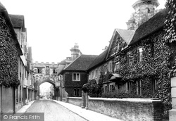
To the right of the picture is the foliage-covered Matrons' College, built in the 1680s as a refuge for the widows of priests who were ordained in the Salisbury dioceses.
Lack of major industrial development in Tewkesbury meant that the town retained much of its 17th- and 18th-century character and did not experience much of an explosion in its population.
The Palace, designed by the illustrious London architects Ernest George & Peto and built in 1882 at the then enormous cost of £20,000, was funded by Viscountess Ossington, sister of the 5th Duke of
Holyhead is best known as the ferry port for Ireland, and stands on Holy Island, linked by a causeway to the Isle of Anglesey.
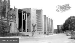
When Basil Spence designed the new cathedral, he incorporated the ruins of St Michael’s into the scheme of things: the old church in effect became the new cathedral’s vestibule.
Magdalene Almshouses (left), were rebuilt in 1877 on the site of a lazar-house or leper hospital, apparently founded by a member of the de Leyes or Legh family, in the early 13th century.
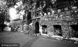
We have two items of interest in this picture: the archway, the Gannock Gate, and the Red Mount Chapel behind the trees on the left.
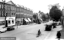
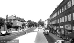
To the south-east of mediaeval Finchley, the High Road drops down from the North Circular Road between an almost standard series of parade shops built around the turn of the century, and past the Rex Cinema
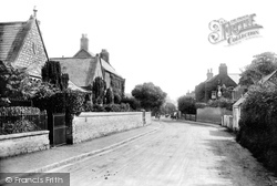
The placename is derived from Haecc or gate. The village is on the north-west edge of Pinner Park, itself a 14th-century deer park owned by the Archbishop of Canterbury.
Denton Hill is part of Cuddesdon. The name of the village is Saxon and means 'Hill of Cuthwine.' From the churchyard there are wonderful views across the plain of Oxford to the Chilterns beyond.
The A47 Leicester-Uppingham road forms one side of the roughly triangular market place; although the photograph shows, in the main, modest cottages of 17th- and 18th-century date, more impressive houses
Whereas Glasgow Green had been a part of the common grazing land of the burgh since the earliest times, the greening of Glasgow really began in 1852 when the city acquired the estates of Woodlands
Located on the east side of Magdalen Bridge, The Plain signifies the boundary of the old city. Just out of sight, the River Cherwell flows under the easterly part of the High Street.
The laying out of Windsor Gardens in 1880 was an early manifestation of the 'new' Penarth, an integral part of the work to gentrify the seafront area.
Old Swinford is a suburb of Stourbridge today, which represents a reversal of fortune: the Domesday Book (1086) recorded Stourbridge as part of the manor of 'Suineford'.
This is an excellent example of the seemingly inexorable tide of uniform London County Council housing which swept northwards to engulf this former hamlet of Elstree after the Second World War.
Places (6814)
Photos (9106)
Memories (29054)
Books (11)
Maps (181006)


