Places
36 places found.
Did you mean: street or streetly ?
Those places high-lighted have photos. All locations may have maps, books and memories.
- Heathfield, Sussex (near Cade Street)
- Street, Somerset
- Chester-Le-Street, Durham
- Adwick Le Street, Yorkshire
- Scotch Street, County Armagh
- Friday Street, Surrey
- Potter Street, Essex
- Boughton Street, Kent
- Newgate Street, Hertfordshire
- Streetly, West Midlands
- Shalmsford Street, Kent
- Green Street Green, Greater London
- Boreham Street, Sussex
- Park Street, Hertfordshire
- Cade Street, Sussex
- Appleton-le-Street, Yorkshire
- Hare Street, Hertfordshire (near Buntingford)
- Romney Street, Kent
- Trimley Lower Street, Suffolk
- Streetly End, Cambridgeshire
- Hare Street, Hertfordshire (near Stevenage)
- Brandish Street, Somerset
- Colney Street, Hertfordshire
- Langley Street, Norfolk
- Silver Street, Somerset (near Street)
- Street, Yorkshire (near Glaisdale)
- Street, Lancashire
- Street, Devon
- Street, Cumbria (near Orton)
- Street, Somerset (near Chard)
- Bird Street, Suffolk
- Black Street, Suffolk
- Ash Street, Suffolk
- Broad Street, Wiltshire
- Brome Street, Suffolk
- Penn Street, Buckinghamshire
Photos
24,921 photos found. Showing results 4,121 to 4,140.
Your search returned a large number of results. Please try to refine your search further.
Maps
1,622 maps found.
Books
3 books found. Showing results 4,945 to 3.
Memories
6,667 memories found. Showing results 2,061 to 2,070.
Bensham In The 40s
I was born in 1934 in Southill Rd, Bensham and went to Lady Vernon School, my name in them days was Sheila Lucas. I had a wonderful life in those days. My life revolved round Bensham, the baths in Mulgrave Terrace were ...Read more
A memory of Sheriff Hill by
Leeholme Family History
Hello everybody, wish I had found this site years ago. My Grandparents Margaret and Christopher Clark, I believe were one of the first to move into 8 Buckingham Terrace in around 1909. He was a hewer at the coal mine, and a ...Read more
A memory of Leeholme in 1910 by
Wandle Park
I grew up in Lower Church Street, next to the Pitlake ph. As kids we used to play all summer long in the park. By then the boating lake had been drained and it was just a big circular ditch with the island in the middle. The river was ...Read more
A memory of Croydon in 1965 by
Avondale Street
My cousin Edna and her husband Walter, lived in 53 Avondale.
A memory of Ynysboeth in 1950 by
Phil & John's Amazing Journey Part 1 Infant School Memories
How many of us as fresh faced five year olds, on our very first day at school, look around the classroom and think ‘will any of these children be classed as ‘true’ friends fifty years from ...Read more
A memory of Groby in 1961
My Childhood Holidays In Abercwmboi
I was born in 9 Graig Terrace, Abercwmboi at my grandparent's house; Charles William and Elizabeth Mary Davies. My mother was Christabel Viola Davies, (married name Mills). We moved to Penwaun when I was 6 ...Read more
A memory of Abercwmboi in 1951 by
My Grandparents
My memory does not relate to one specific year but to many. My grandparents lived in Hall Street, they ran a haulage company, S E Foster, and wedding car firm, the only one in the village at that time. Their names were Edwin and ...Read more
A memory of Wednesfield by
Childhood Memories
I was born in Nanty in 1947, I lived on High Street. My dad was Tom Bevan and I went to Nanty Infants School. I remember as a child playing down by the river with my friends and my mam shouting at me because I was getting ...Read more
A memory of Nantyffyllon in 1956 by
Raglan Street
I was born 1943 and lived with my mother and sister, Joan, in Raglan St., Lower Broughton. My mother was Barbara Joels who had lost her husband (our dad) in Casino, during the war. I remember attending St, Andrews Mixed Infants School, ...Read more
A memory of Salford in 1940 by
Captions
5,435 captions found. Showing results 4,945 to 4,968.
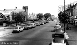
There are excellent parking facilities for vehicles in this part of the High Street.
High Street c1960 On the left is the Town Hall with its unu- sual lead-sheathed clock turret.
We see a view of the main street here; this was probably as busy as it got in those days! The name Borden means 'woodland pasture by the hill'.
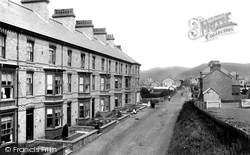
We are looking eastwards into the Welsh mountains along the high street from the railway bridge.
This view looks out of the market place into Bow Street, which leads down to the river.
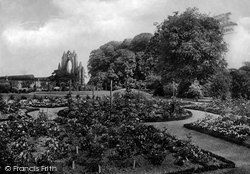
In the years before the Second World War, the Priory Gardens were entered by a picturesque gateway in Bow Street.
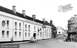
The road sweeps past the Lansdowne Arms Hotel and, before the A4 road widening, it curved gently up the High Street past imposing shops and banks.
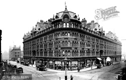
St Mary's Gate is to the left, and the now lost Victoria Street is away to the right, leading to Exchange Station; Cromwell's Statue can just be seen on the far right.
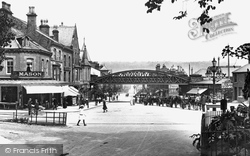
This railway bridge over Brook Street was taken down a year after the last train to Skipton left Ilkley on 20 March 1965.
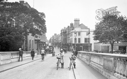
Moving northwards, we cross the Ouse bridge, with the High Street ahead.
This view looks down the High Street towards the clock tower. This was built as a market hall and lock up, or temporary prison, in 1842, but in 1870 the clocktower, belfry and spire were added.
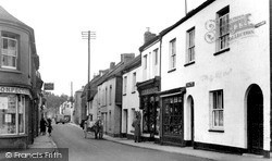
The adjacent tobacconist's premises bears numerous advertisements for assorted products, while on the opposite side of the street, the hardware store displays some of its stock, including a roll
The fells sheltering this village, most of which lies at the foot of this steep main street, rise to 1,000ft. The rest of the village follows the high road above the River Ribble.
The camera looks north-south along the High Street as it crosses the Leicester to Nottingham railway, and at a not unattractive group of houses and shops ranging in date from the 18th
Still close to the Yorkshire county boundary and south- west of Harworth, Oldcotes village is situated at the crossroads of the A634 and A60; Main Street runs east from the A60 Doncaster Road
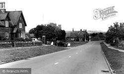
The large gabled house on the left of the street, with the telephone box outside, is the village shop and post office, both of which have since closed.
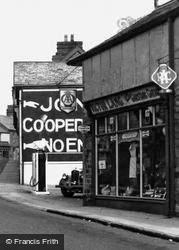
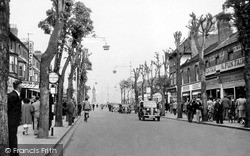
picture shows local shops with a proliferation of signs of all types outside; vending machines are attached to the shopfront.An obtrusive clutter of tall poles lines the road, and a modern concrete street
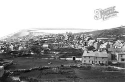
Fortune's Well, the main street (centre right), leads to the tower of the church of St John the Baptist and gives its name to Fortuneswell village.
This photograph was taken in the other direction to H277056 (page 35), looking east along Market Street.
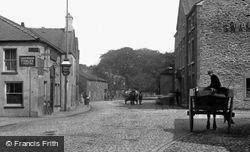
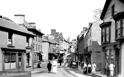
This street is a short one, running up into the town after crossing the Usk. The motor car is not yet a common sight, hence the horse-drawn carts going about their business.
In the early 1950s, the street lamps were being converted from gas to electricity; these in Lumley Road are the last gas lamps in use just before the changeover.
The camera looks north-south along the High Street as it crosses the Leicester to Nottingham railway, and at a not unattractive group of houses and shops ranging in date from the 18th
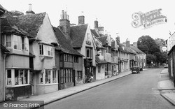
Many of the delightful houses in this photograph of the north side of St Paul's Street originated in the 13th century, but their fronts were rebuilt later.
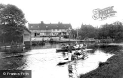
But as these boaters opposite the Green Dragon pub in Water Street in Chesterton demonstrate, it does take some practice, which is why a paddle can come in handy for the less experienced.
Places (385)
Photos (24921)
Memories (6667)
Books (3)
Maps (1622)


