Merry Christmas & Happy New Year!
Christmas Deliveries: If you placed an order on or before midday on Friday 19th December for Christmas delivery it was despatched before the Royal Mail or Parcel Force deadline and therefore should be received in time for Christmas. Orders placed after midday on Friday 19th December will be delivered in the New Year.
Please Note: Our offices and factory are now closed until Monday 5th January when we will be pleased to deal with any queries that have arisen during the holiday period.
During the holiday our Gift Cards may still be ordered for any last minute orders and will be sent automatically by email direct to your recipient - see here: Gift Cards
Places
36 places found.
Those places high-lighted have photos. All locations may have maps, books and memories.
- North Walsham, Norfolk
- North Berwick, Lothian
- North Chingford, Greater London
- Harrogate, Yorkshire
- Whitby, Yorkshire
- Filey, Yorkshire
- Knaresborough, Yorkshire
- Scarborough, Yorkshire
- Clevedon, Avon
- Weston-super-Mare, Avon
- Richmond, Yorkshire
- Selby, Yorkshire
- Ripon, Yorkshire
- Scunthorpe, Humberside
- Pickering, Yorkshire
- Settle, Yorkshire
- Skipton, Yorkshire
- Saltburn-By-The-Sea, Cleveland
- Norton-on-Derwent, Yorkshire
- Rhyl, Clwyd
- Chester, Cheshire
- Llandudno, Clwyd
- Grimsby, Humberside
- Durham, Durham
- Nailsea, Avon
- Southport, Merseyside
- Brigg, Humberside
- Colwyn Bay, Clwyd
- Redcar, Cleveland
- Bath, Avon
- Grange-Over-Sands, Cumbria
- Cleethorpes, Humberside
- Sedbergh, Cumbria
- Barrow-In-Furness, Cumbria
- Barmouth, Gwynedd
- Dolgellau, Gwynedd
Photos
2,953 photos found. Showing results 1,061 to 1,080.
Maps
9,439 maps found.
Books
39 books found. Showing results 1,273 to 1,296.
Memories
1,550 memories found. Showing results 531 to 540.
The Atlantic House Hotel
Back in 1971, I joined a friend from London on a surfing trip to Polzeath. I'm from America, and was in the middle of a year-long jaunt around Europe and North Africa. I hadn't gone surfing in several months and was ...Read more
A memory of Polzeath in 1971 by
Thornbury Road, Osterley And Spring Grove Central School, Isleworth
I was born at West Middx. Hosp in 1940. Christened at St. Mary's Church, Osterley. I lived in Syon Park Gardens until I was 34. I remember Thornbury Road and can remember some of ...Read more
A memory of Osterley by
Holy Cross
I was the born at the Green in Wallsend. I used to live in Holy Cross and I remember the burn, the old cemetery at the top of our road and shopping on Wallsend High Street. My dad was a supervisor at the Rising Sun Pit. We also lived ...Read more
A memory of Wallsend by
Part 13
He then ran a wet fish trade from a horse and cart, but also ran a fish and chip shop. Last time I was in Houghton the fish shop was still there. In Newbottle Street, just up from the school and on the same side. Gran was very proud ...Read more
A memory of Middle Rainton in 1945 by
Love Living In North Cave
I have enjoyed all the times being at Mr. Judges. I have enjoyed being around the family and dinner parties. Love from Ruby Marson
A memory of North End in 1945 by
North Shields
I first came to North Shields after leaving the army in 1972. I stayed at the Railway Hotel run by a tyrant of a woman who threw you out at 8am and would not let you back till 5pm! Worked at Tor-days then General Foam and at ...Read more
A memory of North Shields by
The N.H.S. Early Years To Retirement
The Transport Department at Southmead Hospital when I joined them consisted of an officer, foreman, and four porter drivers, with two buses, three vans, and two cars. We were responsible for supplying ...Read more
A memory of Bristol in 1960 by
1952 1962
After moving many times between Enniskillen and Liverpool, I moved to Kirkby with my mum, dad and two brothers in 1952. There were only a couple of roads finished and after living in a cramped one room, which housed the bed, the ...Read more
A memory of Kirkby by
My Earlist Memories
My earliest memories are of East Harlsey where my father was an undergardener at the Hall. The owners were the Constantine family, whose business was something to do with shipping in the North East. We lived in a tied cottage ...Read more
A memory of East Harlsey in 1950 by
Fighting Fieldings
Anybody from Hope / Caergwle, got any photos, handbills, posters, paper cuttings etc..on the boxing brothers the Fighting Fieldings? Obviously I would pay for them, as I'm researching for doing a book on boxers from North Wales. ...Read more
A memory of Caergwrle in 1930 by
Captions
2,676 captions found. Showing results 1,273 to 1,296.
Sited beside the main north road, the pub has always been a busy place, with the canal and, later, the railway also bringing their trade. The former nearby station took the name of Roebuck.
Bispham lies just a little to the north of Blackpool's bright lights and seemingly non- stop amusements, and its sea-front hotels and guesthouses attracted holidaymakers seeking a more
Carnforth's industries of sand and gravel extraction and iron smelting depended upon the Lancaster Canal and later the railway, when an important junction between the north-south and east-west
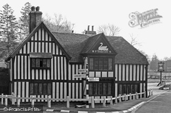
Situated in North Hampshire, on the border with Berkshire, Ye Swan Inn is the first Hampshire building to be seen when coming south.
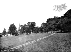
We are looking north-west, with St Mary's left of centre. The row of houses on this side of the Common vary from the 14th to the 19th century.
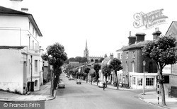
The High Street, running south to north, was wide enough for two carriages to pass in times gone by.
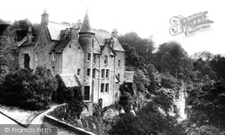
Located nine miles south of Edinburgh, Hawthornden stands high above the river North Esk amid a densely wooded estate.
Viewed from the 23-acre Iron Age fort which stands on the steep road leading north-west away from the village, the church of St Giles stands out to the left of the picture.
'Glorious Goodwood', one of the great advertising slogans, usually lives up to its name, and the racing that takes place here, high on the South Downs and a mile north of Goodwood House, is usually blessed
Located about eight miles north-west of Northampton, the village of Creaton used to comprise two communities - Great Creaton and Little Creaton.
This view looks north along the A15 towards the church of St Guthlac and Bourne.
Until the 19th century this was a boundary between the north and east ridings. There were also a stream and small pools here, which were eventually covered in to form part of the sewer.
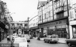
and somewhat two-dimensional timbered front of Woolworths and the 1907 Perpendicular Gothic-style Mac Fisheries (a chain long departed from our high streets) were recently demolished to make way for the
On a creek on the north shore of the Helford, Port Navas was once the shipping place for granite from the quarries around Constantine.
though it has expanded so much in recent years that by no stretch of the imagination could it still be described as a village.The old redundant 17th-century bridge over the Test now lies on the north
We are looking north along the jetty towards the hexagonal Jetty Extension of 1877.
The zoo opened at the north end of Regent's Park in 1828, and two years later the Royal Menagerie was added, to be joined by the animals which had formerly been kept at the Tower of London.
Gone from here are the men, horses, buildings and stables of the Royal Dragoon Guards.The site is now the Divisional Headquarters of the North Yorkshire Police.
Pier Hill can be seen rising behind the foreshore buildings with the High Street stretching north from The Royal Hotel.
Kendal Castle was built by the Normans to the east of the town, probably by Ivo de Tailbois, the first Lord of Kendal in the late 12th century, and it still commands good views to the north and
There were six piers in North Wales by 1900, and Rhyl was the second, opening in 1867.
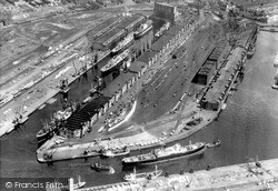
This photograph was taken several years before the opening of the container terminal on North No 9 Dock. Containerization traffic led Manchester Liners to restructure their fleet.
There is the Sugar Loaf Rock at Spanish Head, the caves at Port Soderick, and in the north east the Maughold Brooghs - a Manx Heritage site that stretches from Port e Vullen to Grob ny Strona.
Frampton, 'the settlement on the Frome', is an attractive downland village north-west of Dorchester. The old manor house of Frampton Court was demolished in 1939.
Places (9301)
Photos (2953)
Memories (1550)
Books (39)
Maps (9439)


