Places
36 places found.
Those places high-lighted have photos. All locations may have maps, books and memories.
- Cardiff, South Glamorgan
- Barry, South Glamorgan
- Penarth, South Glamorgan
- Rhoose, South Glamorgan
- St Athan, South Glamorgan
- Cowbridge, South Glamorgan
- South Molton, Devon
- Llantwit Major, South Glamorgan
- Chipping Sodbury, Avon
- South Chingford, Greater London
- South Shields, Tyne and Wear
- Ayr, Strathclyde
- St Donat's, South Glamorgan
- Llanblethian, South Glamorgan
- Thornbury, Avon
- Llandough, South Glamorgan
- Fonmon, South Glamorgan
- St Nicholas, South Glamorgan
- Jarrow, Tyne and Wear
- Penmark, South Glamorgan
- Font-y-gary, South Glamorgan
- Maybole, Strathclyde
- Yate, Avon
- Oxford, Oxfordshire
- Torquay, Devon
- Newquay, Cornwall
- Salisbury, Wiltshire
- Bournemouth, Dorset
- St Ives, Cornwall
- Falmouth, Cornwall
- Guildford, Surrey
- Bath, Avon
- Looe, Cornwall
- Reigate, Surrey
- Minehead, Somerset
- Bude, Cornwall
Photos
5,607 photos found. Showing results 1,141 to 1,160.
Maps
2,499 maps found.
Books
23 books found. Showing results 1,369 to 23.
Memories
1,580 memories found. Showing results 571 to 580.
Looking For Lost Friend
Hello everyone-- i am hoping someone out there can help me trace a very dear friend from Grangetown -- let me add my memory -- i live in South Wales but in the early 1960 i lived with my aunt in Eston but i became very ...Read more
A memory of Grangetown by
School Days
In the 1950s I lived in Broadhurst Gardens and every day walked with friends through this twitten to get to North Bank School in Smoke Lane. The lane was dark and overgrown on one side and on the other side backed onto the Crusader Insurance ...Read more
A memory of Reigate by
My First Job
I started work for J R Ashall Ltd. in April 2nd1956 Easter was early that year and it was snowing as I reported their offices.I waited outside in the snow I was wearing hand me downs that was all except my under ware, I had not top coat I ...Read more
A memory of Padgate by
I Have Memory Of This.
Opposite the shops was Galloway road. during the snowy winter months I used to sledge downhill away from Galloway road,. and once crashed into a pile of wood that was covered in snow,I winded myself. Just around the corner in ...Read more
A memory of Peterlee by
Italian Restaurant South Road
can anyone help with regards to a family discussion regarding an Italian restaurant Which I could have sworn was on the right hand side of the South road coming down from Lady Margaret road . I don't know Southall very ...Read more
A memory of Southall
Summer Of '63
Hello. Although I spent all of my early life - that is up to the age of 21 - in Penge, South London, I also spent some time(s) in Ash (Kent) during August to December, 1963. I have already written about my early life in ...Read more
A memory of Ash by
Childhood Memories
I was born and raised in Robertsbridge and Salehurst at the end of December 1950 and my dad was the village postman - Jack Baker. I went to Salehurst primary school in 1956 and the secondary school in 1962. I remember mum ...Read more
A memory of Robertsbridge by
Photos?
I lived in South Norwood from 1957 to 1973 and my grandparents lived in Anthony road Woodside. I'm sure the photographs You are showing of the war memorial and horse trough stand on Woodside Green not South Norwood. I know both are SE25. I ...Read more
A memory of South Norwood
Chesilton Crescent
When my father retired from the Army my parents bought a semi detached house in Chesilton Crescent, part of the Verne Estate. Built by Comblin and Waklin (They claimed they were the best builders in the South). It was ...Read more
A memory of Church Crookham
Edith Brough Childrens' Home
Hi my name is Elizabeth Young, or was then, as I am now married. I, along with my three older sisters, Muriel, Margaret and Anne went into the Edith Brough home on Whaggs Lane in 1953 and stayed there until we left secondary ...Read more
A memory of Whickham by
Captions
2,476 captions found. Showing results 1,369 to 1,392.
In this view, the photographer looks south-east back past the corner of High Street to St John's Street and St John's 15th-century west tower. To the left is St Mary's Church spire.
Ludford is a now a single-street village on the Louth to Gainsborough road at the head of the River Bain, which flows south through the Wolds to join the River Witham.
Billy Banks Wood, prominent in views from Castle Walk, is ancient 'hanging' woodland clinging to limestone rock on the south bank of the River Swale just west of Richmond Castle.
A chip on the south west corner is shrapnel damage from the blitz.
Among the church's interesting curiosities are a sundial on the south wall, a stout Norman tub font and a delicately carved 15th-century pulpit.
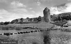
Ogmore lies two miles to the south-west of Bridgend.
Bramley Road to the south has an avenue of horse chestnut trees.
We are south-west of the village centre, and the photograph exudes a strange feeling of well- cared-for neglect.
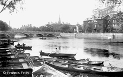
The south bank was a popular location for hiring rowing boats, and the Bedford Rowing Club, founded in 1886, have their boat and club house to the left of the photographer.
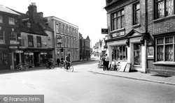
This view looks south down Dunstable Street from Market Place; the Moot Hall is on the right with its slender iron-glazed casements.
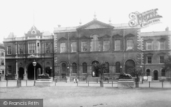
The south side of the square is dominated by the Georgian County Hall, whcihwas designed by Thomas Harris.
Angmering-on-Sea is one of those suburbs that blossomed along the south coast between the wars, partly as holiday homes, and partly as homes for London commuters.
This was one of the most important mining ports in the 19th century; the harbour was often packed with sailing vessels bringing coal from South Wales and returning with copper ores.
West Street is quieter than the High Street and this view looks south-west past the village hall with its somewhat ungainly porch 'perched' on the roof.
From peaceful Arlington our route passes Arlington Reservoir before heading south to cross the A27 to Drusilla's Park, one of Sussex's major tourist attractions.
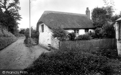
This thatched cottage with its little garden stood in Pondhu Road, in the valley bottom to the south west of the town centre.
It is famed for its Shrewsbury Chapel, which is located on the south side of the 15th-century chancel; among the monuments is one to the 6th Earl who was burdened for so many years with the task of looking
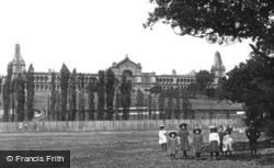
This was the second palace on the site: the first, built originally for the 1862 International Exhibition, burnt down just two years after being opened in 1873 as north London's rival to the south's Crystal
The last tour heads west from the Wiltshire border to Devonshire; we are never far from Dorset to the south. We start close to Stourhead, at King Alfred's Tower.
A Wesleyan church stood in South Street but was demolished in the late 1960s. John Wesley visited Dorking in January 1764 on one of many visits that he made to the town.
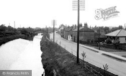
Further south is the Foss Dyke. In the middle distance is the site of the old swing bridge, now replaced by the present 1937 bridge on the A57 bypass upon which the photographer is standing.
A Panorama south-eastwards across Allington hamlet and West Allington street to the Rope Works, St Michael`s Works and Priors Mills (middle distance, left).
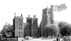
On the south bank of the Thames, opposite the Palace of Westminster is this handsome building, for centuries the official residence of the Archbishops of Canterbury.The entrance is through a Gothic
Five miles south-west of Bridgend, this crenellated mansion was built on the site of a former medieval fortress for Thomas Wyndham MP between 1802 and 1806.
Places (15471)
Photos (5607)
Memories (1580)
Books (23)
Maps (2499)


