Merry Christmas & Happy New Year!
Christmas Deliveries: If you placed an order on or before midday on Friday 19th December for Christmas delivery it was despatched before the Royal Mail or Parcel Force deadline and therefore should be received in time for Christmas. Orders placed after midday on Friday 19th December will be delivered in the New Year.
Please Note: Our offices and factory are now closed until Monday 5th January when we will be pleased to deal with any queries that have arisen during the holiday period.
During the holiday our Gift Cards may still be ordered for any last minute orders and will be sent automatically by email direct to your recipient - see here: Gift Cards
Places
36 places found.
Those places high-lighted have photos. All locations may have maps, books and memories.
- Cardiff, South Glamorgan
- Barry, South Glamorgan
- Penarth, South Glamorgan
- Rhoose, South Glamorgan
- St Athan, South Glamorgan
- Cowbridge, South Glamorgan
- South Molton, Devon
- Llantwit Major, South Glamorgan
- Chipping Sodbury, Avon
- South Chingford, Greater London
- South Shields, Tyne and Wear
- Ayr, Strathclyde
- St Donat's, South Glamorgan
- Llanblethian, South Glamorgan
- Thornbury, Avon
- Llandough, South Glamorgan
- Fonmon, South Glamorgan
- St Nicholas, South Glamorgan
- Jarrow, Tyne and Wear
- Penmark, South Glamorgan
- Font-y-gary, South Glamorgan
- Maybole, Strathclyde
- Yate, Avon
- Oxford, Oxfordshire
- Torquay, Devon
- Newquay, Cornwall
- Salisbury, Wiltshire
- Bournemouth, Dorset
- St Ives, Cornwall
- Falmouth, Cornwall
- Guildford, Surrey
- Bath, Avon
- Looe, Cornwall
- Reigate, Surrey
- Minehead, Somerset
- Bude, Cornwall
Photos
5,054 photos found. Showing results 881 to 900.
Maps
2,499 maps found.
Books
1 books found. Showing results 1,057 to 1.
Memories
1,580 memories found. Showing results 441 to 450.
Dukeshouse Wood Camp School Hexham (Part One)
My school was one of the first to go to Dukeshouse Wood Camp School just outside Hexham. This was in November 1945 shortly after the Second World War with the lads from Gateshead at Alexandra Road school. ...Read more
A memory of Hexham in 1945 by
The Taylors
My grandfather who I never knew was Albert George Taylor, born in Petham 1886. He was killed in France on Christmas Eve 1914. His father was Frederick and mother Elizabeth Taylor, he had brothers and sisters: Thomas, Frederick, Rosa, ...Read more
A memory of Petham in 1910 by
Burnt Oak In The Second World War And After
I moved to Burnt Oak in May 1940, to 84 Fortescue Road. I was 4. My memories are like a batch of video clips, as follows: Moving in. Removal men trying to get a wardrobe into the front bedroom by hauling ...Read more
A memory of Burnt Oak in 1940 by
Very Fond Memories
I was born in Ewell in 1945 and lived with my family at 156 Banstead Road South from 1950 to 1966. My first school was Miss Attrel's at the top of Station Road opposite the garage. I used to walk from home and back although a bit ...Read more
A memory of Belmont in 1951 by
Wilsons Bakery Griffith Wilson
My parents are Angela (nee Goulden) and Bryan Wilson (now sadly deceased), both from Bramhall. My paternal Grandfather owned the bakery in the village "Wilsons" which was taken over after my grandfather's retirement by ...Read more
A memory of Bramhall in 1955 by
Welwyn Garden City, Sweet Briar
This view is from the west side of Sweet Briar looking south down the hill towards Cole Green Lane (out of view). To the left is the entrance to Heronswood School (since closed, now a modern housing area). I ...Read more
A memory of Welwyn Garden City by
I Grew Up Here
My first recollection of living in the valley was at Duffrin where my sisters Pat and Pam Smith also lived, later we moved to the Gwynfi, and that is where I lived and was educated in the local infants school at the bottom of the ...Read more
A memory of Abergwynfi in 1953 by
Memories Of Colden Common
I have never heard of this person, although he makes reference to some people, and places in Colden Common I knew. So if anyone who knows him ever comes across this then I have been some help! COLDEN COMMON? Oh, yes - ...Read more
A memory of Colden Common by
Is This The Watch Tower
I wonder if anyone can tell me if the tall black object in the distance in this photo is the coastguard watch tower which was at the top of Sea Lane throught the war and into the sixties or seventies. My grandfather was an ...Read more
A memory of Saltfleet by
A Holiday In South Street, Seahouses March 2004
A friend let me stay in her wee fisherman's cottage in Seahouses for an early holiday in March 2004. My wife Elizabeth and I drove up from our home in Watford through the unseasonal snow and we were ...Read more
A memory of Seahouses in 2004 by
Captions
2,444 captions found. Showing results 1,057 to 1,080.
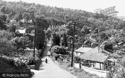
This Wiltshire village grew up on three roughly parallel terraces on the steep and well-wooded Avon valley side, with the parish church at the south end.
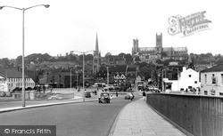
The area south-east of the city was marshy and virtually undeveloped until its draining after the Witham Act of 1812.
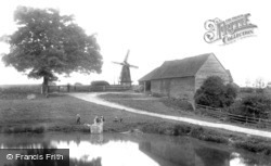
The windmill was built in 1802, and was one of a number in the south and eastern parts of the county.
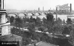
On the far side there is a packed industrial waterside where now the South Bank Centre and the Royal National Theatre stand.
Moseley, a mere two miles south of Birmingham, has now become a suburb of that great city.
The South Marine Lake opened in 1887, the North Lake in 1892.
This old town is at the heart of a region of fertile farming country known as the South Hams. This view looks down the main street towards the tidal estuary extending up from Salcombe.
This time he was facing south towards Boutport Street. There is a welter of shop signs - the Victorian and Edwardian shopkeepers were never slow to advertise their wares.
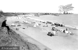
This view looks south from one of the two lookout towers on the beach.
It is quite a stocky, neo-Perpendicular building, with a west tower, nave and south aisle; the interior has single-framed roofs, and arched braces to the high collar beams in the chancel.
The mouths of the Rivers Bure, Yare and Waveney were joined through silting above Yarmouth and now flow south to the sea at Gorleston.
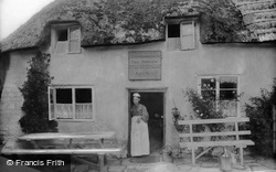
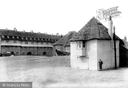
John Kiely`s Refreshment Rooms in South Street had a rustic look, accentuated by moss on the thatched roof and the windows open for air in a hot summer.
This was followed by the Liverpool-to-Crewe line, and then south to London's Euston.
Esthwaite Water, south of Hawkshead, is one of the quietest of the lakes, and is a Norse name meaning 'the lake by the eastern clearing'.
South of the river, Chelmsford becomes Moulsham.
Looking north from roughly the same viewpoint on the south bank of the Thames, the Perpendicular Gothic parish church with its tall spire, one of Gloucestershire's fine 'wool' churches, dominates the view
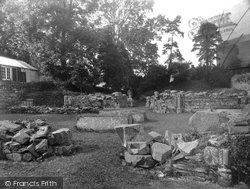
The priory was razed to the ground during the dissolution of the monasteries in 1539, and these ruins were discovered in 1886 during the construction of the London and South West Railway.
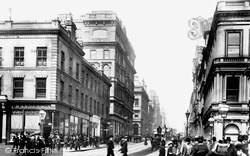
Renfield Street is now part of the south-bound one-way system.
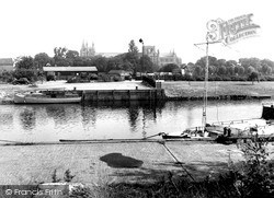
A few lorries of the period are parked on rough ground behind a hut; this makes a contrast with the full south-east outline of St Peter's Cathedral.
This view, looking south towards Aylesbury, shows some of the range of buildings, including the rendered and jettied Tudor House in the middle distance.
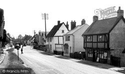
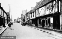
This view looks south towards London, along the narrow stretch of Ermine Street or the Old North Road, with its overhanging 17th-century houses and gables.
Its Victorian and Edwardian staff would have been very occupied in monitoring the substantial shipping traffic in the treacherous waters of Lyme Bay, where in severe south- westerly storms many
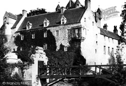
A few miles to the south of Nairn stands Cawdor Castle, one of Scotland's finest medieval buildings. It is famous for its association with Macbeth and the murder of Duncan.
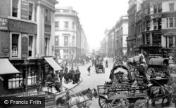
This photograph shows the Cannon Street end of King William Street, which heads south-east from the Mansion House towards London Bridge.
Places (15471)
Photos (5054)
Memories (1580)
Books (1)
Maps (2499)


