Places
36 places found.
Those places high-lighted have photos. All locations may have maps, books and memories.
- Shanklin, Isle of Wight
- Ventnor, Isle of Wight
- Ryde, Isle of Wight
- Cowes, Isle of Wight
- Sandown, Isle of Wight
- Port of Ness, Western Isles
- London, Greater London
- Cambridge, Cambridgeshire
- Dublin, Republic of Ireland
- Killarney, Republic of Ireland
- Douglas, Isle of Man
- Plymouth, Devon
- Newport, Isle of Wight
- Southwold, Suffolk
- Bristol, Avon
- Lowestoft, Suffolk
- Cromer, Norfolk
- Edinburgh, Lothian
- Maldon, Essex
- Clacton-On-Sea, Essex
- Norwich, Norfolk
- Felixstowe, Suffolk
- Hitchin, Hertfordshire
- Stevenage, Hertfordshire
- Colchester, Essex
- Nottingham, Nottinghamshire
- Bedford, Bedfordshire
- Bury St Edmunds, Suffolk
- Aldeburgh, Suffolk
- St Albans, Hertfordshire
- Hunstanton, Norfolk
- Chelmsford, Essex
- Bishop's Stortford, Hertfordshire
- Peterborough, Cambridgeshire
- Brentwood, Essex
- Glengarriff, Republic of Ireland
Photos
9,106 photos found. Showing results 13,821 to 9,106.
Maps
181,006 maps found.
Books
11 books found. Showing results 16,585 to 11.
Memories
29,052 memories found. Showing results 6,911 to 6,920.
Radlett Prep
I attended Radlett Prep between 1958 and 1965. It was located in a converted three floored Edwardian house on the corner of Hillside Avenue and Aldenham Grove, and has since been converted back to a private residence. Aldenham Grove was ...Read more
A memory of Radlett by
Help Needed With Info About My Stay At Langley House
Hi, I'm not sure if anyone can help me but I was taken to Langley School when I was about 8 years old (1965). I can't seem to find out much information about the school and just why I was ...Read more
A memory of Baildon in 1965 by
Mmmm...Rushmere
How well I remember Rushmere. I used to attend Kings College School around 300 metres away, and a group of us would frequently return home along South Side with a quick detour to the pond. It was best in winter because of the weather. ...Read more
A memory of Wimbledon in 1960 by
The Wire Trellis
I was something of a naughty boy back in those years: there were four of us young lads who were to bus it to Barnsley from Royston where we were barely old enough to go sampling Barnsley Bitter. If we were sixteen let alone eighteen ...Read more
A memory of Barnsley in 1965 by
A Child's Paradise
I stayed here when I was nine. I have fond memories of it, together with the hotel dog who fell in love with me - we would go for walks across the luscious green fields together. Across the road was the railway station where I ...Read more
A memory of Strathyre in 1955 by
Bootle Evacuee
I was evacuated to Llangunllo after the Liverpool Blitz in 1941 and stayed with Mr and Mr's George Lloyd in a house named "Larch Grove". I have very fond memories of those folk. I live in Canada now, since 1957.
A memory of Llangunllo in 1941 by
Wycliffe Road
I lived in 31 Wycliffe Road just down from where the chimney sweep kept his soot. A number of films were shot in the "courts" between the streets Beaufoy Road and Bassnett Road. I moved in 1965 aged 11 not long after the area was ...Read more
A memory of Battersea by
I Remember...
I remember Canterbury market, the pie and mash shop, with crates of eels on ice outside. I remember going on my own for mash and liquor, it was 3 pence and a real treat. There was also a chip shop there and as kids we used to go and ask ...Read more
A memory of Willesden in 1943 by
Why Did They Knock It Down
I remember the last days of the Ilfracombe Hotel. It was a beautiful building but after years of neglect and then under council ownership it fell into disrepair (plus a certain hotelier/councillor didn't like it as it ...Read more
A memory of Ilfracombe
Market Place, Boots The Chemist
Well this is of the corner of the Market Place and the High Street to the right or the A6. They moved Boots further down to the left, now a few buildings down.
A memory of Loughborough by
Your search returned a large number of results. Please try to refine your search further.
Captions
29,158 captions found. Showing results 16,585 to 16,608.
The previous estate manager had been his father James Fair, who had had the task of laying out the streets, making wider access roads and building cottages.
(The song 'Flowers of the Forest' is a lament mourning the many Scottish dead who fell at that battle).
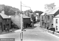
We are at the top of Main Street, looking back down through the village from the bus station.
One longstanding local commented: 'On a summer's evening, I can now hear the steam trains on the Watercress Line - you couldn't when the A31 was here.'
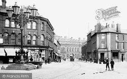
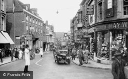
The shops behind the big lamp in the centre of the road are interesting.
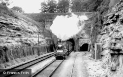
Isambard Kingdom Brunel built the famous Box Tunnel in 1841 as part of his ambitious Great Western Railway link between London's Paddington station and Bristol's Temple Meads.
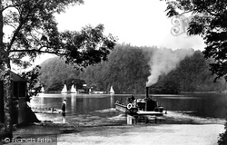
In this beautiful photograph we see the ferry boat setting out across the broad, placid waters of Lake Windermere with two horse-drawn carts on board.
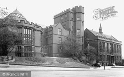
The university was an amalgamation of three earlier institutions, the Sheffield School of Medicine, the Firth College and the Technical School.
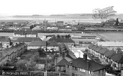
Since the 1820s Runcorn has been a centre for the chemical industry, with factories producing a wide range of products.
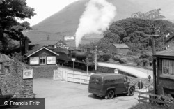
Carlisle and Sons' delivery van waits at the level crossing near Silecroft Station on the west coast route between Barrow and Workington, which opened to traffic in 1848.
This view, taken from Folly Bridge at the south end of St Aldate's Street, is of an earlier Eights Week with the Christchurch Meadow bank lined with the College Barges.
Half a mile from Lyndhurst and yet located within the parish lies the scattered hamlet of Emery Down, surrounded by peaceful forest glades and countryside.
Policemen directing traffic at the top of the High Street in this late 1920s photograph. The George Hotel, on the left, was demolished in the 1950s to facilitate a road-widening scheme.
The former Peninsula Barracks stand on the site of a medieval castle which was destroyed after the Civil War.
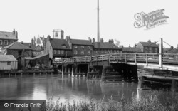
Under the right-hand section of the bridge, the swivelling mechanism can be seen. This opens the bridge to river traffic, now but a shadow of what it was.
Cheriton's original parish church is of considerable antiquity – it contains some stonework dating from the Norman conquest.
All is tranquil a couple of miles up-river of Barnstaple. The L&SW railway follows the river almost from the water- shed at Copplestone near Crediton, 30 miles away.
This small market town on the banks of the Sow was entitled to hold four annual fairs, mainly for the buying and selling of horses and cattle.
This view shows the foot of Mere Street, close by Diss Mere. On the left is West's Garage, offering Shell petrol and BP car batteries.
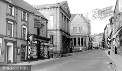
On the left, just down from the bank, is the Guildhall, which was built in 1839 on the site of the old market house.
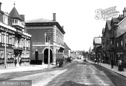
The handsome lines of the Old Town Hall dominate this view of London Street. The Old Town Hall was built in 1851 by George Briand, and has an arcaded ground floor open to the street.
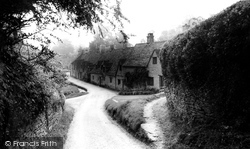
One of the most picturesque - and most photographed - groups of cottages in the Cotswolds, Arlington Row's first function was as a barn.
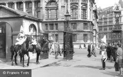
A little further north is Horse Guards, a fine building by William Kent of the 1750s and one of the earlier surviving government offices.
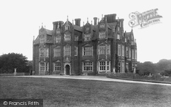
This view of the entrance front shows an excellent example of Jacobean work.
Places (6814)
Photos (9106)
Memories (29052)
Books (11)
Maps (181006)


