Merry Christmas & Happy New Year!
Christmas Deliveries: If you placed an order on or before midday on Friday 19th December for Christmas delivery it was despatched before the Royal Mail or Parcel Force deadline and therefore should be received in time for Christmas. Orders placed after midday on Friday 19th December will be delivered in the New Year.
Please Note: Our offices and factory are now closed until Monday 5th January when we will be pleased to deal with any queries that have arisen during the holiday period.
During the holiday our Gift Cards may still be ordered for any last minute orders and will be sent automatically by email direct to your recipient - see here: Gift Cards
Places
36 places found.
Those places high-lighted have photos. All locations may have maps, books and memories.
- Cardiff, South Glamorgan
- Barry, South Glamorgan
- Penarth, South Glamorgan
- Rhoose, South Glamorgan
- St Athan, South Glamorgan
- Cowbridge, South Glamorgan
- South Molton, Devon
- Llantwit Major, South Glamorgan
- Chipping Sodbury, Avon
- South Chingford, Greater London
- South Shields, Tyne and Wear
- Ayr, Strathclyde
- St Donat's, South Glamorgan
- Llanblethian, South Glamorgan
- Thornbury, Avon
- Llandough, South Glamorgan
- Fonmon, South Glamorgan
- St Nicholas, South Glamorgan
- Jarrow, Tyne and Wear
- Penmark, South Glamorgan
- Font-y-gary, South Glamorgan
- Maybole, Strathclyde
- Yate, Avon
- Oxford, Oxfordshire
- Torquay, Devon
- Newquay, Cornwall
- Salisbury, Wiltshire
- Bournemouth, Dorset
- St Ives, Cornwall
- Falmouth, Cornwall
- Guildford, Surrey
- Bath, Avon
- Looe, Cornwall
- Reigate, Surrey
- Minehead, Somerset
- Bude, Cornwall
Photos
5,054 photos found. Showing results 1,621 to 1,640.
Maps
2,499 maps found.
Books
1 books found. Showing results 1,945 to 1.
Memories
1,580 memories found. Showing results 811 to 820.
A Very Big Step
My wife and I went to Caio some 6 months after we married. I was recalled into the army 2 days after our wedding due to the Sues crisis although I was only away from home for 4 months it was long enough for me to loose my job and so ...Read more
A memory of Caio in 1957 by
Grove Farm, Paddockhurst Road
I used to live at Grove Farm Cottages, Paddockhurst Road, Turners Hill. My father was Noel Sargent and worked as a farm employee for Grove Farm which was either managed or owned by a Mr. Hocken. My father's name ...Read more
A memory of Turners Hill in 1959 by
South Chingford Parks And Lakes.
I was born in March 1939 and lived in South Chingford 1939-66. Frances Road 1940-47 and Underwood Road (Ropers Farm Estate) 1947-66. I loved Chingford and still do. I regularly visit Chingford and was there ...Read more
A memory of South Chingford in 1940 by
Mrs Cladd
Anyone remember Mrs Cladd who lived in a converted railway carriage - at least I think thats what it was - just up from Fairfax Hall, opposite the house called Farthings? She was an old lady who grew what we now call cherry tomatoes, but ...Read more
A memory of Menston in 1961 by
My Childhood
I was born in 1944 in my grandmother's house named 'Bloemfontein' at Higher Fraddon. She named the house after the capital of the Orange Free State of South Africa where she was born. Her father, my great-grandfather Parkyn, ...Read more
A memory of Higher Tolcarne in 1948 by
Good Old Days
I was stationed at RAF South Cerney from approx. early 1956 until late 1958. I was just a lowly SAC working in the pay accounting department, but everyone on base thought that a special job! When we could afford to go out on our ...Read more
A memory of South Cerney in 1957 by
Hessenford
I was so pleased to come across a site talking about 'my' family village of Hessenford. I was also evacauated to Hessenford with my mum and spent my 1st birthday there. This was the first of many August holidays with my Great Aunt ...Read more
A memory of Hessenford in 1944 by
My Godfather
My Godfather, Peter Jones's parents owned the Scotch Piper. I remember being told about the oak tree which actually grew up through the bar area. I went to primary school just along the way at Lydiate CE where I had the most fantastic ...Read more
A memory of Lydiate by
The Church
Lots of my relatives and friends are buried in the churchyard here. I was christened here by Rev Woodcock who had married my parents. I believe that he may have also christened me in 1955. I sang in the choir with Mr Foot as choirmaster ...Read more
A memory of Lydiate by
Springhead Terrace
I was born at number 11, and was told I did not open my eyes, so Mrs Tyreman baptized me. She had changed from Methodist to Catholic when she married her husband who was a tailor. When the priest came the next morning and blessed ...Read more
A memory of Loftus in 1930 by
Captions
2,444 captions found. Showing results 1,945 to 1,968.
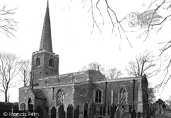
On the exposed Wolds, the ironstone church is situated on the south side of the village street, away from the main A606 Nottingham to Stamford road.
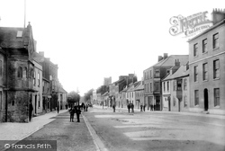
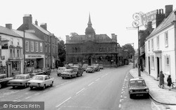
This looks Southwards along South Street to St Mary`s parish church (centre).
Moving east we reach Coleshill, a mile south of Amersham.
This was constructed in the early 19th century by Walter May so that he could enjoy a prospect of the sea, however the South Downs prevented his dream from being realised.
It is sheltered from the north wind by hills rising to the sombre Welsh mountains south of Cadair Idris. Today it is popular for watersports, but formerly it was an important sea port.
In contrast to the bustle of East Street, the southern length of South Street was very much a secondary shopping area. There are fewer people and fewer cars.
Now around to the south-west side of Glastonbury, where Wearyall Hill lies between the town and the river Brue. The name is a corruption of 'Wirral Hill', a deer-park established by the Abbots.
Adjacent to the thatched house is an excellent early 19th-century three-storey red brick residence which overlooks The Green on its south side.
Up until the Second World War, this work was undertaken by entire families who came from South London and the East End to stay on the farms and supplement their income with this casual labour
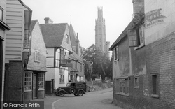
A little further south, the photographer looks past The Old Cottage, on the west or left side of the High Street, towards the rendered and jettied mid 16th-century Tudor House with the carved bargeboards
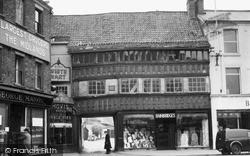
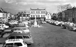
In the south-east corner of the Market Square is its only surviving timber-framed building, Ye Olde White Hart, a superb and rich example of late 15th-century building.
In the south-east corner of the Market Square is its only surviving timber-framed building, Ye Olde White Hart, a superb and rich example of late 15th-century building.
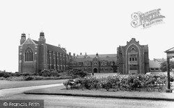
South of the town, beyond the modern A57 by-pass, accessed via a long avenue from the Netherton Road, is Worksop College.
On the level ground to the south-west of the town stands the almost ploughed-out remains of an ancient double-ditched camp called The Aubreys.
This view was taken looking south to the Bear Hotel at the top end of the car park. The new Bear Hotel was built some time after 1750 by John Provis, a painter, and leased out.
The great Victorian architect William Butterfield (1814-1900) rebuilt the south porch in 1851, and minor works were carried out here by the equally eminent John Loughborough Pearson (1817-97
The round-arched doorway to be seen on the left was re-erected here in the 1560s; it was salvaged from the demolished church of St Peter Dunstable on Cauldwell Street south of the river.
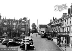
At the top of the High Street, the photographer looks south. The Lime Street/Lurke Street junction is beyond the Swan Hotel's handcart.
Lechlade, situated on the river Thames, is the gateway to the Cotswolds from the south-east.
This village stands on the south-west edge of the Isle of Ely. In the 17th century the fens around Sutton were drained by farmers with the help of wind pumps.
Further south, Watling Street widens to form a market place complete with town hall and a corn exchange.
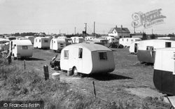
South Road is to the left, and the sea is only one field away to the right. The White House is now the White House pub and Restaurant.
The photographer has turned his camera a little to the south and included an additional couple of interesting cars - a Rover 90 and behind it a rare and expensive Bristol saloon.
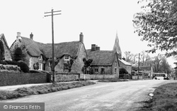
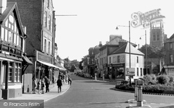
Here we look south along Godstone Road, with the church tower on the right.
Places (15471)
Photos (5054)
Memories (1580)
Books (1)
Maps (2499)


