Places
36 places found.
Those places high-lighted have photos. All locations may have maps, books and memories.
- Cardiff, South Glamorgan
- Barry, South Glamorgan
- Penarth, South Glamorgan
- Rhoose, South Glamorgan
- St Athan, South Glamorgan
- Cowbridge, South Glamorgan
- South Molton, Devon
- Llantwit Major, South Glamorgan
- Chipping Sodbury, Avon
- South Chingford, Greater London
- South Shields, Tyne and Wear
- Ayr, Strathclyde
- St Donat's, South Glamorgan
- Llanblethian, South Glamorgan
- Thornbury, Avon
- Llandough, South Glamorgan
- Fonmon, South Glamorgan
- St Nicholas, South Glamorgan
- Jarrow, Tyne and Wear
- Penmark, South Glamorgan
- Font-y-gary, South Glamorgan
- Maybole, Strathclyde
- Yate, Avon
- Oxford, Oxfordshire
- Torquay, Devon
- Newquay, Cornwall
- Salisbury, Wiltshire
- Bournemouth, Dorset
- St Ives, Cornwall
- Falmouth, Cornwall
- Guildford, Surrey
- Bath, Avon
- Looe, Cornwall
- Reigate, Surrey
- Minehead, Somerset
- Bude, Cornwall
Photos
5,607 photos found. Showing results 541 to 560.
Maps
2,499 maps found.
Books
23 books found. Showing results 649 to 23.
Memories
1,580 memories found. Showing results 271 to 280.
Wood End
I lived in Wood End Lane until rather late in life really. Moved out of the family home when I was 29 and moved to Ruislip. I went to Wood End Nursery, infants and Junior Boys school, then moved to Horsenden Secondary Boys School. Both ...Read more
A memory of Northolt by
Mitcham County Grammar School For Boys
Mitcham County Grammar School for Boys Remembered Memory is a selective thing, the best is easy, but the mind glosses over the worst. Some things recollected as certainties turn out to be not quite so. These are ...Read more
A memory of Mitcham by
Wartime Memories Of Wincanton
I arrived in Wincanton as an Evacuee in 1940/41 and lived for a while with my Uncle Frank and his family. My uncle at that time owned Bayford Garage. I was only about 6 yrs of age and quite naturally missed my mother ...Read more
A memory of Wincanton by
Boac Hatton Cross Part 2
TBA (tech block a) was a very large building so much so that people often got lost. There were four hangars East West North and South. In each hangar there was a technicl control and documents office which was ...Read more
A memory of Heathrow Airport London
Pub In Victoria Road South
Does anybody remember the name of a pub that was in Victoria Road South? It was on the left hand side around 75 yards from Duke Street on the way to where the police station can now be found. It formed part of the island of ...Read more
A memory of Chelmsford by
Come For A Stroll Back In Time Through South Hackney
Hi Guys , I recently wrote on this site about the childhood memories I have of South Hackney, apparently it triggered quite a lot of interest on Facebook by people who connected with my memories, ...Read more
A memory of South Hackney by
It’s Been A Long Time Away
I remember South Harrow very well my mum and I would go there every Saturday to do the shopping and we would both carry it back walking to Reading Road. I used to go to Saturday morning pictures at the Cinema in South ...Read more
A memory of South Harrow by
Sainsbury In Tonbridge
I may well have a poor recollection here as I would have been only 3 or 4 years old at the time but wasn't Sainsbury's first Tonbridge store located on the west side of the high street just south of the old post office / just ...Read more
A memory of Tonbridge by
Memories Of Southall
Lived in West End Road from 1960 to 1969, my brother was born there in 1961. We both attended Beaconsfield Road Infant School. My teacher for the first 3 years was Mrs Blong, our headmistress was Mrs Goodall. Have many happy ...Read more
A memory of Southall by
My First Memories Of Saltfleet
My first visit to Saltfleet was as a 12 year old in 1956. A relative , Kitty Scherdel was managing the Sunnydale site for local farmer George Tuxworth and had recently moved a converted bus there from South Yorkshire and ...Read more
A memory of Saltfleet by
Captions
2,476 captions found. Showing results 649 to 672.
Kidwelly lies due south of Carmarthen. The borough is one of the oldest in the principality; it received its first Charter under Henry VIII.
On the right here is the south range, which includes the parlour and great chamber. On the left is the east range, which contains the hall, marked by the splendid bay window.
St Andrew's Church sits on an unspoilt headland to the south-west of Clevedon. Buried here is Arthur Hallam (1811-1833), the son of historian Henry Hallam (1777-1859).
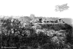
Taken from Billy Banks Wood south of the Swale, this distant view shows the defensive site of Richmond Castle, and the town clinging precariously - and picturesquely - to the hillside
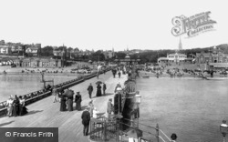
Less than a century after its foundation, the town was already dominating the skyline and its beaches were among the most crowded on the south coast.
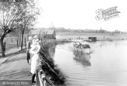
Earlswood Lakes are on Earlswood Common, south of Redhill, and really in the clay Weald. The ponds lie across the road from New Pond Farm, where today there is a nature reserve.
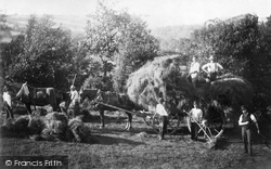
A superb haymaking scene which shows the manpower once required on the land at this hill-top farm, to the south west of Haslemere.
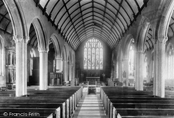
The church interior is large, with granite arcades for the north and south aisles. The benches date from 1894.
This fine estate is about one and a half miles south of the town, on the minor road to Newbliss and Cavan. Little now remains, but the park is very popular.
To the south of the town is remote heath and woodland.
Back in the Market Place, the photographer looks south down the High Street. Cook's on the corner is still a newsagent and stationer, Goodnews.
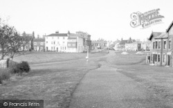
The green is fronted by North Terrace, East Terrace, South Terrace and West Terrace. Here we see North Terrace and East Terrace.
Branston is just two miles south of Burton, and at one time belonged to Burton Abbey. It was made a parish in its own right in 1870.
White Nancy is a tower situated on the ridge to the south of the town, and is said to have been built by a member of the Gaskell family to commemorate the Battle of Waterloo, and to be named after one
The lack of traffic in the main street is in sharp contrast with the scene today in this busy little village in the south-west Lakes.
Originally a village, Eastleigh expanded rapidly around Bishopstoke Junction after the London and South Western Railway Company's carriage works moved here in 1889-90, followed by the locomotive workshops
It is cruciform in plan and consists of a nave of five bays with transepts to the north and south.
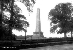
This 204ft (63m) high obelisk on the south side of the main road was designed by Robert Smirke and believed to be the highest in the world at the time.
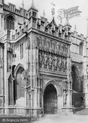
Here we see a closer view of the south porch, displaying carved figures of King Osric and Abbot Serlo on either side of the entrance.
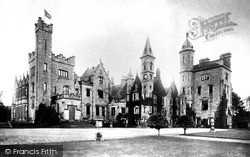
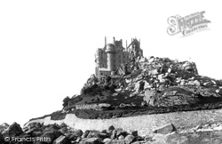
We see the fairytale house and chapel built on the site of a Benedictine priory, with the south-east wing added by Piers St Aubyn in 1875-78. Landscaped gardens are among the rocks below.
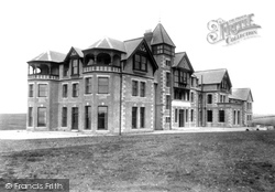
This very austere hotel is seen in the year it was opened, out on the cliff top just south of Poldhu Cove.
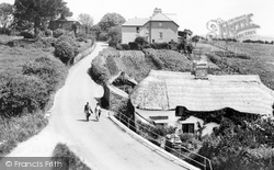
Two walkers enjoy the country lanes of the South Hams in the days before the highway was dominated by motor cars.
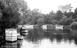
Naburn is situated four miles south of York. In 1757 a weir and a lock were built to accommodate the river traffic.
Originally a separate village, Lexden is now absorbed in Colchester's south-western expan- sion, but its identity is still clear with the church at its heart.
Places (15471)
Photos (5607)
Memories (1580)
Books (23)
Maps (2499)


