

Places
36 places found.
Those places high-lighted have photos. All locations may have maps, books and memories.
- Cardiff, South Glamorgan
- Barry, South Glamorgan
- Penarth, South Glamorgan
- Rhoose, South Glamorgan
- St Athan, South Glamorgan
- Cowbridge, South Glamorgan
- South Molton, Devon
- Llantwit Major, South Glamorgan
- Chipping Sodbury, Avon
- South Chingford, Greater London
- South Shields, Tyne and Wear
- Ayr, Strathclyde
- St Donat's, South Glamorgan
- Llanblethian, South Glamorgan
- Thornbury, Avon
- Llandough, South Glamorgan
- Fonmon, South Glamorgan
- St Nicholas, South Glamorgan
- Jarrow, Tyne and Wear
- Penmark, South Glamorgan
- Font-y-gary, South Glamorgan
- Maybole, Strathclyde
- Yate, Avon
- Oxford, Oxfordshire
- Torquay, Devon
- Newquay, Cornwall
- Salisbury, Wiltshire
- Bournemouth, Dorset
- St Ives, Cornwall
- Falmouth, Cornwall
- Guildford, Surrey
- Bath, Avon
- Looe, Cornwall
- Reigate, Surrey
- Minehead, Somerset
- Bude, Cornwall
Photos
5,607 photos found. Showing results 1,681 to 1,700.


Maps
2,499 maps found.


Books
23 books found. Showing results 2,017 to 23.
Memories
1,580 memories found. Showing results 841 to 850.
South Pelaw School
I lived in south pelaw from 1964 until I was married in 1984. We lived in Glencoe Avenue across the road from South Pelaw school which I attended. My first teacher was Mrs Hall and my headmistress was Mrs Young and when she ...Read more
A memory of South Pelaw by
Whittlebury 57 To 61
I have nothing but fond memories of my time at Whittlebury,okay if you were expecting to advance to Oxbridge,forget it but it did teach you to fight your'e own battles and make your own bed.I had a head start I suppose ...Read more
A memory of Whittlebury in 1957 by
Croydon Memories
I was actually born in KCH in the 1960's , but my parents lived in Grange Road, Upper Norwood - and that is where I spent my childhood. Went to All Saints School, Westwood and Lady Edridge Schools. Lessons with the boys from ...Read more
A memory of Addiscombe
Grandmas House
I grew up at my grannys house until age 5. I went to Wingate primary school for a while before we moved south. Her name was Anne Berry and my grandpa James died of cancer. I was born in 1957, and I had 2 little sisters, Pania and ...Read more
A memory of Wingate in 1960 by
Faircross
I was born in Barking Hospital in 1967 but my family moved into Upney House at Faircross in 1953 I believe, this may have been when these were first built. I have lots of memories of Faircross Parade, mostly of the different shops that came ...Read more
A memory of Barking in 1979 by
Kingsdown In The 1940's
The picture shown is North Street, where my grandmother & grandfather lived. I always knew the village to be up the hill where some of the shops were. At the end of the houses on the right was the Home ...Read more
A memory of Kingsdown in 1940 by
Childhood
My Mum, Dad and I moved to the new council houses in Boundaries Road (built on a bombsite) in 1957 when I was 1 year old, so obviously my first memories are of Balham. Dad went to work and Mum and I went shopping every day. These are some of ...Read more
A memory of Balham by
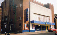
Gillingham Cinema
The Embassy in Green Street was formerly called the Odeon. Other cinemas in Gillingham at that time were the Plaza in Duncan Road (on the site of what is now Aldi's) and the Grand on the corner of Skinner Street and Jeffery ...Read more
A memory of Gillingham in 1950 by
Battersea In The 60's And 70's
Hello, My family originated from east London (mainly Dagenham), but our branch 'emigrated to Battersea in 1964. Our first address was 22 Morella Road, right opposite Wandsworth common. I went to Honeywell junior ...Read more
A memory of Battersea in 1970 by
Cherwell Grove/ Stifford Road
These houses are in Cherwell Grove, South Ockendon. The one on the right hand side of the semi with the white door and garage door was the doctor's surgery at some time during the 1960s.
A memory of Aveley in 1960
Captions
2,476 captions found. Showing results 2,017 to 2,040.

Its left-hand projecting wing has blinds to protect these rooms from the sun, as it faces south.

The headland at Porthdinllaen offered a natural anchorage, sheltered from the prevailing south-west winds. This was the only good harbour on the west coast of Lleyn.

Staplehurst grew as a result of being on the South Eastern Railway's route from London to Dover.

This was constructed in the early 19th century by Walter May so that he could enjoy a prospect of the sea; however, the South Downs prevented his dream from being realised.

The former offices of Eastern Gas have already undergone a dramatic change: Tower Point is now 11 floors of one- to four- bedroom flats in the main area and a fitness centre at the south end.

Here we see the south front of the grammar school; it is now Bedford School, and from the start took boarders as well as day boys.

The old Infirmary, designed by John Wing and opened in 1803, fronted Ampthill Road; it was later expanded to be the Bedford General Hospital (South Site).

Here we see the well-treed street looking more mature; the photographer is looking south back towards the town centre. It was truly a sylvan approach to Bedford Park.

We are looking from Market Square south-east into Walton Street. The Bell had been reworked in 1919, and is still much the same.

The ruined shell keep in the south-west corner of Pontefract Castle dates from the mid-13th century, when it was rebuilt in a polygonal form similar to those at Knaresborough, Southampton, Roxburgh and

Epsom is famous for two things: Epsom Salts, and the two great classic flat races run on the Downs south of the town, the Derby and the Oaks, both inaugurated in the late 18th century.

To the north is a pretty pond, and to the south of the main road is the excellent dark brown greensand sandstone parish church, rebuilt apart from the belfry timber posts in 1860.

Back in Surrey, the route reaches Haslemere; we look south-west along the High Street into the market place of this small town, with the 1814 Town Hall closing the vista.

To the right, the stone wall is the south boundary of the Grammar School (now Abingdon School) grounds, with Albert Park in the middle distance.

The front lawn sloped south-eastwards to the timber pier (centre right) built by James Walton in 1859. A large sailing ship is berthed alongside.

By the 1950s the south front of Gisborough Hall was covered in Boston ivy; it still is today, and looks stunning in the autumn.

Trade was brisk here, for sailors approaching from South Quay saw this hostelry before all others, and there were about 400 pubs to choose from in the town in the 19th century!

The photograph looks south-east along the culverted stream bordering Station Road, with housing of the 1920s and 30s on the extreme right.
 c.1955, Calne")
These Grade II* listed almshouses at Nos 10-13 Kingsbury Street stand opposite the south entrance to St Mary's. They were erected by Dr John Tounson, vicar of Bremhill, in 1682.

On the right of the photograph is the 15th-century God's House Tower, formerly the south-east gate of the old town and one of the earliest artillery fortifications in Europe.

East Cliff (centre left) rises to the south-east; the distinctive building is Pier Terrace, which is locally known as Noah's Ark (centre right).

From Newstead Abbey the route heads four miles south to Hucknall, which also has Byronic associations: in this church Byron was buried in the family vault after his body had been brought home from Greece

South-east of the town, along the valley of the River Ise and west of Barton Seagrave village, is The Wicksteed Park with the river dammed to form a large lake as the centrepiece.

We are just below the South Downs on the road between Midhurst and Chichester; this view looks across a footbridge over the stream that feeds into the Rother near Midhurst.
Places (15471)
Photos (5607)
Memories (1580)
Books (23)
Maps (2499)

