

Places
36 places found.
Those places high-lighted have photos. All locations may have maps, books and memories.
- Shanklin, Isle of Wight
- Ventnor, Isle of Wight
- Ryde, Isle of Wight
- Cowes, Isle of Wight
- Sandown, Isle of Wight
- Port of Ness, Western Isles
- London, Greater London
- Cambridge, Cambridgeshire
- Dublin, Republic of Ireland
- Killarney, Republic of Ireland
- Douglas, Isle of Man
- Plymouth, Devon
- Newport, Isle of Wight
- Southwold, Suffolk
- Bristol, Avon
- Lowestoft, Suffolk
- Cromer, Norfolk
- Edinburgh, Lothian
- Maldon, Essex
- Clacton-On-Sea, Essex
- Norwich, Norfolk
- Felixstowe, Suffolk
- Hitchin, Hertfordshire
- Stevenage, Hertfordshire
- Colchester, Essex
- Nottingham, Nottinghamshire
- Bedford, Bedfordshire
- Bury St Edmunds, Suffolk
- Aldeburgh, Suffolk
- St Albans, Hertfordshire
- Hunstanton, Norfolk
- Chelmsford, Essex
- Bishop's Stortford, Hertfordshire
- Peterborough, Cambridgeshire
- Brentwood, Essex
- Glengarriff, Republic of Ireland
Photos
9,106 photos found. Showing results 4,541 to 4,560.


 2010, Greenwich")

Maps
181,006 maps found.


Books
11 books found. Showing results 5,449 to 11.
Memories
29,054 memories found. Showing results 2,271 to 2,280.
Where I Was Born
My Beginning, at Sole Street near Cobham Kent. (9th March 1946 - 2nd January 1951) I was born on Saturday March 9th 1946 at 3.29pm at Temperley, The Street, Sole Street, Kent. I was delivered at home by the ...Read more
A memory of Sole Street in 1946
Heswall Shore
My nanny and gampi lived on Banks Road in the 1960s. Nanny (Tilly Wilson) used to shell the shrimps in her kitchen. We would pay them a visit on our way down to Heswall shore and the shrimps would be piled high in the middle of the cold ...Read more
A memory of Heswall in 1967 by
Going To Junior School In Radcliff On Trent In 1960
My dad was in the Canadian Air Force (RCAF) stationed in Langar (born in England though) but my family lived at 16 Douglas Close just outside Radcliffe. I remember walking daily to the ...Read more
A memory of Radcliffe on Trent in 1960 by
The Limes
My mother Ethel Mary Austin was born at "The Limes", which is next door to the church on 20 August 1919. Her parents were Charles & Lillian Austin. They moved to Australia. My mother died in 1979. I have been back ...Read more
A memory of King's Norton in 1910
Evacuated To Coedpoeth 1944
My older brother and two other boys were taken in by Mrs Jones in Roberts Terrace. I was seven and had my 8th birthday there. She was a wonderful lady and looked after the four of use. I remember going to find logs and ...Read more
A memory of Coedpoeth in 1944 by
The Orchid Ballroom Purley
Ah yes, I remember it well. It was magical to go there and dance the evening away. So many great bands in the 50's. The floor was great, the music super. I learned to dance at a place called Quinns dance school near ...Read more
A memory of Croydon in 1950 by
60 Years Ago
In 1950,1951 and 1952 I spent two months summer holidays/year at the Lodge. The house belonged then to Mrs Webster. Her daughter Annet had married Mr. (first name forgotten) Nickisson. Together they ran a riding school. I was ...Read more
A memory of South Warnborough in 1950 by
Ganaway Farm In Claverdon
My grandfather, William Harwood, leased the "Ganaway Farm" from a Lady Trevelyan in the early 1900's. It is my understanding that the Ganaway Farm was part of or very near the Claverdon Park Farm. I haven't been able to ...Read more
A memory of Claverdon in 1900 by
School Days
I remember moving from a one up one down back to back house in Hunslet at the age of approx 4 years to a brand new council house in Newhall Road, Belle Isle. I had a great time, my father borrowed a pony and trap, and we went back to ...Read more
A memory of Belle Isle by
Starting School
This is my first school, Dunston Hill Infant & Junior School, I started school the year the photo was taken, I fell off a small wall first day, I remember it vividly. Favourite teacher in the junior school was a Ms ...Read more
A memory of Dunston in 1955 by
Your search returned a large number of results. Please try to refine your search further.
Captions
29,158 captions found. Showing results 5,449 to 5,472.

The structure behind the drinking fountain is the Simeon Monument, 'erected and lighted for ever at the expense of Edward Simeon as a mark of affection to his native town' in 1804.

The coat of arms on the inn sign depicts its name: a talbot, or hound, was the crest of the Talbots, Earls of Shrewsbury.

LIKE THE INHABITANTS of many coastal towns where creeks and estuaries were formed, the people of Fareham used the sea to extract salt, which before the days of refrigeration was an essential ingredient

For many of us, photographs taken in the 1950s and 1960 remind us of our childhood days.

This more expansive view of the valley conveys a feeling of peace and beauty.
The covered walkway of The Pentice was created when the upper floor of its houses was extended in the 16th century. Until 1279 a Royal Mint of the Norman and Angevin kings stood on the site.

The landscape here is a fine example of the continuing denudation of the Cotswold Scarp; it is of great interest to geologists, as the outlying peaks and downs were once connected to the

It was from the top of the Goblin Tower that the keys to the castle and town were hurled at the feet of the Parliamentarian commander Major General Mytton upon the surrender of the Royalist garrison.

Not far away from the village are local quarries where a kind of gravel called Burley Rock was excavated in earlier times.

This view of the rear of the Town Hall is taken from Town Hall Gardens.

This panoramic view of Porthminster beach and St Ives was taken from near the local coastguard station. On the left of the picture pilchard boats can be seen drawn up at the top of the beach.

A source of water was essential for the use of the monks and the parishioners. The small River Eea (or Ay) is the largest stream in the area, and it runs through the centre of Cartmel.

Native to this country, beeches were planted for shelter, ornament and, of course, their timber.

By the mid 1800s Church Stretton had become a holiday resort for people keen on country walking, and many hotels were established to serve this market.

Broad Street was described by Nikolaus Pevsner as 'one of the most memorable streets in England'.

Here we have a view of the church steeple from the opposite end of the village. The church has a Tudor pulpit. The house on the right was once an inn called the Perserverance.

In late morning sunshine, the boys of the village head for the newsagents, possibly to collect their wages for the daily delivery run.

A large number of the buildings in this photograph are now Grade II listed, but the dishevelled look of the market stalls did little to foster civic pride in antiquity.

A newer Shanklin grew up along the seashore to cater for the demands of both visitors and those who came to settle.

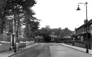
A very regular row of houses lines this quiet street. I wonder if all the residents were enjoying their first taste of commercial television?

Lover's Leap in Ashwood Dale, near Buxton, is one of several in the Peak which recall a long-forgotten romantic tragedy.

The construction of the Midland line through the dales of the Wye excited the wrath of the early conservationist John Ruskin, and the Monsal Dale viaduct was thought to have particularly offended him.

Running between the church and Nutfield Road, this narrow cobbled alley, with red tile-hung Tudor buildings approached by red brick steps, was once the High Street of the village.

The premises of Mellersh & Son, grocers, can be seen over on the left of this picture. Note the rather rough surface of the road at Church Crookham.
Places (6814)
Photos (9106)
Memories (29054)
Books (11)
Maps (181006)

