Places
36 places found.
Those places high-lighted have photos. All locations may have maps, books and memories.
- Shanklin, Isle of Wight
- Ventnor, Isle of Wight
- Ryde, Isle of Wight
- Cowes, Isle of Wight
- Sandown, Isle of Wight
- Port of Ness, Western Isles
- London, Greater London
- Cambridge, Cambridgeshire
- Dublin, Republic of Ireland
- Killarney, Republic of Ireland
- Douglas, Isle of Man
- Plymouth, Devon
- Newport, Isle of Wight
- Southwold, Suffolk
- Bristol, Avon
- Lowestoft, Suffolk
- Cromer, Norfolk
- Edinburgh, Lothian
- Maldon, Essex
- Clacton-On-Sea, Essex
- Felixstowe, Suffolk
- Norwich, Norfolk
- Hitchin, Hertfordshire
- Stevenage, Hertfordshire
- Colchester, Essex
- Nottingham, Nottinghamshire
- Bedford, Bedfordshire
- Bury St Edmunds, Suffolk
- Aldeburgh, Suffolk
- St Albans, Hertfordshire
- Hunstanton, Norfolk
- Chelmsford, Essex
- Bishop's Stortford, Hertfordshire
- Peterborough, Cambridgeshire
- Brentwood, Essex
- Glengarriff, Republic of Ireland
Photos
9,106 photos found. Showing results 8,341 to 8,360.
Maps
181,006 maps found.
Books
11 books found. Showing results 10,009 to 11.
Memories
29,060 memories found. Showing results 4,171 to 4,180.
Pink Cottage
my boyfriend Stephen parents lived at cottage in Quantocks hills just from Aisholt they had stream trickling down the side verge. it was so quiet and peaceful we adventured to the highest tops of the Quantocks such lovely views . you ...Read more
A memory of Aisholt by
Shortmead Street School
I was born in Biggleswade in 1947 and left for Suffolk in 1957. I remember going to the infants school and then shortmead street. We did maypole dancing and got hit over the knuckles regularly by horrible teachers! Pretty ...Read more
A memory of Biggleswade
Never Enough Of Polzeath
I was just about 6months when I first went to Polzeath and have been going most years ever since. It is a place that brings great personal strength out in me and so much fun, enjoyment plus energy. Many of the people i have met ...Read more
A memory of Polzeath by
Memories Of Leytonstone
I went to may ville rd school and then Connaught rd in the late 40s early 50s I was friends with violet ponsford she was from a large family I think from melford rd
A memory of Leytonstone
Winster Rd.,
We moved to Peel Green when I was 9 we lived in Winster Rd., it was a new house when we moved in it was one of the first to be finished, When we moved there the houses on the opposite side were just being started, I remember the shop at the ...Read more
A memory of Peel Green by
Winster Rd.
Yesterday I wrote in my memories of Peel Green but I missed out some of the shops, Mrs. Scott grocers, Meg the herbalist where we all met up and had saspirella, dandelion and burdock and hot vimto, she used to chase us out when we had ...Read more
A memory of Peel Green by
Haydock Ave., Islip Manor, St.Vincents....What Memories....
I lived 8,Haydock Ave,.next to old peoples home, opposite the back of the shops service road, including the Cabin.1955 to 1967. My parents Reg & Bea with my older brother Terry. I was born Perivale ...Read more
A memory of Northolt by
The Hotel Lions
Two Stone sculptured Lions were situated at the entrance steps of the Grand Pump Room Hotel before it was sadly demolished in 1958/59 during the so called "Rape of Bath". They were removed by Sparrows Crane Hire of Bath, Alf Sparrow and ...Read more
A memory of Bath by
Cowden Caravan Memories
We (Nelson family) spent our summer in the 50s in a caravan on a site within walking distance to the beach and water. I have fond memories of that beach and ocean including shrimping with our big nets we pushed along the edge of ...Read more
A memory of Cowden
The Hermits Cave
kate barnes was a perminae fixture at the bottom of grove lane in camberwell she was a fiery lady and if you upset her the air could be quite blue with her colourfull labguage she enjoyed her pint and she often sat by her newspaper ...Read more
A memory of Camberwell by
Your search returned a large number of results. Please try to refine your search further.
Captions
29,158 captions found. Showing results 10,009 to 10,032.
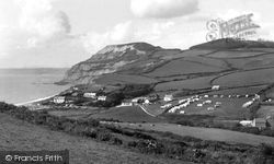
The view looks westwards from the foothills of Ridge Cliff to Seatown hamlet (centre left) and Mill House and Mill Lane (lower right), which was concrete-covered in the Second World War to enable the large-scale
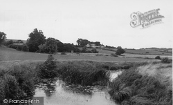
Two miles south-west of Michelham Priory, further downstream along the Cuckmere River, we reach Arlington, another scattered village of farmsteads bisected by the meandering river.
The medieval parish church, Ashtead Park house and its landscaped park, now part of the City of London Freemen's School, are south of this main through road, the A24 London to Worthing road.
Moving east towards Leith Hill, but still south of the woodland that covers the greensand hills, the tour reaches Forest Green, a hamlet scattered around an extensive green.
The Town of Kendal Kendal—the 'Auld Grey Town' on the River Kent— was founded on the wealth won from the wool of Lakeland sheep.
The town is considered the gateway to the moors and forests of the Northumberland National Park, and the Pennine Way also passes through the town.
From here, there was a lock-free run all the way to the edge of Wolverhampton - apart from the one at Wheaton Aston which we saw earlier.
This view shows the river at low water, again with evidence of boating. The Imperial Hotel (centre left) has just completed a major expansion programme.
Following the death of the owner, the site was acquired by the town and first opened to the public in 1960.
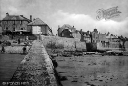
Cobb Gate Jetty is in the foreground, dating in its present state from 1850; it is on the site of Lyme's first early medieval harbour, which was washed away on 11 November 1377 with the
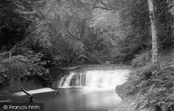
About ten miles north-east of Penrith, near Staffield, pathways have been cut along the banks of the Croglin Beck where it tumbles down through the sandstone gorge it has carved on its way
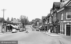
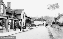
There has been change here, with development on both sides of the road, though the white building in the centre and the terrace of houses remain.
A little further upstream we come to the village of Otterton, built around one long main street.
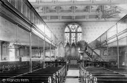
This view of the interior after its reconstruction in 1880 shows the delicate wrought iron work.
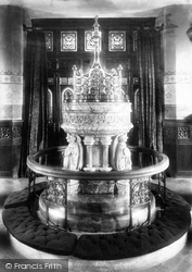
The font, reredos and chancel furnishings were mostly of marble, gaining for All Saints' the reputation of being 'the marble church'.
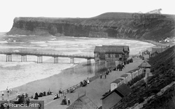
Note the row of bathing machines on the edge of the
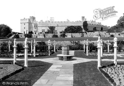
The south front of St Donat's overlooks the Bristol Channel, and a series of terraced gardens lead down to the shore.
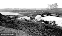
The 1405ft long concrete four-span Royal Tweed Bridge, designed by L G Mouchel & Partners, was built in 1925-28 to take traffic off the old stone bridge that still stands nearby.
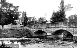
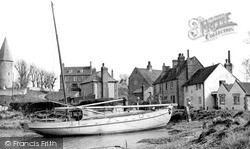
We are in the Ouse valley just north of Newhaven. St John's church is on high ground overlooking the tidal river. It has a Norman flint-built round tower, and a shingled octagonal spire.
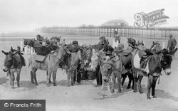
Donkeys are awaiting the arrival of the day's holidaymakers on the beach. A fisherwoman in a tall hat stands behind the donkey boys and their mounts.
Formerly a dirty, rutted lane, this was changed into a shopping centre from 1872 with the demolition of the Hick Lane cottages.
The Cathedral viewed from the south has been a favourite subject for artists - including, of course, Constable.
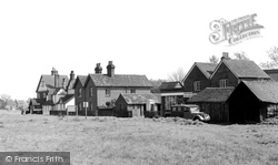
Behind the spot where the photographer must have stood is Windrush Valley School, founded in 1951, and the low building on the extreme right of the picture, next to the three-gabled house
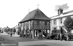
The Town Hall, standing in the middle of the High Street, was given by Lawrence Hyde, first Earl of Rochester, in 1700. Restored in 1889, it was presented to the town by Lady Meux in 1906.
Places (6814)
Photos (9106)
Memories (29060)
Books (11)
Maps (181006)


