Merry Christmas & Happy New Year!
Christmas Deliveries: If you placed an order on or before midday on Friday 19th December for Christmas delivery it was despatched before the Royal Mail or Parcel Force deadline and therefore should be received in time for Christmas. Orders placed after midday on Friday 19th December will be delivered in the New Year.
Please Note: Our offices and factory are now closed until Monday 5th January when we will be pleased to deal with any queries that have arisen during the holiday period.
During the holiday our Gift Cards may still be ordered for any last minute orders and will be sent automatically by email direct to your recipient - see here: Gift Cards
Places
36 places found.
Those places high-lighted have photos. All locations may have maps, books and memories.
- Cardiff, South Glamorgan
- Barry, South Glamorgan
- Penarth, South Glamorgan
- Rhoose, South Glamorgan
- St Athan, South Glamorgan
- Cowbridge, South Glamorgan
- South Molton, Devon
- Llantwit Major, South Glamorgan
- Chipping Sodbury, Avon
- South Chingford, Greater London
- South Shields, Tyne and Wear
- Ayr, Strathclyde
- St Donat's, South Glamorgan
- Llanblethian, South Glamorgan
- Thornbury, Avon
- Llandough, South Glamorgan
- Fonmon, South Glamorgan
- St Nicholas, South Glamorgan
- Jarrow, Tyne and Wear
- Penmark, South Glamorgan
- Font-y-gary, South Glamorgan
- Maybole, Strathclyde
- Yate, Avon
- Oxford, Oxfordshire
- Torquay, Devon
- Newquay, Cornwall
- Salisbury, Wiltshire
- Bournemouth, Dorset
- St Ives, Cornwall
- Falmouth, Cornwall
- Guildford, Surrey
- Bath, Avon
- Looe, Cornwall
- Reigate, Surrey
- Minehead, Somerset
- Bude, Cornwall
Photos
5,607 photos found. Showing results 1,841 to 1,860.


Maps
2,499 maps found.


Books
23 books found. Showing results 2,209 to 23.
Memories
1,580 memories found. Showing results 921 to 930.
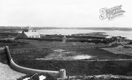
Tywyn Capel / Trearddur Bay
This is a view across Trearddur Bay, looking south - the beach is known in Welsh as Tywyn Capel. The house behind the beach is Glan-y-Môr built in 1889 and next to it is the Dune Mound which was the location of St.Ffraid’s ...Read more
A memory of Holyhead
Nostalgia
I have been reading many articles printed here & it got me & my wife thinking back to our childhood days (my wife was born in Llanelli, South Wales , & her childhood memories of the 1950's & were very much akin to mine ...Read more
A memory of Leytonstone by
When We Played In The Road
Gipsy Road in Welling where I lived as a child in the 1950's was a long one. It stretched from Okehampton Crescent near Bostall heath and woods at its north end, down to the Welling/Bexleyheath mainline railway and a short ...Read more
A memory of Wellings, The
Milk And Fish!
In the 1950s we spent several family holidays in the South Hams, staying at the Dairy in Stoke Fleming. We lived in south west London and travelled overnight on the A30 in my Dad's wet fish van, my brother and I sleepiing on a ...Read more
A memory of Stoke Fleming
School Journey
As a sickly child, I missed much of my early schooling and eventually attended schools for the physically handicapped. My senior school was the Venetian School for boys in Camberwell, south London. We went on School Journeys during my ...Read more
A memory of Rustington by
After The War In Burnt Oak
Being conceived at the end of the war I don't have memories of it of course, but my late brother, my mum and sister had lots. The only street party I remember was the Queen's one in Mostyn Road where we all got a cup with ...Read more
A memory of Burnt Oak in 1953 by
National Sea Training College At Gravesend
I spent the academic year 1987/88 in Kent training to become a Careers Adviser on a post-graduate course run by Kent College for the Careers Service. During my course I had to visit businesses, ...Read more
A memory of Gravesend in 1987 by
Memories Of Stockland, Bristol
My mother's father and mother Mr & Mrs Tom Dibble lived in the Cooperage, Stockland. Thomas's parents Thomas snr and Jane (nee) Palmer had children Sam, George from the Old Oak pub on the Cornhill, Mary + Mrs ...Read more
A memory of Woolavington in 1930 by
Watson House
What a delight to find this site and the photographs of Sutton Coldfield. I too have memories of a children's home but mine were of Watson House. From what I remember it was a big beautiful Tudor-built house, with the biggest in ...Read more
A memory of Sutton Coldfield in 1965 by
Childhood In Waterloo
Lived at 4 Walmer Road, Waterloo and 21 Cambridge Road Waterloo in the 1950's. Both houses were divided into flats. I have fond memories of the Beach, Potters Bar Park, the Five Lamps, South Road and St John's Road. Would ...Read more
A memory of Waterloo in 1952 by
Captions
2,476 captions found. Showing results 2,209 to 2,232.

This is another exceptional little town, set in its own south-facing timbered valley just east of the escarpment between Stroud and Gloucester. It is a place that makes grey look very good.

It sits at the south-western end of the lake, where the River Dysynni comes tumbling out in a series of little cascades. The lake has always been famous for trout fishing.

Until the 1930s the south side of the market, facing the camera, was bordered by a row of buildings which would be later demolished.

The first shop was in a house in South Street, and then new premises were found in Swan Street, to the left of the island site. As business grew, it moved in 1875 to this site in Bocking End.

From the George's entrance, on the right, she walked on a mile of local broadcloth to Coursehorn, a Tudor farmhouse owned by a wealthy weaver, which is south-east of the town.

We are looking south-west from the Memorial Park; John Street and St Anselm`s Church and school are behind Market Street. Three air raid shelters are in the field in front of the church.

The just-paddling brigade stayed south of the Stone Pier, which was still a busy working port. It would continue to be so until Heysham opened in around 1904.

Its style owes something to the Wentworth Estate to the south-west, where there are many houses in a similar style, but mostly better than this.

The first thing that greets travellers arriving from the south is the Percy Tenantry Column, known locally as the Farmers' Folly.

This final view from the castle keep looks due south across the bus station in Porter's Field.
This is another exceptional little town, set in its own south-facing timbered valley just east of the escarpment between Stroud and Gloucester. It is a place that makes grey look very good.

Today there are numerous road, rail and foot bridges crossing both the river and the Ship Canal further south.
The East Lancashire Regiment, together with the South Lancashire Regiment and the Loyal Regiment (North Lancashire), is the forebear of the Queen's Lancashire Regiment.

After the Great Exhibition of 1851, the Crystal Palace was moved to Sydenham in south-east London, where it was filled with lavish displays.

It overlooks the River Ouzel to the north, but there are housing estates to its south.

This view looks south, away from the church.

This view looks along Foregate Street; the bridge carrying the Great Western Railway lines to Hereford and South Wales can be seen in the background.

This was built around 1905 on the site of the London and South West Bank, which in turn had replaced a Tudor farm house.

functional machine for healing people, quite new when the photograph was taken, contrasts dramatically in its simple, almost domestic design with its very close neighbour, the Colney Hatch Asylum to its south-east

The short battlemented tower adorns an attractive group of 18th- and 19th-century houses at the south-eastern end of the village.

The houses on the north side, on the right of the photograph, are of 1881; with their ornate cast iron railings they are a little grander than those on the south side, which are slightly later

Another of the surrounding parishes into which Bridport borough expanded, Bothenhampton lies to the south-east, with a deep-cut village street which has left a dense cluster of terraces standing

The main village was moved west and south of the Tilling Bourne and out of the park in the early 19th century, but the best buildings date from the 1850s.

Frith's photographer has chosen the best bit of Bagshot to photograph: he is looking south-west along the High Street from its junction with Bridge Road towards the Square.
Places (15471)
Photos (5607)
Memories (1580)
Books (23)
Maps (2499)

