Places
36 places found.
Those places high-lighted have photos. All locations may have maps, books and memories.
- Shanklin, Isle of Wight
- Ventnor, Isle of Wight
- Ryde, Isle of Wight
- Cowes, Isle of Wight
- Sandown, Isle of Wight
- Port of Ness, Western Isles
- London, Greater London
- Cambridge, Cambridgeshire
- Dublin, Republic of Ireland
- Killarney, Republic of Ireland
- Douglas, Isle of Man
- Plymouth, Devon
- Newport, Isle of Wight
- Southwold, Suffolk
- Bristol, Avon
- Lowestoft, Suffolk
- Cromer, Norfolk
- Edinburgh, Lothian
- Maldon, Essex
- Clacton-On-Sea, Essex
- Norwich, Norfolk
- Felixstowe, Suffolk
- Hitchin, Hertfordshire
- Stevenage, Hertfordshire
- Colchester, Essex
- Nottingham, Nottinghamshire
- Bedford, Bedfordshire
- Bury St Edmunds, Suffolk
- Aldeburgh, Suffolk
- St Albans, Hertfordshire
- Hunstanton, Norfolk
- Chelmsford, Essex
- Bishop's Stortford, Hertfordshire
- Peterborough, Cambridgeshire
- Brentwood, Essex
- Glengarriff, Republic of Ireland
Photos
9,106 photos found. Showing results 4,741 to 4,760.
Maps
181,006 maps found.
Books
11 books found. Showing results 5,689 to 11.
Memories
29,054 memories found. Showing results 2,371 to 2,380.
Notes From The Frith Files.
This photograph shows residents waiting for the No.144 Midland Red bus from Malvern to Worcester outside the village shops. Far left is EW Bird's butchers, left is Cromptons newsagents, off picture further left is Procters ...Read more
A memory of Powick
Hundredth Anniversary Of Wordsworth's Death
I was born in Bridge Street and went to Fairfield School, or "Fairfield Junior Mixed" as it was called when it became Co-Ed in about 1948. I remember the whole class having to walk up to Harris Park and ...Read more
A memory of Cockermouth in 1950 by
My Memories Of Living In Westbury Leigh 1940 1944
The house shown in the foreground of this photograph was the home of my Uncle, Percy Drury. This was sometime around 1940/42, I do not know how long he resided there. I lived at 115 Westbury Leigh ...Read more
A memory of Westbury Leigh in 1940 by
View Down Onto Umberleigh Bridge, Showing Village Square
It is with great interest we see your picture of the village square, showing what is now the Post Office and largest post code sorting office in England. It also shows the Regency Gables Tea ...Read more
A memory of Umberleigh by
Moving Of The War Memorial
Note in this photo that the war memorial has been moved back and the wall lowered. Flats have been built on the Banstead house site. You could always see the green houses over the high wall from the top of the 164a bus. The ...Read more
A memory of Banstead in 1956 by
Born In 1941 Redhill A Wonderful Place To Have Grown Up
I was born and raised in Redhill. It was a wonderful childhood and many great memories. I was born in 1941 at Thornton House. We lived on Ladbroke Road, and remember the fish and chip shop, Mrs ...Read more
A memory of Redhill in 1950 by
The Cadena Cafe
This shot of the High Street presents the signage for the Cadena Cafe, a chain of national cafes (in the 'Lyon's' mould) where shoppers met for coffee and light meals. I have fond memories of visiting the cafe with family and friends, ...Read more
A memory of Worcester by
Building Relocated
Around the 1920s this building was known as Perry's Place and was located diagonally opposite the Black Jug, known then as the Hurst Arms. It was dismantled and moved to nearby Mannings Heath. It now forms the clubhouse and is called ...Read more
A memory of Horsham in 1920 by
Your search returned a large number of results. Please try to refine your search further.
Captions
29,158 captions found. Showing results 5,689 to 5,712.
KIPPAX was a small estate village servicing Kippax Hall and Kippax Park for three centuries before developing rapidly in the mid 19th cen- tury with the discovery of coal reserves.
Unlike King's Lynn, which remained predominantly a port, Great Yarmouth was able to embrace the functions of both port and holiday destination, with its harbour channel to the west and its holiday
Heading north-west roughly parallel to the River Witham, we reach two small towns on either side of the River Bain, which meets the Witham a mile away at Dogdyke.
One of its most famous pupils was the radical writer and activist Tom Paine, author of 'The Rights of Man' (1790-92). There is a statue of him in the town.
The pretty village of Shackleford, west of Godalming, has a mixture of houses in different styles, as evidenced here by the creeper-clad building on the right, the tall-chimneyed cottages with their neatly
Many estates of what we now call social housing sprang up around Britain following the war.
The ancient name for the village is Barelegh (meaning 'wasteland'), but lush meadows now support flocks of sheep.
The abbey was founded in AD670 as a nunnery by Sexburga, widow of Ercombert, King of Kent; the original building was burnt by the Danes.
In this very settled community, very little has happened during the past forty years to change the appearance of either the building or its surroundings.
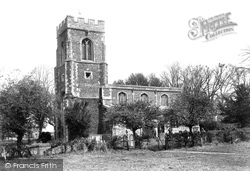
The manor of Offord Cluny was held by the monks of Cluny from 1086. The parish church of All Saints is built of brown cobbles with Barnack limestone, repaired in brick.
Clanfield sits in a valley to the west of the A3, 12 miles north of Portsmouth, and 6 miles south of Petersfield. Its name derives from Old English, and means 'field clean of weeds'.
Even the wooden gate (centre) is newer, but of the same functional design.
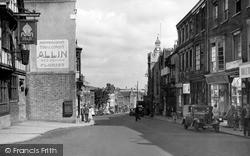
The contraption on the brick wall of Allin's Newsagents beside the pub is a vending machine.
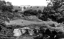
The years between 1904 and 1914 were boom years for the game of golf - a large number of both private clubs and municipal greens were opened at this time.
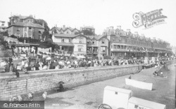
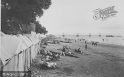
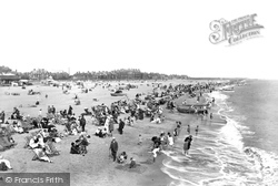
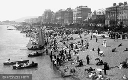
Behind the crammed Edwardian beach, with boats launched into the millpond of a sea, most of the buildings of Grand Parade survive today, the notable exception being the small gabled house, now replaced
The widening of the A5 (Watling Street) removed a number of buildings of late mediaeval and later dates, particularly as it passed through Edgware.
The last of the male line of the Stradling family died in 1738, not of old age in his bed, but killed in a duel at Montpellier whilst on the Grand Tour.
West of the church and across a stream is The Bury, the manor house until 1741. At one time council offices, it is now divided into houses and its grounds are a public open space.
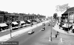
A swish, up-to-the-minute dual carriageway was created to relieve the pressure of excessive traffic in 1931 by widen- ing and extending a street which, until that time, ran only between Humberstone Gate
Honiton's lace production was at its peak during and in the years after the reign of Elizabeth I. It seems to have declined after a series of devastating town fires in the 18th century.
THE CHURCH of St Mary the Virgin is a Grade I listed building of cruciform plan. Much of it is in Perpendicular style (although Norman features remain), and there are later additions.
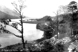
We are looking south from Lower Gatesgarth.The pines of Crag Wood are prominent in the centre of the photograph, while the slopes of Dodd sweep up the lake shore beyond.
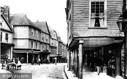
The ancient town of Totnes was once second only to Exeter as a prosperous merchants' town, but declined in importance in the 19th century. This view shows a lower view of the High Street.
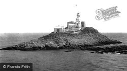
This picture of the famous lighthouse on Middle Head was taken from Bracelet Bay.
Places (6814)
Photos (9106)
Memories (29054)
Books (11)
Maps (181006)


