Places
36 places found.
Those places high-lighted have photos. All locations may have maps, books and memories.
- Shanklin, Isle of Wight
- Ventnor, Isle of Wight
- Ryde, Isle of Wight
- Cowes, Isle of Wight
- Sandown, Isle of Wight
- Port of Ness, Western Isles
- London, Greater London
- Cambridge, Cambridgeshire
- Dublin, Republic of Ireland
- Killarney, Republic of Ireland
- Douglas, Isle of Man
- Plymouth, Devon
- Newport, Isle of Wight
- Southwold, Suffolk
- Bristol, Avon
- Lowestoft, Suffolk
- Cromer, Norfolk
- Edinburgh, Lothian
- Maldon, Essex
- Clacton-On-Sea, Essex
- Norwich, Norfolk
- Felixstowe, Suffolk
- Hitchin, Hertfordshire
- Stevenage, Hertfordshire
- Colchester, Essex
- Nottingham, Nottinghamshire
- Bedford, Bedfordshire
- Bury St Edmunds, Suffolk
- Aldeburgh, Suffolk
- St Albans, Hertfordshire
- Hunstanton, Norfolk
- Chelmsford, Essex
- Bishop's Stortford, Hertfordshire
- Peterborough, Cambridgeshire
- Brentwood, Essex
- Glengarriff, Republic of Ireland
Photos
9,106 photos found. Showing results 12,721 to 9,106.
Maps
181,006 maps found.
Books
11 books found. Showing results 15,265 to 11.
Memories
29,054 memories found. Showing results 6,361 to 6,370.
Working For The Ministry
I started working for the ministry (ancient monuments) in 1969 at South Wingfield Manor. At the time it was owned by two brothers, Sam and Bill Critchlow, who ran a dairy farm situated at the side of the manor, in ...Read more
A memory of South Wingfield in 1969 by
Looking For Memories Of Watchester Farm In Minster
Does anyone out there have any memories of Watchester Farm in Minster (Isle of Thanet) that they might share with me please? I am a keen amateur genealogist and have found a mention of ...Read more
A memory of Minster by
My House My Home
This is Southcombe Terrace, Axmouth. 6-13 Southcombe Terrace was designed by the architect Frederick Kett and built by Bert Warren around 1937/8 for the Stedcombe Estate. My parents, Rock and Olive Real, then in their mid ...Read more
A memory of Axmouth in 1955 by
Childhood In Glanwydden North Wales
Is there anybody out there who lived at or visited the village of Glanwydden, or was a pupil of the local county council school during the period 1937 to 1945?, I attended the local school between 1937 and 1945 ...Read more
A memory of Glanwydden in 1940 by
Lovegreen Street
My maternal grandmother lived in Lovegreen Street from around 1900 until 1957 when she moved in with my family in Framwellgate Moor. Her name was Parkinson and I believe her house was the first one as you turned the corner into the ...Read more
A memory of Durham in 1950 by
Sisters Of Charity Of Our Lady Of Mercy
The above order of psychological sadists ran St Clare's orphanage where small children suffered dreadfully (see BBC Wales website 2009). The order also owned a private boarding and day school on West Hill in ...Read more
A memory of Pantasaph by
The Flood
Teresa Clarke's memory reminded me of the flooding of Jan. 1953. I was 9 years old and living in Gwynne Road with my folks. We were boarding at No 44, owned by Mr and Mrs. Carr. They played Crib and he polished the brass in the house ...Read more
A memory of Dovercourt in 1953 by
An Apple A Day
Mr and Mrs Smith lived in the first small house on the left as you go up the hill. When I was about 4 years of age I used to toddle over from Kenwyn which was on the other side of the road to visit them. There was an unusual ...Read more
A memory of Mawgan Porth in 1950 by
Trying To Find Family
I am trying to trace anyone who has knowledge of Harold Bulter or his family who lived in Morley around 1957. I believe he could have lived on Albert Terrace although I cannot find this street when I visited recently. I can ...Read more
A memory of Morley in 1957 by
Pill Bicycle Shop
My maternal grandfather, Allan Henry Ball, had a bicycle shop in Pill prior to the Second World War. My mother had a photo of herself as a child outside the shop (in the 1920s). I believe that both my grandfather and his wife were born ...Read more
A memory of Pill in 1940 by
Your search returned a large number of results. Please try to refine your search further.
Captions
29,158 captions found. Showing results 15,265 to 15,288.
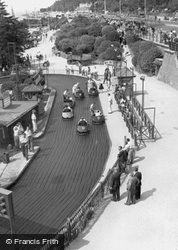
Here we see part of the amusement park again. It was known for many years as Peter Pan's Playground and lies to the west of the pier, close to the place where the previous photographs were taken.
This medieval port stands at the head of the Camel estuary. Sailing ships from Bristol once plied up and down its channel and berthed at the town wharves.
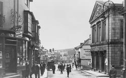
In 1910 the Mayor announced from the Guildhall steps that as a mark of respect for the late King Edward VII the Furry Dance was to be postponed.
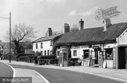
Most rationing had ended by now, but you still needed sweet coupons to spend your sixpence or shilling pocket money at this thatched Post Office and general stores.
In the early 19th century the town had a population of around 1,100. The poor were reasonably well cared for.
The importance of Salisbury to the military establishment after the war can be seen in this picture of Fish Row, just behind the Guildhall.
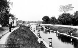
A carefully-posed study of the old lock at Chertsey, looking west, showing the lock gates partially open. This lock was replaced by the present one in 1913.
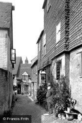
An enchanting corner of old Dorking: the photographer has captured a moment with two people standing in their respective doorways, and a cat sitting on the left looking at the bearded man.
The humbler quarter of town is on the east side of the bridge over the Fowey, where the old road climbs out towards Liskeard.
This view, similar to number 16049, is interesting, because it shows the square block of the new cable station on the right.
The Strand is the site of Topsham's famous 'Dutch Houses'. They were built between 1680 and 1730 from Dutch brick, which was brought over as ballast in ships which docked to load Exeter cloth.
The sign in the background reads 'This House For Sale' - a restrained version of the estate agent's notices of today.
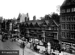
The magnificent frontage of half-timbered work is the finest in London. Here the plaster rendering shown in the previous photograph has been stripped off revealing a wealth of timbers.
St Pauls Church of 1837, by William Railton, dominates the village with its intricate pattern of roofs.
In the mid 19th century, as Birmingham expanded rapidly, wealthy businessmen were moving out of the city to prime suburbs such as Edgbaston, Harborne and Moseley, where some large, imposing
The cheese of the same name was possibly first made in the market during the 13th or 14th centuries, but the market was closed in the early 1900s (not long after this photograph was taken
A violent storm broke over Exmoor, and torrents of water hurtled through the streets of the town carrying all before them. More than thirty people lost their lives and the town was devastated.
Steamers like this were a feature of many harbours in Victorian times, offering the first pleasure service to eager holidaymakers.
The outer pier, which provides access to Ilfracombe at any state of the tide, was not yet constructed. In this view, a pleasure steamer is berthed at the quay.
Half a mile from Lyndhurst and yet located within the parish lies the scattered hamlet of Emery Down, surround- ed by peaceful forest glades and countryside.
At East Runton you could walk out along broad stretches of beach and enjoy digging for fossils in the soft cliffs, a pastime made popular by the Victorians.
The smart uniformed soldier stands silent guard outside this building, built in 1878 on the corner of Fishergate and Melbourne Street.
The imposing front of the Western Infirmary. Between 1861 and 1881 the city experienced four major cholera epidemics.
From the beginning, Henley's prosperity depended on communications. Timber, stone, corn and malt were transported from here to London by river.
Places (6814)
Photos (9106)
Memories (29054)
Books (11)
Maps (181006)


