Places
36 places found.
Those places high-lighted have photos. All locations may have maps, books and memories.
- Shanklin, Isle of Wight
- Ventnor, Isle of Wight
- Ryde, Isle of Wight
- Cowes, Isle of Wight
- Sandown, Isle of Wight
- Port of Ness, Western Isles
- London, Greater London
- Cambridge, Cambridgeshire
- Dublin, Republic of Ireland
- Killarney, Republic of Ireland
- Douglas, Isle of Man
- Plymouth, Devon
- Newport, Isle of Wight
- Southwold, Suffolk
- Bristol, Avon
- Lowestoft, Suffolk
- Cromer, Norfolk
- Edinburgh, Lothian
- Maldon, Essex
- Clacton-On-Sea, Essex
- Norwich, Norfolk
- Felixstowe, Suffolk
- Hitchin, Hertfordshire
- Stevenage, Hertfordshire
- Colchester, Essex
- Nottingham, Nottinghamshire
- Bedford, Bedfordshire
- Bury St Edmunds, Suffolk
- Aldeburgh, Suffolk
- St Albans, Hertfordshire
- Hunstanton, Norfolk
- Chelmsford, Essex
- Bishop's Stortford, Hertfordshire
- Peterborough, Cambridgeshire
- Brentwood, Essex
- Glengarriff, Republic of Ireland
Photos
11,144 photos found. Showing results 15,781 to 11,144.
Maps
181,031 maps found.
Books
442 books found. Showing results 18,937 to 18,960.
Memories
29,040 memories found. Showing results 7,891 to 7,900.
Pineapple Cottages Lower Swell
My gran's name was Lily Illes and she lived in one of Pineapple Cottages at Lower Swell as a child. She left home at 15 to go and work in London and then moved to Scotland with my grandpa. I have visted and stayed in ...Read more
A memory of Lower Swell by
Esh Winning
I left Esh Winning with my family in 1963 when I was 5 or 6 for a new life in Staffordshire. We initially lived at North Terrace, which is no longer there and later 4 South Terrace. Like Ruth Hill, my father worked at Esh Winning ...Read more
A memory of Esh Winning by
My Memories Of Calne As A Small Boy
Please visit www.moonrakers.com/memories.pdf where you can download my humorous account of my rather mischievous childhood in Calne in the 50's and 60's, called MEMORIES OF CALNE. A copy of this book is lodged with the town library.
A memory of Calne in 1860 by
My First Day At Work
I can never pass through Maids Moreton without recalling my first day at work as an apprentice electrician for The East Midlands Electricity Board, Buckingham. It was April 14th 1958 and I was assigned to Mr Jack Holland, ...Read more
A memory of Maids' Moreton in 1958 by
Milnes Of Ashover
In about 1995, I found amongst my late grandmother's papers, reference to a couple of 'Uncles' - William and John Milnes - who lived at one time at Butts House in Ashover. It was mentioned that the two brothers had owned mines in the ...Read more
A memory of Ashover by
High Road Leytonsone
These are the places I remember in Leytonsone High Road: - The chocolate shop opposite the police station, they had a wonderful display of sweets, many of which you can't get these days. Then there was Harlingtons butchers ...Read more
A memory of Leytonstone by
Living In Bubwith 1966 1970
During the late 1960s I lived in the large house on the left of the main street in this picture. The shop just before it on the left was called Whittakers. My husband bought some land at the back of the shop to extend the area behind our house where we had some stables.
A memory of Bubwith in 1967
Awalk With Grandfather
A walk with grandfather « Thread Started Yesterday at 2:03pm » -------------------------------------------------------------------------------- A Walk with Grandfather. I was about 11 years old, one summer's day, when ...Read more
A memory of Stramshall in 1930 by
Lady Dorothy Paget
I am trying to get some info on Chalfont and wonder if anyone can help me with some 'memories'. I am 64 now and having recently returned to the UK after many years in the USA, and I am trying to find out about my past. I ...Read more
A memory of Chalfont St Giles in 1945 by
First Families
We moved to The Gore, in about 1962. My brother was born here. Our family lived at number 83, and up until 2000, no other family had ever lived there. We moved in when the other end of the road was still being finished. I went to ...Read more
A memory of Basildon by
Your search returned a large number of results. Please try to refine your search further.
Captions
29,395 captions found. Showing results 18,937 to 18,960.
As its name implies, this small town is the westernmost in Kent, almost on the border with Surrey.
This photograph was taken from close to the site of the obelisk fountain which is visible in the photograph taken in c1890.
To the right of the bungalow on the left, which now has four dormer windows, is the roof of the Club Union Home, which was then topped with a small tower; this tower was demolished in the 1960s
Market Hill House, Grade II* listed (centre), has had a variety of uses over the years: a doctor's house, a dormitory for St Mary's School and bank premises.
This shows the war memorial on the corner of Kingsbury Street which leads to The Green.
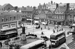
West of the Market Square the road divides: the left hand road goes to Long Sutton, the right fork heads for Langport.
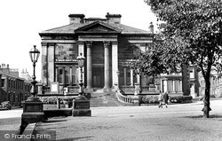
The Institute for the Diffusion of Useful Knowledge has stood up well to the passing of time.
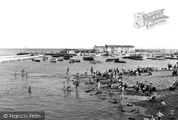
There is safe bathing for children at high tide, protected from the open sea and its waves, behind the North Wall of the harbour.
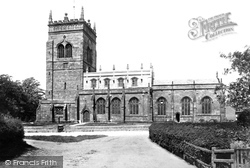
The 120-foot tower of St James' dominates this view from the south-east. The church is notable for its 15th- century frontals, which are said to be the earliest set in the country.
In a sense, the photograph captures the essence of village England as it was in the 1960s and as it is today.
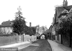
Viewed from the Close and looking East, the room with the large window over the Gate was a chapel belonging to Malmesbury House, the front of which can be seen to the left of the picture.
It was named Kings House after James I, and Queen Ann of Denmark and Henry, Prince of Wales stayed there in the early 17th century.
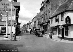
This picture was probably taken soon after the end of the Second World War, judging by the Food Office sign on the right of the picture.
As at Tipton and Wednesbury, the 30 ft seam of Thick Coal was near the surface at Bilston.Though there is evidence for coal pits at the time of Edward I, Bilston came into its own during the 19th century
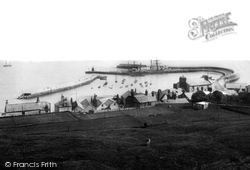
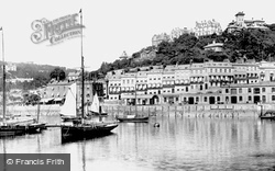
We are looking at the medieval Cobb harbour (centre) from the tennis ground on the cliffs south of Langmoor Gardens.
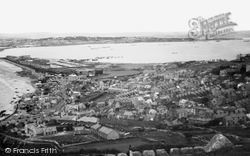
Beyond is the four square mile expanse of the Royal Navy's Victorian Harbour of Refuge, and its 20th-century oil tanks (centre left) beside the Mere.
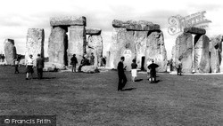
So too were aspects of the 'alternative society', who used Stonehenge for all sorts of spiritual enlightenment or protest, as can be seen by the CND sign daubed on the stone in the centre.
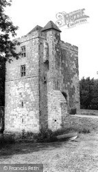
Half a mile south-east of Dicker we reach Michelham Priory, the buildings set within a large rectangular wet moat fed by the Cuckmere River, which forms the moat's north-west arm.
St Mary's Church is one of the finest churches in Cheshire, and serves a community that was, at one time, more important than nearby Nantwich.
Less than two hundred years ago this was farmland. The the railways arrived.
The horizontal distribution of the buildings shows how the houses had to be built in terraces, thanks to the town's hilly location.
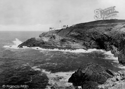
The north coast of Cornwall is extremely hazardous for shipping; after numerous wrecks and petitions to Trinity House, a new lighthouse was built on the Head in 1847 with a range of over 20 miles.
The Bradford Exhibition of 1904 stimulated the laying-out of this former country estate.
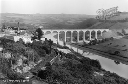
The construction workyard on the Devon bank has been cleared, but the wooden ketch 'Garlandstone' can be seen being built at James Goss's shipyard just behind the viaduct.
Places (6814)
Photos (11144)
Memories (29040)
Books (442)
Maps (181031)


