Merry Christmas & Happy New Year!
Christmas Deliveries: If you placed an order on or before midday on Friday 19th December for Christmas delivery it was despatched before the Royal Mail or Parcel Force deadline and therefore should be received in time for Christmas. Orders placed after midday on Friday 19th December will be delivered in the New Year.
Please Note: Our offices and factory are now closed until Monday 5th January when we will be pleased to deal with any queries that have arisen during the holiday period.
During the holiday our Gift Cards may still be ordered for any last minute orders and will be sent automatically by email direct to your recipient - see here: Gift Cards
Places
36 places found.
Those places high-lighted have photos. All locations may have maps, books and memories.
- Cardiff, South Glamorgan
- Barry, South Glamorgan
- Penarth, South Glamorgan
- Rhoose, South Glamorgan
- St Athan, South Glamorgan
- Cowbridge, South Glamorgan
- South Molton, Devon
- Llantwit Major, South Glamorgan
- Chipping Sodbury, Avon
- South Chingford, Greater London
- South Shields, Tyne and Wear
- Ayr, Strathclyde
- St Donat's, South Glamorgan
- Llanblethian, South Glamorgan
- Thornbury, Avon
- Llandough, South Glamorgan
- Fonmon, South Glamorgan
- St Nicholas, South Glamorgan
- Jarrow, Tyne and Wear
- Penmark, South Glamorgan
- Font-y-gary, South Glamorgan
- Maybole, Strathclyde
- Yate, Avon
- Oxford, Oxfordshire
- Torquay, Devon
- Newquay, Cornwall
- Salisbury, Wiltshire
- Bournemouth, Dorset
- St Ives, Cornwall
- Falmouth, Cornwall
- Guildford, Surrey
- Bath, Avon
- Looe, Cornwall
- Reigate, Surrey
- Minehead, Somerset
- Bude, Cornwall
Photos
5,607 photos found. Showing results 1,881 to 1,900.
Maps
2,499 maps found.
Books
23 books found. Showing results 2,257 to 23.
Memories
1,580 memories found. Showing results 941 to 950.
Canada Bound
While working in the Lake District as an hotel assistant manager I reached such a point of frustration that I up and quit my job and applied to emigrate to Canada. Five minutes later, after hearing of my decision, the head accountant gave ...Read more
A memory of Enfield in 1966 by
Mabledon & Nightingale Farms
Saw your Memory with interest. I have done two others on the site - people will think "He's vain", but hardly anyone else seems to have bothered. I can remember the smell of hops drying here in the 1950/60s. I was born in ...Read more
A memory of Tonbridge in 1956 by
Oughtrington Hall
I was in the first group of Lymm Grammar School students to move to Oughtrington Hall in 1945/46. Later, perhaps 1952/53, we established cricket at the school and played matches against other Cheshire Grammar Schools there - all ...Read more
A memory of Oughtrington in 1946 by
Cafe On Northolt Road And Robert Shipley
Hello my name is Lee Shipley. I'm looking for any info on my grandad Robert Shipley who worked in a cafe on Northolt Road in South Harrow in the 1950s. If you have any info on him please could you email me at: leeshipley@ymail.com Thankyou.
A memory of South Harrow by
1960s
I grew up in Dundee Street in Darlington. I remember the shops on each end of Dundee Street and Montrose Street, and the alleys between, the alleys were made of blue tiles that always sparkled in rain and frost. I remember the rag and bone ...Read more
A memory of Darlington in 1967 by
Northolt Wood End
Our family moved to Northolt (Mildred Avenue) around 1956 from Harlesden and I left in 1978. I have great memories of Wood End infants/junior school. Playing near Northolt Park Station and anoying the station master who we lovingly ...Read more
A memory of Northolt by
276 Shirley Road
During WW2, my twin brother and I were born at this house on 2 Nov 1943 to Evelyn and Tom Williams. Dad built an Anderson bomb shelter in the back garden during the early years of the war, and was used by mother and children ...Read more
A memory of Acock's Green in 1943 by
Annbank Hotel
I remember my dad asking me to go to the hotel in Annbank for his fags (funny how it was always at night), if it wasn't for the promise of getting a bag of crisps for going, I'd surely never go. This was the most scariest hotel, in the ...Read more
A memory of Annbank in 1963 by
East Coast Floods
Does anyone have any memories about the 1953 floods? My aunt Phyliss Papworth and her daughters Suzanne, Jennifer and Patricia who lived in South Beach Road all drowned, but her other daughter Janet was at a birthday party at a ...Read more
A memory of Hunstanton in 1953 by
Where I Used To Get The Bus To School
This picture (e199012) must be mid-afternoon judging by the shadows but there is surprisingly little traffic. The bus stop on the right, with a shelter, is where the 17 and 104 would stop on their way ...Read more
A memory of East Finchley in 1965
Captions
2,476 captions found. Showing results 2,257 to 2,280.
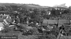
We are looking south-eastwards across the centre of the village towards the Springhead home of environmental guru Rolf Gardiner and the hills of Cranborne Chase.
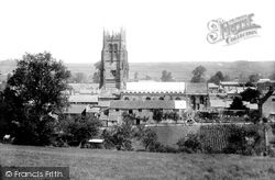
Approach from the south, over a brook and through trees, to the 15th-century tower and slender recessed crocketed spire of St Mary's, standing over 200 feet high.
Lyme Regis is situated towards the northern end of Lyme Bay and six miles south of the mouth of the Axe, a river once navigable for some distance upstream.
This is because it was originally a daughter church to Campion, a mile or so to the south-west, and Shefford would have buried its dead there.
His two ships that sailed to the South Seas, the 'Resolution' and 'Endeavour', were built here.
church at its southern end and the A47 to the north, the village is entered by long-abandoned medieval roads from Cold Newton to the north, itself a shrunken village, and from Gaulby and Frisby to the south-west
Shops on the south side include that of grocer and jam manufacturer William G Cornick. The Greyhound Hotel forms the penultimate frontage.
At the time this picture was taken, Parkstone was being compared to Menton in the south of France; there is also a Mentone Road.
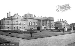
This picture shows the south front with its fine portico with an entablature supported by eight Corinthian columns. In front of it is a small covered stall set up for a local charitable event.
The town developed as a Victorian watering hole for the well-to-do, especially after the railway came in 1863, but in post-war years it has been the destination for mass-tourism, mainly from the south
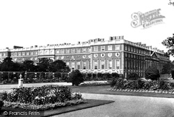
This is the south-east front, designed by Sir Christopher Wren and built between 1689 and 1700.
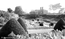
To the south of the palace are the Pond Gardens.
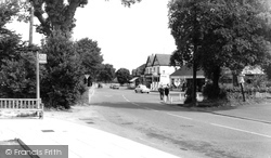
This view of the High Street, looking south from the Station Road crossroads, changed dramatically when the M23 and M25 by-passed the town; much has been pedestrianised and demolished.
This view looks south-west along North End Road past the former pub, now a house.
Norman control over England was effectively limited to the south-east of the country; there were rumours that the sons of King Harold were in contact with King Diarmait of Leinster, who was prepared to
It was from here that FitzGerald ruthlessly put down a rebellion in the south-west.
This view looks south down the main street towards the church of St Thomas and St Nicholas - we can see its 14th-century crossing tower (centre).
Upper Rushall Street and Peal Street running north and south from the bottom of the church steps indicate ancient routes to Lichfield and Wednesbury.
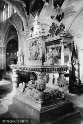
Mrs Maria Heathcote, 1768, is resting in peace in the south transept; she is represented as Britannia seated, one hand holding an anchor, the other a medallion with her portrait.
In the picture: In the picture we can see a bus stop sign on a concrete post, for Southdown route 106 only, Worthing to South Ferring.
The original Preston Post Office had been at the south end of Wide Shambles in a building leaning on the side of the shambles.
From the George's entrance, on the right, she walked on a mile of local broadcloth to Coursehorn, a Tudor farmhouse owned by a wealthy weaver, which is south-east of the town.
The south-west side of Ware High Street changed drastically when it was decided to build a new Tesco Store in 1960.
At the foot of the hill the Old Church and St John the Evangelist share a single churchyard, while remnants of the original mediaeval parish church can be found to the south.
Places (15471)
Photos (5607)
Memories (1580)
Books (23)
Maps (2499)


