Places
36 places found.
Those places high-lighted have photos. All locations may have maps, books and memories.
- Shanklin, Isle of Wight
- Ventnor, Isle of Wight
- Ryde, Isle of Wight
- Cowes, Isle of Wight
- Sandown, Isle of Wight
- Port of Ness, Western Isles
- London, Greater London
- Cambridge, Cambridgeshire
- Dublin, Republic of Ireland
- Killarney, Republic of Ireland
- Douglas, Isle of Man
- Plymouth, Devon
- Newport, Isle of Wight
- Southwold, Suffolk
- Bristol, Avon
- Lowestoft, Suffolk
- Cromer, Norfolk
- Edinburgh, Lothian
- Maldon, Essex
- Clacton-On-Sea, Essex
- Felixstowe, Suffolk
- Norwich, Norfolk
- Hitchin, Hertfordshire
- Stevenage, Hertfordshire
- Colchester, Essex
- Nottingham, Nottinghamshire
- Bedford, Bedfordshire
- Bury St Edmunds, Suffolk
- Aldeburgh, Suffolk
- St Albans, Hertfordshire
- Hunstanton, Norfolk
- Chelmsford, Essex
- Bishop's Stortford, Hertfordshire
- Peterborough, Cambridgeshire
- Brentwood, Essex
- Glengarriff, Republic of Ireland
Photos
9,106 photos found. Showing results 9,441 to 9,106.
Maps
181,006 maps found.
Books
11 books found. Showing results 11,329 to 11.
Memories
29,059 memories found. Showing results 4,721 to 4,730.
Magical Place
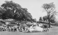
My childhood was lived in Burton and Stapenhill - 1952 to 1965 I remember fondly the swan and gardens, running up and down the beautiful rock garden steps. There was a huge willow tree between the swan and the river that hung down ...Read more
A memory of Burton upon Trent by
Mother's Birthplace
My mother was born in August 1912 at 14 Perriman's Row, Withycombe Raleigh (this is shown on her birth certificate). She was illegitimate and the home was that of her mother's relation George Parkhouse and his wife and family. I recently visited Exmouth and saw the home (I live in Canada).
A memory of Withycombe Raleigh by
V2 Rocket Hatley Ave
I was at Gearies when the rocket fell in Hatley Ave. We lived at no 9 and it was on a Monday (washing day) and the replacement windows that we had(because they were blown out when the V1 dropped in Dr Barnardos behind us) fell on ...Read more
A memory of Barkingside by
Start Of Western Esplanade From The Pier
This Picture was taken by someone on the Pier, above the roadway. The shops to the right were known then as Palmyra Terrace, IIRC, and the little sunken amusement park to the Left had been renamed by then from "The Shrubbery" to "Peter Pan's Playground".
A memory of Southend-on-Sea by
Western Esplanade, Alexandra Y.C. Dinghy Park. A Post Ww2 Facility.
As the classic 18ft long local dayboat classes became more expensive to build and maintain, there was an explosion of smaller, cheaper racing dinghy classes all round the UK, postWW2. ...Read more
A memory of Southend-on-Sea by
Bromley High Street
I remember the coffee smell as one wandered up the high street. Someone on this memory board has asked what was it called. It was called: Coffee Importers, because that was what they did. You could buy beans or have them ground there ...Read more
A memory of Bromley by
Looking Westwards, Towards Thorpe Hall Boulevard Junction With The Esplanade.
In 2014, across the road there are tennis courts, and from Google Earth it looks like a thriving Sports Centre. If there were tennis courts on that site in 1963, hardly ...Read more
A memory of Thorpe Bay by
Looking Westwards, Towards Thorpe Hall Boulevard Junction With The Esplanade.
In 2014, across the road there are tennis courts, and from Google Earth it looks like a thriving Sports Centre. If there were tennis courts on that site in 1963, hardly ...Read more
A memory of Thorpe Bay by
Sea Water Bathing & Paddling Pools, Between Chelsea Ave And Elizabeth Rd.
No doubt at all about this location. The Facility was renovated after the neglect of 5 years of war, but was never very popular. One had to pay to use the swimming pool, but the ...Read more
A memory of Thorpe Bay by
My Birthplace? "Little Danewood Cottage", Church Rd, Dane Hill
I believe the cottage in the bottom right hand corner could be near my birthplace? If it is, it is one of two cottages on the hill leading up to the church from the village and just below the ...Read more
A memory of Danehill by
Your search returned a large number of results. Please try to refine your search further.
Captions
29,158 captions found. Showing results 11,329 to 11,352.
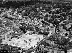
In the centre of this aerial photograph is an area known as Harvey town after a previous owner of the land. In the late 1950s all this area was cleared to build a multi-storey car park.
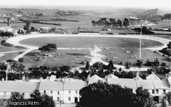
In early days the hub of the community was the church, but later, as we see here, it was the neighbourhood recreation ground.
The street follows the course of the Roman road Ermine Street, and is typically without any sign of a bend.
Here we see Park Street in the days of horse-drawn transport. Half-way up the street is what appears to be a water-cart on damping-down duty.
On the right hand side, several businesses, including Pedley & White outfitters, occupy the Church House building, erected in the 1530s on the site of old tenements.
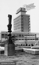
The Town Hall, opened in 1960 by Clement Attlee, is part of a group of buildings in the Civic Centre. The sculpture is 'Bronze Cross', by Henry Moore.
The summer of 1914 was long and hot; the hottest day of the year in Lancashire was 28 June.
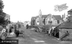
Behind and to the right is the turreted tower of the parish church. Built in 1851, it replaced the original church dating from the reign of Richard III.
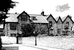
This school, on Stanedge Road, still exists today. The only real change has been the construction of the headmaster's house to the right hand side of this view.
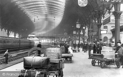
The magnificent sweeping curve of the station at York, the railway city of the north. During excavations beneath the platforms, human remains from the Roman period were found.
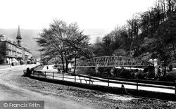
Another view of Derwent Terrace and the Promenade. This shows the Jubilee Bridge crossing the Derwent - the bridge was erected to mark the jubilee of Queen Victoria's reign.
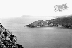
The old fort seen on the headland of Castle Point was completed in 1781 and boasted eight cannons, each capable of firing a nine or twelve- pound shot.
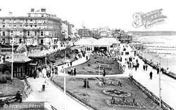
This used to be the most genteel of the Yorkshire seaside resorts, a view that is exemplified by the promenading of the nouveau riche in this 1920s photograph.
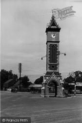
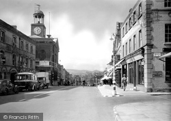
The clock tower was built in 1887 to commemorate the Jubilee of Queen Victoria. It was built of red brick and locally-made white bricks called 'Warboys whites'.
Here we see another view of the long, straggling street with its delightful half-timbered cottages and the brick Baptist Chapel on the opposite side of the road.
Heading south towards Bourne, the route diverts north-east of the town to Edenham, a delightful village on the east bank of the winding East Glen River, whose church has many remarkable monuments to the
This view and 61432 on page 36 presage the changes to come in the 20th century.
Lying east of Pocklington, this village was bought in the 18th century by the 5th Duke of Devonshire. He sold it in 1845 to the railway entrepreneur George Hudson.
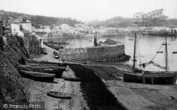
This picture, which features the old quay, was taken some months before the completion of the new harbour.
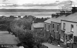
This view was taken from the top of School Hill, looking across the Dee Estuary towards the Clwydian Hills. Trees now obstruct the view of Heswall parish church, whose tower we can clearly see here.
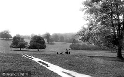
Bounded by Gosmoor and Charlton Roads, Priory Park was a favourite spot for picnics and Sunday afternoon strolls down to the banks of the River Hiz close to Brick Kiln Lane, Charlton, which runs behind
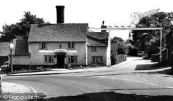
One of two Hertfordshire inns with cross-street signs (the other is the Four Swans at Waltham Cross), the Fox and Hounds moved to its present site in 1955 after a disastrous fire at the old building in
The board on the side of the Town Hall is for the Municipal Camping Ground.
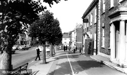
This picture looks westwards down the north side of West Street, with its lollipop limes, from the Post Office to Victoria Grove (right of centre).
Places (6814)
Photos (9106)
Memories (29059)
Books (11)
Maps (181006)


