Places
36 places found.
Those places high-lighted have photos. All locations may have maps, books and memories.
- Shanklin, Isle of Wight
- Ventnor, Isle of Wight
- Ryde, Isle of Wight
- Cowes, Isle of Wight
- Sandown, Isle of Wight
- Port of Ness, Western Isles
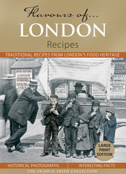
- London, Greater London
- Cambridge, Cambridgeshire
- Dublin, Republic of Ireland
- Killarney, Republic of Ireland
- Douglas, Isle of Man
- Plymouth, Devon
- Newport, Isle of Wight
- Southwold, Suffolk
- Bristol, Avon
- Lowestoft, Suffolk
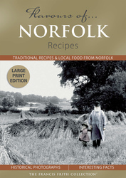
- Cromer, Norfolk
- Edinburgh, Lothian
- Maldon, Essex
- Clacton-On-Sea, Essex
- Felixstowe, Suffolk
- Norwich, Norfolk
- Hitchin, Hertfordshire
- Stevenage, Hertfordshire
- Colchester, Essex
- Nottingham, Nottinghamshire
- Bedford, Bedfordshire
- Bury St Edmunds, Suffolk
- Aldeburgh, Suffolk
- St Albans, Hertfordshire
- Hunstanton, Norfolk
- Chelmsford, Essex
- Bishop's Stortford, Hertfordshire
- Peterborough, Cambridgeshire
- Brentwood, Essex
- Glengarriff, Republic of Ireland
Photos
2,038 photos found. Showing results 1 to 20.


Maps
25 maps found.


Books
431 books found. Showing results 1 to 24.


Memories
Sorry, no memories were found that related to your search.
Captions
237 captions found. Showing results 1 to 24.

On one of Stony Stratford's first bridges over the River Great Ouse, Grilkes Inn had been operating since 1317, possibly the oldest alehouse in Buckinghamshire; and the Cross Keys (1475) and the

The expansion of the dockyard, the building of permanent military installations and the garrisoning of large numbers of troops in the area enabled the population of Chatham to overtake that of

Geoffrey Fitz Piers, Earl of Essex, holder of the castle at the time, was the founder of the church, one of the largest in the county.

A flying boat rests on the calm waters of the Medina, in the peaceful days of the 1950s.

Much of the county is still largely agricultural. Along the rivers and the shoreline, there are still miles of sparsely-inhabited wilderness.

A majestic yew tree marks the approach to St Lawrence's, which has a west tower of flint and stone blocks topped with early brick.

The opening of Woburn Abbey to the general public introduced many to the delights of a rural involvement without the necessity to move home and hearth.

The Cathedral 1888 A springtime photograph of the massive and imposing cathedral, the first in Britain and the seat of the Primate of All England, as well as one of Europe's most celebrated places

The layout of Stamford, climbing gently in terraces up from the Welland, is well shown in this photograph from St Martin's church tower. The churches of All Saints, St John, and St Mary stand out.

owing to the growth of cheap foreign holidays and an industrial recession.

Here we see a section of Hadrian's Wall near the village of Gilsland. 73 miles long, with seventeen forts, mile-castles and turrets, the wall was one of a number of linear defences built to designate

This famous junction was once known as Regent Circus and developed out of Nash’s elegant modelling of Regent Street.

Lying three miles north east of the Trent, the Minster was founded by the Archbishop of York in the early 12th century and is undoubtedly one of the most beautiful Norman buildings in England.

In this early view of the beach, there are already signs of local businesses capitalising on the new influx of visitors, with terraces of newly-built lodging houses and cheap hotels.

Winchcombe was once the walled capital of Winchcombeshire, whose abbot sat in the Saxon parliament; it was the site of the martyrdom of Kenelm, the child king of the Mercians, who was allegedly

The splendid Norman tower of the Cathedral rises above the roofs of the county town, forming an important part of the city’s skyline.

Approaching the village from the west along the Botley Road, we see on the right All Saints' Church, built in 1836 in Early English style. The village war memorial is on the left of the picture.

The council paid £139,000 for the park in 1872, it being one of a number of acquisitions by the authority over the previous 20 years.

The rebuilding took nearly twenty years, and the craftsmen tried to put only the best and finest materials back into Manchester's chief house of God. 192 new traceried panels were fitted to the ancient

Canford Manor, not far from Wimborne, dates from the early years of the 19th century, though it stands on the site of an ancient house which once belonged to the Earls of Salisbury.

The foreground of this view is now entirely obscured by trees and hedging. The railway line is no longer visible.

Waddington is now noted more for its large Royal Air Force station to the east of the village, but it grew up on a diversion of Ermine Street to the western scarp of the limestone ridge.

It would take seven centuries from the granting of the first written royal charter. The dark spire in the foreground is that of the Tollbooth, the old headquarters of the council, built about 1616.

The shape of things to come is the brand-new National Bank building; this bank had a London base boasting capital of £7m, and several branches in Ireland.
Places (6814)
Photos (2038)
Memories (0)
Books (431)
Maps (25)

